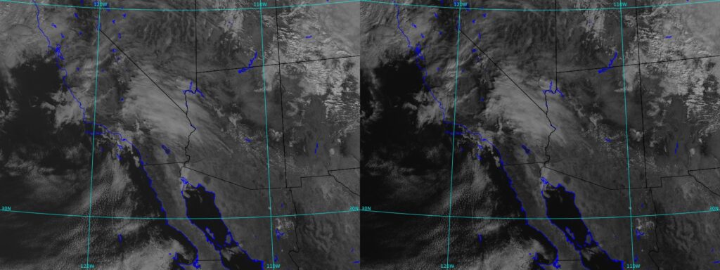
Stereo Satellite Imagery involves the acquisition of images from two slightly different perspectives mimicking the human visual system’s binocular vision. This method is based on the parallax principle which states that objects appear to change in perspective and this parallax effect is used in satellite photography to produce a three-dimensional depiction of the Earth’s surface. Stereo satellite imagery is obtained by merging images from various passes of the same satellite or by employing satellite sensors with numerous viewing angles. A few spacecraft have two or more sensors installed, and these sensors take pictures from slightly varied angles while in orbit where this arrangement guarantees the formation of stereo pairs which are necessary to produce precise three-dimensional models. The use of stereo satellite images is now essential for analysis, mapping and visualization. Our ability to detect and represent the Earth’s surface in three dimensions has greatly improved with the incorporation of stereo satellite images into GIS workflows allowing for more precise and in-depth spatial analysis. The technical nuances of stereo satellite imagery, as well as its uses, difficulties and changing environment within the GIS sector are explored in this article.
Understanding Stereo Satellite Imagery
Basics of Stereoscopy
Stereoscopy is the process of showing two slightly offset pictures to the viewer’s left and right eyes independently to create or enhance the illusion of depth in an image. This depth perception in satellite images is attained by taking two separate pictures of the same region of the Earth’s surface. The ensuing stereo pairs make it possible to precisely quantify topographical features and create three-dimensional (3D) models.
Satellite Sensors and Platforms
High-resolution optical sensors installed on different satellite platforms are principally used to acquire stereo satellite pictures and to create the required stereo pairs, two or more sensors on satellites with stereo imaging capability often take pictures of the same area after a delay. A few well-known satellites with stereo imaging capability are Pleiades, WorldView-3 and GeoEye.
Image Resolution and Accuracy
The capacity of stereo satellite photography to produce precise and high-resolution depictions of the Earth’s surface accounts for its success. The size of a ground pixel determines an image’s resolution; higher resolutions enable more in-depth and accurate analysis and to ensure the accuracy of the generated 3D models and to align stereo pairs, accurate georeferencing is essential.
Applications of Stereo Satellite Imagery
Topographic Mapping: Topographic mapping is one of the main uses of stereo satellite imagery in GIS and the GIS experts can create incredibly precise and comprehensive topographic maps by extracting elevation data from stereo pairs. Applications for these maps include environmental monitoring, infrastructure building and urban planning.
Digital Elevation Models (DEMs): Digital elevation models that show the elevation values of the Earth’s surface as a continuous raster are made possible in large part by stereo satellite data. DEMs contribute to many GIS applications by providing essential data for line-of-sight, slope and hydrological modeling.
Change Detection: Using stereo satellite images, change detection is made possible by the capacity to capture the same area at several periods. Changes in infrastructure, natural characteristics and land cover throughout time can be recognized and measured by GIS analysts. The ability to monitor environmental changes, deforestation and urban growth is vital.
Disaster Response and Management: Stereo satellite imaging is essential for disaster response and management during natural disasters like earthquakes and floods. Planning and carrying out relief operations are made easier by the early assessment of the impacted areas made possible by the speedy gathering of 3D data.
3D City Modeling and Urban Planning: Urban planners can view and analyze the spatial arrangement of cities with the help of stereo satellite images which makes the production of 3D city models easier. This is especially helpful for zoning, infrastructure development and determining how new construction projects would affect the current urban environment.
Future Directions and Emerging Trends
Next-Generation Satellite Sensors: The potential of stereo satellite imaging keeps expanding because of developments in satellite sensor technology and it is anticipated that next-generation sensors will offer even greater resolutions, better spectral capabilities, and longer revisit periods, creating new opportunities for GIS applications.
Artificial Intelligence for Image Analysis: The merging of machine learning (ML) and artificial intelligence (AI) in stereo-picture processing is a developing field. GIS operations are getting more precise and efficient as a result of AI algorithms’ growing proficiency in feature recognition, categorization and change detection.
Fusion of Multisensor Data: The merging of data from several sensors such as hyperspectral, SAR (Synthetic Aperture Radar) and stereo satellite images is becoming more popular. Through the use of several sensors, GIS datasets become richer facilitating more thorough analysis and a better comprehension of Earth’s dynamics.
Stereo satellite imagery stands at the forefront of technological advancements in the GIS industry, enabling professionals to extract detailed 3D information about the Earth’s surface. The applications are numerous and include urban planning, disaster relief, topographic mapping and more. The future of stereo satellite imagery in the GIS landscape is full of intriguing potential as technical advancements tackle difficulties related to data processing and integration and the combination of stereo satellite imagery and GIS along with next-generation sensors and AI-driven analysis is poised to revolutionize our understanding and management of the complexity of our ever-changing globe.


