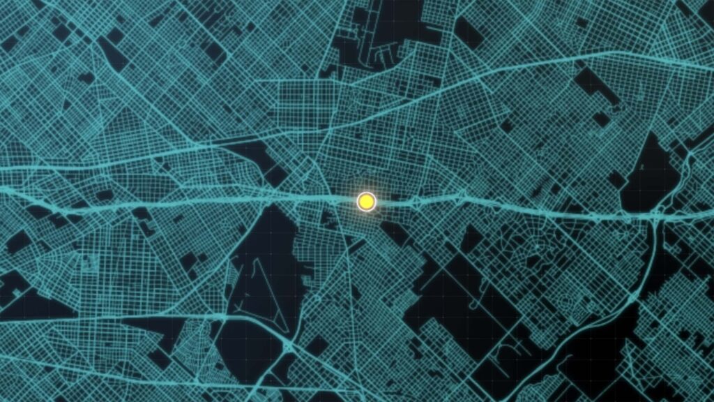
Geographic Information System or GIS is a strong framework for gathering, storing, processing and displaying geographic data and this customized system makes it easier to handle spatial information efficiently by integrating data, software and hardware. GIS links location-based attributes to geographical elements so that users may comprehend linkages, patterns and trends within the data. GIS (Geographic Information Systems) has become a key piece of technology for decision-making, mapping, and spatial analysis. GIS is essential for integrating geographical information to gain insights, resolve challenging issues and support well-informed decision-making in a world where data is driving change. This process explores the underlying ideas, technical aspects, applications and emerging trends that will shape this dynamic area as it dives into the complexities of GIS.
Understanding the Basics of GIS
Geospatial Data: Geospatial data or information associated with particular geographic places on Earth’s surface is the foundation of GIS. There are two categories for this data: raster and vector where raster data uses a grid of cells to represent the surface, much like a pixelated image whereas vector data uses points, lines and polygons to express spatial information.
Coordinate Systems: Coordinate systems provide a framework for locating and visualizing spatial data which makes them the foundation of GIS. Latitude and longitude are common coordinate systems for global positioning, and many local coordinate systems are used for more accurate area mapping.
Data Sources: Satellite images, aerial photography, remote sensing and ground surveys are just a few of the several data sources that GIS uses and by combining various sources, GIS experts may provide accurate and thorough spatial datasets.
The Technical Components of GIS
Data Acquisition and Input: Numerous technologies are used during the data collection and input phases of a GIS. Real-time data collection in the field is made possible by GPS (Global Positioning System) devices while remote sensing technologies use imagery from drones or satellites. Furthermore, information can be gathered through surveys or digitalized from already-existing maps.
Data Management and Storage: GIS databases are made to effectively store and handle massive amounts of spatial data where spatial databases make it easier to store and retrieve spatial data. Examples of these databases are PostgreSQL with PostGIS extension and Esri’s ArcSDE.
Data Analysis and Processing: GIS software packages such as ArcGIS, QGIS and GRASS GIS provide a multitude of analytical capabilities for data analysis and processing and with the use of spatial analysis techniques like overlay analysis, proximity analysis and network analysis, experts may extract valuable information from geospatial datasets.
Data Visualization and Output: GIS study culminates in the creation of maps and visualizations and the production of visually beautiful and informative maps is guided by cartographic principles. GIS experts utilize programs like Tableau and Mapbox to communicate intricate geographical data understandably.
Applications of GIS across Industries
GIS Applications in a Variety of Industries
Development and Urban Planning: By examining population distribution, land use trends and infrastructure needs, GIS helps urban planners create sustainable cities. It makes it possible to see how suggested advancements might affect the ecosystem.
Environmental Management: GIS is essential to environmental research for controlling and keeping an eye on natural resources and to manage resources sustainably, it provides vital information on mapping biodiversity, tracking deforestation and evaluating the effects of climate change.
Public Health GIS: GIS plays a critical role in public health by analyzing healthcare accessibility, tracking disease transmission and identifying high-risk locations. GIS has proven to be extremely helpful in tracking the spread of infectious illnesses during times of global health emergencies.
Logistics and Transportation: GIS is used in efficient transportation systems for traffic analysis, infrastructure design and route optimization and by monitoring supply chain networks and streamlining delivery routes, GIS technology improves logistics operations.
Agriculture and Precision Farming: Geographic Information System (GIS) is used in agriculture to help farmers monitor irrigation, analyze soil conditions and determine if a piece of land is suitable for a certain crop. GIS is used in precision farming practices to increase total agricultural productivity.
Future Trends in GIS
Spatial AI and Machine Learning Integration: GIS is about to undergo a revolution with the combination of machine learning (ML) and spatial artificial intelligence (AI) and by improving the automation of spatial analysis, these technologies allow systems to learn from patterns in data and anticipate future events.
Real-time Data Analytics: Real-time data analytics in GIS is becoming more and more in demand and the ability to analyze and visualize data as it is being collected is beneficial for applications such as environmental monitoring, traffic management and emergency response.
3D GIS and Augmented Reality: A more engaging and interactive experience is offered by the development of GIS into the fields of augmented reality and three-dimensional modeling. This is especially helpful for simulation-based training, architecture and urban planning.
Blockchain for Spatial Data Security: The necessity for transparent and safe data management grows along with the significance of spatial data and researchers are investigating the use of blockchain technology to improve the security and integrity of spatial data, guaranteeing its veracity and thwarting unwanted manipulation.
Geographic Information Systems have developed from specialized instruments to vital resources for a variety of sectors where it is always pushing the boundaries of technology with the combination of cutting-edge applications, growing datasets and creative thinking. The importance of GIS in creating a world that is spatially aware is becoming more and more evident as GIS experts work through the difficulties and welcome new developments. The GIS journey is an exciting data-driven study of our globe that provides insights that enable us to make wise decisions for a sustainable future.


