Pan Sharpening
PAN SHARPENING
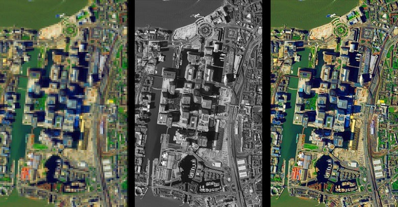
For example, 4-band multispectral data is available from QuickBird and GeoEye. Panchromatic imagery from QuickBird-3 has a spatial resolution of about 0.6 meters at nadir. The same sensor collects the nearly the multispectral data at about 2.4 meters resolution. For GeoEye’s Ikonos, the panchromatic and multispectral spatial resolutions are about 1.0 meters and 4.0 meters respectively. Thus image fusion between these panchromatic and multispectral images will result in 0.6 meters and 1 meters spatial resolution and 4 multispectral bands imageries for QuickBird and GeoEye’s Ikonos respectively.
Images above shows the pan-sharpened image can substantially improve the amount of spectral information in a panchromatic image, conversely it can substantially increase the spatial resolution of multispectral images.