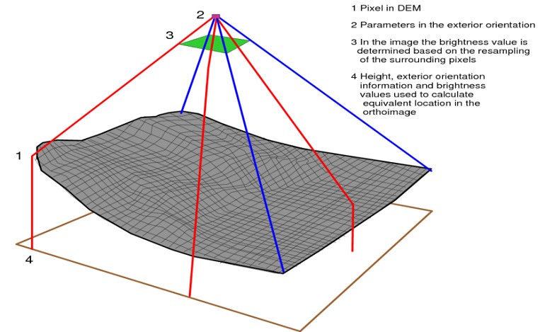
Distortions appear in the form of feature displacement, and create inconsistencies in scaling through the image. The level of distortion changes throughout the imagery scene, which means that a simple ground control point adjustment alone is unable to compensate for these errors. A correction process considering topographical variations and sensor orientation is required to readjust the displaced pixels to their correct position. Once orthorectified, the imagery can be used for direct measurement, feature extraction, and other applications requiring measurement-ready data.
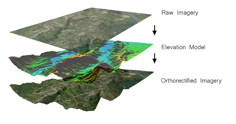
SATPALDA performs the orthorectification of images of environmental, geological, topographic, or any source maps that will be used in the GIS mapping environment. The accuracy standard defined by the customers allows us to select the optimal DTM sources such as ALOS PRISM, ASTER, SRTM, and GE-1, to obtain the best result fulfilling our customer’s satisfaction. We also work on customer provided DTM if provided.