Land Cover Mapping

LAND COVER MAPPING

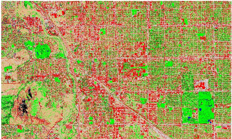
Land cover maps, also known as Land use maps, represent spatial information on different types (classes) of physical coverage of the Earth’s surface, e.g. forests, grasslands, croplands, lakes, wetlands. A dynamic land cover map includes transitions of land cover classes over time and hence captures land cover changes. Land use maps contain spatial information on the arrangements, activities and inputs people undertake in a certain land cover type to produce, change or maintain it.

Land cover maps provide information to help managers best understand the current landscape. They are very useful in Radio Frequency (RF) planning. To see change over time, land cover maps for several different years are needed. With this information, managers can evaluate past management decisions as well as gain insight into the possible effects of their current decisions before they are implemented.

SATPALDA is a team of highly qualified remote sensing professionals with domain-specific experiences. We strongly rely on automatic and semi-automatic image classification techniques to obtain Landuse/Landcover maps which are highly accurate with minimal human errors. We can provide maps with wide range of resolutions depending upon client requirement, from high resolution of 0.5m to medium-low of 250m.