Technological developments in the field of Geographic Information Systems (GIS) are always pushing the frontiers of investigation and analysis. Ground Penetrating Radar (GPR) is one such innovative technology. By looking beneath the surface of the Earth, this state-of-the-art technology provides a unique perspective that goes beyond typical GIS tools. We will examine the principles, uses, and revolutionary effects of ground-penetrating radar on the GIS sector in this essay as we delve into the complexities of this technology.
The electromagnetic wave propagation theory underpins the operation of ground-penetrating radar. It records the reflections that bounce back from high-frequency radio wave pulses that are sent into the ground. A transmitter-receiver antenna, a control device, and data processing software make up the system. Different subsurface materials allow different electromagnetic waves to pass through them; these changes in electrical characteristics cause reflections. After processing, a thorough cross-sectional image of the underlying strata is produced from these reflections.
Technical Components
System of Antennas: The antenna, which transmits and receives electromagnetic waves, is the central component of any GPR system. Different frequencies are available for different penetration depths and resolutions of GPR antennas. While high-frequency antennas offer finer detail but have a restricted depth range, low-frequency antennas can reach deeper into the subsurface at the expense of resolution. Dual-frequency systems, which provide a balance between resolution and depth, are also widely used.
Units for Transmitter and Receiver: Short bursts of electromagnetic pulses, usually in the microwave or radio frequency range, are produced by the transmitter unit. The subsoil receives these pulses after they have passed through the antenna. In contrast, the reflected signals from the subsurface features are picked up by the receiver unit. The depth and location of the subsurface anomaly are determined by measuring the time it takes for the signal to return. Accurate data interpretation depends on the transmitter and receiver being precisely synchronized.
Data processing and the control unit: The control unit, which oversees the radar’s timing, triggering, and general operation, acts as the GPR system’s brain. An interface for adjusting system settings, like antenna frequency and pulse length, is frequently included. The raw signals are processed to reduce noise, improve signal-to-noise ratio, and transform temporal data into spatial information after data capture. The conversion of unprocessed GPR data into useful subsurface maps depends heavily on sophisticated signal processing techniques, which are frequently combined with GIS software.
Systems for Georeferencing and Positioning: Accurate georeferencing is essential for GIS applications. To precisely determine the position and orientation of the radar during data collection, GPR systems incorporate GPS (Global Positioning System) and IMU (Inertial Measurement Unit) technology. The production of subsurface maps with precise spatial coordinates is made possible by this geospatial data. Analysis and interpretation are made simple by the integration of GPR data with already existing GIS databases.
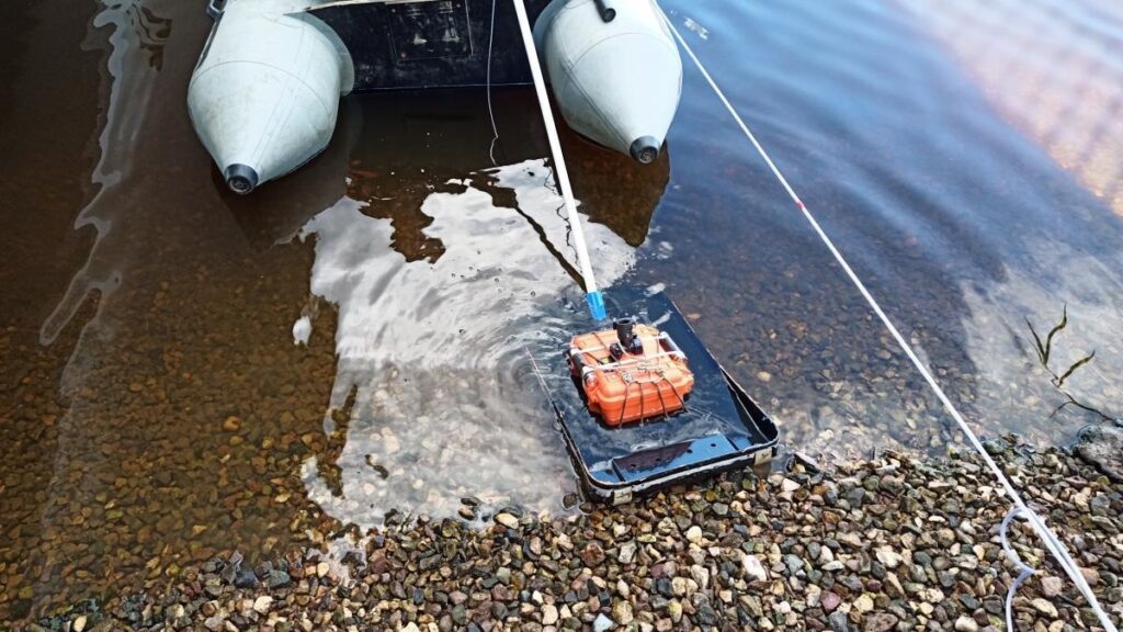
Power Supply and Mobility: GPR systems require strong power supplies and mobility features because they frequently operate in a variety of difficult settings. Rechargeable battery-powered portable solutions give geospatial experts freedom in the field and enable them to effectively cover wide areas. It’s crucial to strike a balance between power usage and operating time, particularly in isolated areas where charging might not always be possible.
Display and Visualization: Visualizing GPR data is an essential part of the GIS process. Sophisticated display systems provide real-time subsurface feature visualization; they are frequently connected with GIS software. With the aid of these displays, people may instantly evaluate data and make decisions. Tools for three-dimensional visualization improve our comprehension of underlying structures and make it easier to spot environmental abnormalities, utility lines, and relics from archaeology.
Integration and Storage of Data: Large volumes of data are produced by GPR systems, necessitating effective storage options. High-capacity storage devices and wireless data transfer to centralized databases are features of modern GPR systems. GPR data may be seamlessly integrated with GIS databases, enabling users to overlay it with additional layers of geospatial information. The total comprehension of subsurface elements within the larger geographic context is improved by this integrated approach.
Quality Assurance and Calibration: The system incorporates quality control and calibration procedures to guarantee the precision and dependability of GPR data. System parameters are adjusted during calibration operations to take environmental variables, such as differences in soil composition and moisture content, into consideration. The purpose of quality control checks is to find and fix irregularities in the collected data so that the output is as accurate as intended.
Ground Penetrating Radar Applications in GIS
Uses for GIS Archaeology and Cultural Heritage: Ground Penetrating Radar has transformed archaeological surveys by allowing researchers to find artifacts and hidden buildings without the need for excavation. With the use of technology, historical sites may be examined without causing damage, protecting cultural heritage and offering insightful information about the past.
Infrastructure and Civil Engineering: Within the field of civil engineering, GPR is essential for evaluating the state of infrastructure. It enables preventive maintenance and averts possible tragedies by detecting voids, subsurface anomalies, and deterioration in concrete structures.
Environmental Studies: GPR is a tool used by environmental scientists to investigate groundwater levels, pollution, and soil composition. Researchers can better understand environmental dynamics and support resource management and conservation efforts by mapping subsurface conditions.
Utility Mapping: GPR is used in urban planning for utility mapping and management. It lowers the possibility of unintentional harm during building and excavation projects by assisting in the identification of subterranean utilities like pipes and wires.
Geophysical Investigation: GPR is used in the oil and gas sector for geophysical exploration. It can help with effective resource extraction by identifying possible reservoirs, defining subsurface structures, and evaluating geological formations.
Technological Developments in Ground Penetrating Radar
Multiple Frequency Systems: The creation of multi-frequency systems is one recent development in GPR technology. These devices can change frequencies while collecting data, enabling a more thorough subsurface investigation. This adaptability is very useful while researching various geological formations.
Connectivity to Geographic Information Systems: Integration with GIS systems has emerged as a key strategy to improve the synergy between GPR and GIS. Because of this connectivity, geospatial analysts can easily integrate subsurface data into their GIS projects through smooth data transmission and visualization.
Processing Data in Real Time: Real-time data processing has been made easier by increases in processor power. GPR users may quickly visualize subsurface features thanks to on-site processing capabilities, which speed up decision-making in a variety of industries, including emergency response and construction.
At the vanguard of scientific advancement, ground-penetrating radar provides previously unattainable perspectives into the hidden worlds under our feet. Applications for GIS in the industry are numerous and revolutionary, ranging from infrastructure maintenance optimization to cultural asset preservation. The combination of GPR and GIS platforms is set to transform the field of geospatial analysis as technology advances, offering a comprehensive comprehension of both the surface and subsurface environments. Our research of the Earth’s interior is only getting started, and the combination of GPR and GIS is going to open up new avenues for discovery.


