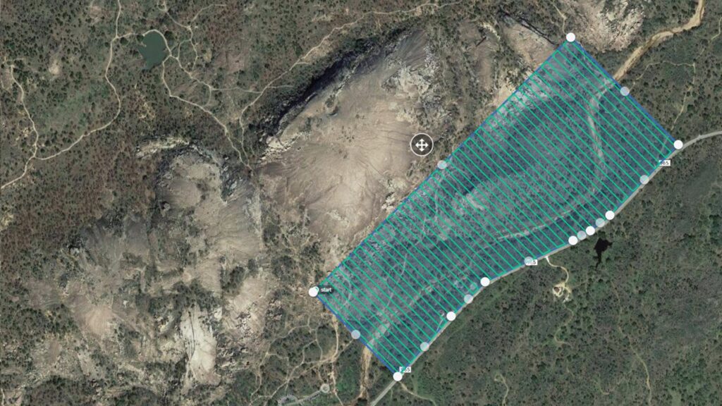
Accuracy and precision are critical in the ever-changing field of Geographic Information Systems (GIS). To guarantee the accuracy of geographical data, GIS specialists employ various methods; one essential component in this endeavor is the utilization of Ground Control Points (GCPs). Ground Control Points are essential to georeferencing, which matches geographical data to actual coordinates. The technical nuances of ground control points are examined in this article, along with their importance, application, and effect on the precision of GIS data.
What are Ground Control Points (GCPs)?
Ground Control Points are recognizable, surveyed locations having known coordinates on the surface of the Earth. By acting as reference markers, these points make it possible to precisely align spatial data inside of a GIS framework. GCPs serve as anchors, establishing a precise connection between the digital depiction of geographic features and their actual placements on Earth’s surface.
The significance of Ground Control Points
Accurate Georeferencing: Ground Control Points are primarily used to improve the precision of georeferencing procedures. Aligning raster data—such as scanned maps or satellite imagery—with geographic coordinates is known as georeferencing. To create a trustworthy correlation between the digital representation and the Earth’s surface, GCPs offer the geographical context that is required.
Integration of Spatial Data: The integration of data from many sources is a common task for GIS projects. GCPs serve as shared reference points that make it easier to integrate datasets with different spatial references. This is especially important in situations where datasets come from various platforms, sensors, or historical periods.
Quality Assurance: Ground Control Points are essential for quality assurance since they act as checkpoints to verify the accuracy of georeferenced data. With the help of these points, GIS experts may evaluate and correct any distortions or misalignments in the geographical dataset, guaranteeing a high degree of accuracy.
Features of Ground Control Stations:
Surveyed Precision: GCPs need to be surveyed using exact surveying methods and with a high degree of accuracy. Accurate GCP coordinates are often obtained through the use of Total Station surveys and Differential Global Positioning System (DGPS) data.
Spatial Distribution: For thorough georeferencing, Ground Control Points must be positioned strategically. To account for changes in geography, topography, and land cover, GCPs should be dispersed throughout the study region.
Stability over Time: GCPS must remain stable over time, particularly in dynamic contexts. Maintaining the correctness of GIS data, especially in long-term projects, requires tracking and guaranteeing the temporal stability of reference points.
Implementation of Ground Control Points:
Methods of Surveying: Precise surveying is the first step in the establishment of the Ground Control Points procedure. Centimeter-level accuracy is frequently attained with the use of differential GPS technology. For accurate point placement, total station surveys—which include electronic distance and angle measurement—are also used.
Coordinate Modification: GCP coordinates must be converted into the coordinate system of the geographical dataset to be georeferenced after surveying. Aligning the GCPs with the spatial dataset entails applying mathematical transformations like affine or polynomial transformations.
Software for Georeferencing: The use of georeferencing software, such as ArcGIS, QGIS, or ERDAS IMAGINE, is essential to the effective application of GCPs. Ground Control Points can be used to import, manage, and align spatial data with ease because of these products’ intuitive interfaces.
Obstacles & Things to Think About:
GCP Density: The overall accuracy of georeferencing can be affected by the density of Ground Control Points. Accuracy issues could arise from insufficient GCP density, especially in places with complicated topography or abrupt elevation changes.
Environmental Elements: The accuracy of GPS-based surveys can be impacted by environmental factors like signal interference and atmospheric conditions. GIS specialists must consider these variables and take appropriate action while conducting surveys.
Changing Sceneries: Maintaining the temporal stability of Ground Control Points becomes difficult in dynamic settings that undergo substantial changes over time, like urban development or natural disasters. To take these changes into account, it could be required to do routine updates and re-surveys.
Case Studies:
Georeferencing of Satellite Images: To georeference satellite imagery for uses such as mapping land cover, environmental monitoring, and disaster response, ground control points are widely utilized. The dependability of derived information is increased when satellite photos are precisely aligned with GCPs.
Georeferencing Historical Maps: Georeferencing entails matching up scanned or digitalized old maps with modern coordinate systems. Ground Control Points play a crucial role in guaranteeing the precise depiction of historical spatial data.
Future Developments and Trends:
Integration of Machine Learning: An emerging approach is the inclusion of machine learning algorithms for automatic GCP detection and refinement. The process of finding and improving Ground Control Points in sizable datasets can be accelerated by these algorithms.
GCPs that are crowdsourced: Ground Control Points are being gathered using crowdsourcing, particularly in places where traditional surveying can be difficult. This method helps to build accurate reference points by utilizing the community’s collective intelligence.
Ground Control Points are essential components in the complex world of Geographic Information Systems (GIS) that help achieve spatial precision. Their function in data integration, quality control, and georeferencing procedures is essential to the accuracy of information obtained from geographic information systems. Ground Control Point accuracy and efficiency in GIS will likely be further improved as a result of the research of machine learning applications and the integration of cutting-edge surveying techniques. To put it simply, the secret to realizing the full potential of Geographic Information Systems in a variety of domains, from urban planning to environmental management, is to comprehend and leverage the power of GCPs.


