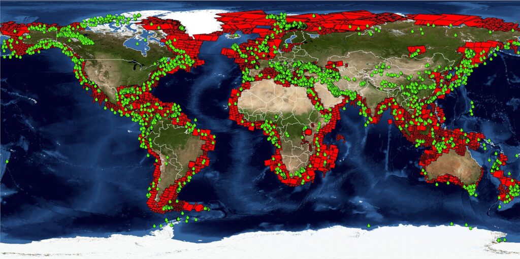
The process of satellite mapping entails gathering, analyzing and processing geographical data gathered by Earth-observing satellites and these satellites’ advanced sensors allow them to collect high-resolution photos and other geospatial data which makes it possible to create precise and in-depth maps. Within the GIS framework, remote sensing, data integration and spatial analysis are the fundamentals of satellite mapping. Geographic Information Systems which rely heavily on satellite mapping have completely changed how we perceive and engage with the outside world. Satellite mapping uses cutting-edge technologies to deliver a multitude of spatial data that is essential for many industries, including disaster management, urban planning, environmental monitoring and defense. This process explores the complex field of satellite mapping including its definition, essential elements, recent technological developments and the wide range of uses that have made it a vital tool for the GIS sector.
The Basics of Satellite Mapping
Satellites for Earth Observation: Satellite mapping is mostly supported by Earth observation satellites and these spacecraft have advanced sensors and devices that can record multispectral data, high-resolution photos and other geographical data. Satellite mapping capabilities have expanded thanks in large part to missions like Sentinel, WorldView and Landsat.
Methods of Remote Sensing: The method of gathering data about a thing or phenomenon without making direct physical contact is called remote sensing where remote sensing methods such as passive and active sensing are crucial to satellite mapping. While active sensors, like radar, release their radiation to collect data, passive sensors pick up natural radiation, like sunshine.
Spectral Bands and Spatial Resolution: The amount of information that can be seen in an image is referred to as its spatial resolution whereas spectral bands are used to record various electromagnetic radiation wavelengths. These two elements have a significant impact on the accuracy and depth of information gathered during satellite mapping. Rich mapping is made possible by high spatial resolution, and different land cover and land use types are identified with the use of many spectral bands.
Technologies for Satellite Mapping
Synthetic Aperture Radar (SAR): Satellite mapping uses Synthetic Aperture Radar, a type of radar imaging technology where SAR satellites send microwave waves in the direction of the surface of the Earth and record the signals that are reflected. SAR is an essential tool for monitoring changes in topography, vegetation and urban areas since it is particularly useful in all-weather and day-and-night imaging.
LiDAR Technology: Laser beams are used in Light Detection and Ranging (LiDAR) technology to measure distances and produce intricate 3D maps of the Earth’s surface. Accurate elevation data is provided by LiDAR-equipped satellites which help with forestry study, urban planning and terrain modeling. LiDAR and satellite mapping work together to improve the accuracy and dependability of geographic data.
Using Hyperspectral Imaging: By recording a wide variety of spectral bands, hyperspectral imaging enables in-depth surface feature analysis. Agriculture, mineral prospecting and environmental monitoring all benefit greatly from this technique and hyperspectral satellite imaging makes it easier to identify particular elements on the surface of the Earth by examining the distinctive spectral signatures of various minerals.
Uses of Satellite Mapping
Conservation and Monitoring of the Environment: To track environmental changes and assist with conservation efforts, satellite mapping is essential and when it comes to making well-informed decisions about environmental management, satellite imagery is a crucial resource for tracking deforestation, monitoring biodiversity and evaluating the effects of climate change.
Development of Infrastructure and Urban Planning: Satellite mapping helps with infrastructure development, land use planning and urban sprawl monitoring in urban planning. Planners are assisted in evaluating the expansion of cities organizing transportation systems and allocating resources most effectively for sustainable urban development by high-resolution photography.
Precision Farming and Agriculture: Precision agriculture maximizes crop management by using satellite mapping where farmers can keep an eye on crop health, pinpoint problem regions and decide on irrigation, fertilization and pest management by evaluating satellite imagery. Increased productivity and sustainable farming methods follow from this.
Response and Management for Disasters: Satellite mapping plays a crucial role in determining the level of damage, pinpointing affected areas and organizing emergency response activities during natural disasters. Planning for reactions to emergencies, recovery efforts and readiness are all aided by timely and precise information obtained from satellite photography.
Data analysis and GIS integration
GIS: Spatial analysis and visualization are made possible with the integration of satellite mapping data by GIS which is a potent tool. GIS platforms facilitate the overlaying of several layers of data, enable geographic analysis and produce significant insights for users. The integration of GIS with satellite mapping improves the use and interpretation of geographical data.
Big Data and Cloud Computing: Earth observation satellites produce enormous amounts of data which calls for sophisticated data management systems. Cloud computing and big data technologies are essential for effectively processing, storing and analyzing large datasets. This permits on-the-spot data processing and guarantees real-time access to geospatial data.
Prospective Developments in Satellite Mapping
Exciting prospects lie ahead for satellite mapping where the precision and effectiveness of satellite mapping are expected to increase with the development of sensor technologies, machine learning and artificial intelligence. Furthermore, it is anticipated that the introduction of tiny satellites and constellations would raise data acquisition frequency and create new opportunities for real-time monitoring and analysis.
Thanks to developments in GIS technology, satellite mapping has become an essential tool for comprehending and managing our globe. Satellite mapping has a wide range of uses starting from disaster relief to environmental conservation. The combination of satellite mapping, GIS and new technologies promises to make our understanding of Earth’s dynamics more accurate than it has ever been in the future as technology progresses.


