New Category

Landuse Landcover mapping

Land Use and Land Cover (LULC)

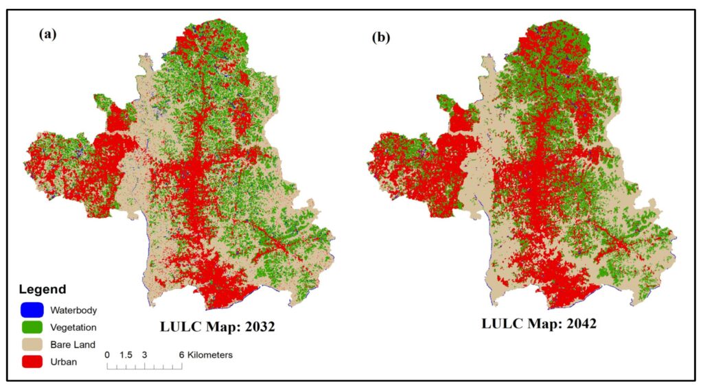
The term Land Use and Land Cover (LULC) refers to the physical and human characteristics-based classification and categorization of the Earth’s surface. In this comprehensive study, the physical characteristics of the land surface (Land Cover) and how land is used (Land Use) are identified. LULC is an important topic when it comes to Geographic Information Systems (GIS). Geographic information systems (GIS) are crucial for mapping and examining LULC trends as well as for learning more about the dynamic relationships between anthropogenic and natural factors that affect our environment. The functional and physical properties of the Earth’s surface are described by the terms “land use” and “land cover,” or LULC for short. These concepts are crucial to comprehending spatial dynamics and are basic to both cartography and GIS analysis. Defination: Land Use: Land Use is a category classification that describes how people use a certain region of land where it includes a wide range of purposes including institutional, commercial, industrial, agricultural, recreational and residential. Land Use is shown in GIS as a thematic layer with distinct codes or symbols allocated to each category for geographical analysis. The physical features and surface characteristics of the Earth’s landscape are referred to as land cover. This covers both man-made features like buildings, roads and urban infrastructure as well as natural aspects like forests, water bodies and bare soil and remote sensing data and pictures are frequently used to illustrate land cover giving a visual depiction of the composition of the Earth’s surface. Methods in LULC Remote Sensing: Utilizing satellite or aerial imagery, remote sensing captures data from a distance where spectral bands help differentiate land cover types based on reflectance characteristics enabling the creation of detailed LULC maps. Supervised Classification: GIS analysts employ machine learning algorithms to classify pixels based on predefined training samples where this method enhances accuracy by training the algorithm to recognize specific land cover signatures. Unsupervised Classification: This method involves grouping pixels without predefined classes and clusters of similar spectral characteristics are identified aiding in the discovery of hidden patterns and facilitating LULC classification. Object-Based Image Analysis (OBIA): Instead of pixel-based analysis, OBIA focuses on image objects, considering spatial relationships where this method improves accuracy by incorporating contextual information, leading to more refined land cover classifications. Change Detection: Monitoring alterations in land use over time is vital and change detection methods, such as image differencing or NDVI analysis, highlight areas transforming, aiding in understanding dynamic LULC patterns. Some Advantages Urban Development and Spatial Planning: LULC in GIS offers crucial insights to legislators and urban planners by supporting the creation of spatial plans and it makes it possible to determine the best locations for residential zones, green spaces and infrastructural development. Cities may ensure sustainable growth and effective resource allocation by optimizing land utilization through the examination of land use trends. Environmental Conservation: Monitoring and managing natural resources is made possible through the use of GIS-based LULC analysis where environmentalists can map land covers including forests, wetlands and agricultural areas to determine how human activity affects ecosystems and the implementation of conservation measures and the preservation of biodiversity depend heavily on this information. Climate Change Assessment: Understanding the effects of climate change requires a thorough understanding of LULC analysis and by tracking how land cover changes over time, GIS technology makes it easier to identify regions that are vulnerable to environmental degradation. Strategies to lessen the effects of climate change such as reforestation projects and sustainable land management techniques can be developed with the use of this information. Disaster Risk Management: The use of LULC in GIS applications is essential for disaster risk reduction where authorities can create efficient plans for responding to disasters by mapping areas that are susceptible to damage and identifying potential hazards. To lessen the effects of natural disasters, for example- mapping land covers in areas prone to flooding enables the deployment of early warning systems and evacuation preparations. Future Trends Land Use and Land Cover (LULC) dynamics are undergoing a transformative evolution, driven by advancements in Geographic Information System technologies where the future trends of LULC are characterized by precision, automation, and integration, revolutionizing how we perceive and manage our environment. Machine learning algorithms are increasingly being employed for accurate land cover classification enabling the extraction of valuable information from satellite imagery with unprecedented accuracy where high-resolution satellite data coupled with LiDAR technology facilitates the creation of detailed 3D models enhancing our understanding of land use patterns. The integration of LULC data with other geospatial datasets such as climate and socioeconomic factors is becoming paramount where this holistic approach enables comprehensive analysis and informed decision-making in urban planning, resource management and environmental conservation. Real-time monitoring using Earth observation satellites allows for timely detection of land cover changes, aiding in disaster management and climate change adaptation. Additionally, the emergence of blockchain technology is enhancing data security and transparency in handling large-scale LULC datasets. Using GIS technology to map land use and land cover is a crucial tool for managing and comprehending our environment. Making educated decisions is aided by the insights gained via LULC analysis which may be used for anything from urban planning to environmental conservation. The assimilation of sophisticated GIS methodologies, artificial intelligence and enhanced data resolution will bolster our capacity to oversee and regulate the ever-changing topographies that mold our planet as technology advances.  
BLACKSKY

BLACKSKY – SATPALDA

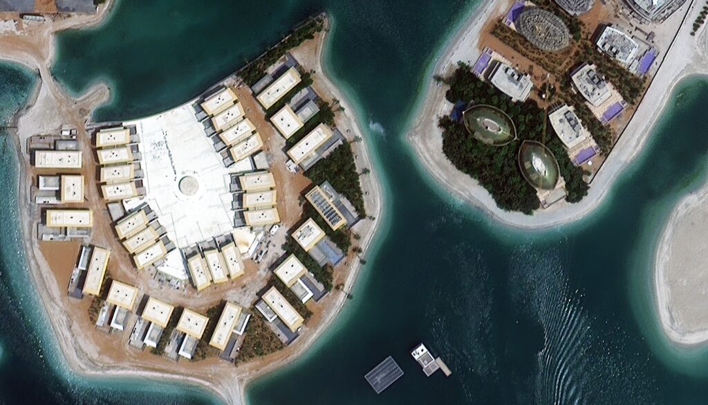
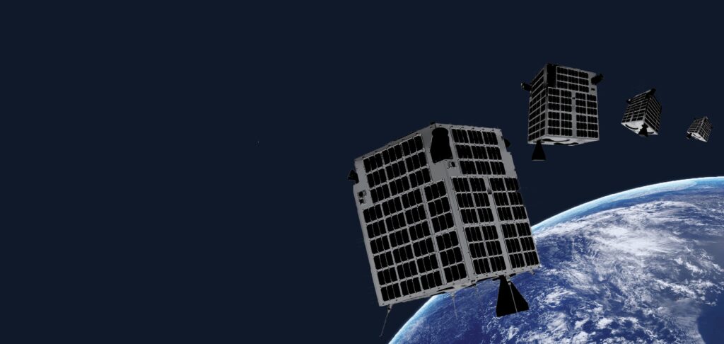
What is a BlackSky satellite? One name has come to light as a beacon of creativity and accuracy in the quickly changing field of geographic intelligence which is BLACKSKY and leveraging state-of-the-art technologies and a powerful GIS infrastructure, it has changed the way we perceive and utilize geographical data. Beyond merely a platform, BLACKSKY is a full-featured geospatial solution that combines real-time data, sophisticated analytics and satellite imagery to provide unmatched insights. Fundamentally, BLACKSKY uses GIS technology to create a dynamic and adaptable ecosystem for geospatial intelligence. Satellite Constellation At the heart of BLACKSKY lies its satellite constellation which is a network of high-resolution imaging satellites orbiting the Earth where this constellation enables BLACKSKY to capture detailed and up-to-date imagery of the Earth’s surface covering vast areas with remarkable precision. The integration of these satellites into the GIS framework allows for real-time monitoring, analysis and response to dynamic events on a global scale. Geospatial Analytics BLACKSKY’s real strength lies in its advanced geospatial analytics capabilities and by utilizing cutting-edge algorithms and machine learning models, BLACKSKY can process massive datasets, identifying patterns, trends and anomalies with exceptional accuracy. This is particularly crucial in fields such as agriculture, urban planning and disaster management where timely and precise information is imperative. In the agricultural sector, for instance, BLACKSKY’s analytics can assess crop health, detect pest infestations and optimize resource allocation. Urban planners can benefit from the platform’s ability to analyze population density, traffic patterns and infrastructure development facilitating informed decision-making for sustainable city planning. Real-time Monitoring One of BLACKSKY’s standout features is its real-time monitoring capabilities and by continuously capturing and analyzing data, BLACKSKY can detect and respond to emergent situations promptly. This is particularly crucial in disaster management scenarios where immediate access to accurate information can save lives and mitigate the impact of natural or man-made disasters. For instance, during a wildfire, BLACKSKY can provide real-time imagery to assess the extent of the fire, monitor its progression and aid in evacuations. Similarly, in the aftermath of a hurricane, the platform can quickly assess infrastructure damage helping prioritize rescue and relief efforts. Integration with GIS Technologies BLACKSKY’s strength is further amplified by its seamless integration with other GIS technologies where the platform supports interoperability with Geographic Information Systems enabling users to overlay satellite imagery with various geospatial layers. This integration enhances the contextual understanding of the data allowing for more comprehensive analysis and decision-making. Industries such as forestry, environmental monitoring and logistics can benefit from this integration by combining satellite imagery with additional geospatial information. For example, in forestry management, BLACKSKY can overlay satellite imagery with data on tree species distribution and terrain characteristics providing a holistic view for sustainable forest planning. Security and Defense Applications BLACKSKY plays a pivotal role in enhancing national security and defense capabilities through its geospatial intelligence solutions where the platform’s ability to monitor and analyze activities in real-time supports defense agencies in surveillance, reconnaissance and threat detection. The military can leverage BLACKSKY to monitor border areas, track troop movements and identify potential security threats. Additionally, the platform’s analytics can help assess the impact of geopolitical events on global security providing decision-makers with valuable insights. Business Intelligence Beyond its applications in defense and disaster management, BLACKSKY offers a competitive edge in the business world where industries such as finance, retail and logistics can harness the power of geospatial intelligence to make informed decisions, optimize supply chains and identify market trends. For example, retail businesses can use BLACKSKY to analyze foot traffic patterns around their stores, optimize product placements and tailor marketing strategies based on location-specific data. Financial institutions can benefit from the platform’s ability to assess economic indicators, monitor infrastructure projects and evaluate investment opportunities. BLACKSKY stands at the forefront of the GIS industry ushering in a new era of geospatial intelligence where its integration of satellite constellations, advanced analytics and real-time monitoring capabilities has far-reaching implications across diverse sectors. From disaster management to business intelligence, BLACKSKY’s applications are as diverse as the data it captures. As technology continues to evolve, the synergy between GIS and platforms like BLACKSKY will redefine how we perceive and interact with the world where the ability to monitor, analyze and respond to dynamic events in real time offers unprecedented opportunities for informed decision-making shaping a future where geospatial intelligence plays a central role in addressing global challenges.

Superview Satellite Imagery

Superview Satellite Imagery

The collection of high-resolution satellite images from the SuperView constellation which is mostly made up of the GF 1, GF 2, and GF 4 satellites is referred to as SuperView imagery and these satellites have sophisticated imaging systems and sensors that can gather precise and in-depth geospatial data. Because of its exceptional spatial resolution, SuperView imagery is well known for allowing users to see even the smallest details on the surface of the Earth. When it comes to supplying useful geographical data for a variety of applications, satellite imagery is essential where the introduction of SuperView Imagery, a state-of-the-art technique that makes use of high-resolution satellite platforms like GF 1, GF 2 and GF 4 is one noteworthy development in this field. GF 1 Satellite: A Pioneer in SuperView Constellation The GF 1 satellite, part of the SuperView constellation, is a trailblazer in providing high-resolution Earth observation data. Launched by the China National Space Administration (CNSA), GF 1 is equipped with multiple sensors including an optical camera with panchromatic and multispectral capabilities and with a spatial resolution as fine as 0.8 meters, GF 1 can capture detailed imagery suitable for applications such as urban planning, agriculture monitoring and disaster management. GF 2 Satellite: Advancing Spatial Resolution and Coverage Building upon the success of GF 1, the GF 2 satellite represents a significant leap forward in terms of spatial resolution and coverage. Launched to enhance Earth observation capabilities, GF 2 boasts a spatial resolution of 0.5 meters in panchromatic mode and 2 meters in a multispectral mode where this improved resolution allows for more precise mapping, environmental monitoring and infrastructure development assessments. GF 4 Satellite: Pushing Boundaries with Enhanced Capabilities The GF 4 satellite, the latest addition to the SuperView constellation, takes the capabilities of SuperView Imagery to new heights. Equipped with state-of-the-art sensors including an even more powerful optical camera, GF 4 achieves a remarkable spatial resolution of 0.5 meters in panchromatic mode and 2 meters in multispectral mode where the enhanced capabilities of GF 4 make it a valuable asset for applications demanding unparalleled image clarity such as military reconnaissance, disaster response and environmental studies. Applications of SuperView Imagery Urban Planning and Development: The high spatial resolution of SuperView Imagery, especially from GF 2 and GF 4, facilitates detailed mapping of urban areas where urban planners can utilize this data for land-use classification, infrastructure assessment and monitoring of construction activities. Agriculture Monitoring: Precision agriculture relies heavily on accurate and timely information where SuperView Imagery aids in monitoring crop health, identifying irrigation issues and assessing overall agricultural productivity. The detailed imagery allows for the detection of subtle changes in vegetation health. Environmental Monitoring: GF 4’s enhanced capabilities make it particularly valuable for environmental studies where researchers can analyze vegetation cover, land use changes and deforestation with unprecedented detail. This information is crucial for understanding and mitigating the impact of human activities on the environment. Disaster Management: Rapid and accurate response to natural disasters is crucial for minimizing damage and saving lives where SuperView Imagery aids in disaster management by providing real-time information on affected areas enabling authorities to plan and execute effective relief efforts. Military and Defense Applications: The high-resolution imagery from SuperView satellites, especially GF 4, is of great significance in military and defense applications and it enables detailed reconnaissance, identification of strategic targets and monitoring of activities in sensitive areas. Technical Nuances of SuperView Imagery Spectral Bands: SuperView satellites including GF 1, GF 2, and GF 4, capture imagery in various spectral bands where these bands range from visible light to infrared allowing for a comprehensive analysis of the Earth’s surface. Multispectral and hyperspectral data enable advanced applications such as vegetation health assessment and mineral identification. Resolution: Spatial resolution is a critical factor in satellite imagery determining the level of detail that can be captured where the panchromatic mode of GF 2 and GF 4, with a spatial resolution of 0.5 meters, enables the detection of small objects and features on the ground. This level of detail is invaluable in applications where precision is paramount. Revisit Time: The revisit time of SuperView satellites is a measure of how frequently a satellite passes over the same area where shorter revisit times, facilitated by the SuperView constellation, ensure more frequent updates of imagery for dynamic applications such as monitoring urban growth or tracking changes in vegetation. Data Fusion: SuperView Imagery often involves the fusion of data from multiple sensors and spectral bands where data fusion enhances the overall quality of the imagery and allows for a more comprehensive analysis by combining the strengths of different sensors. SuperView Imagery, powered by the GF 1, GF 2, and GF 4 satellites represents a pinnacle in the field of Earth observation. The high spatial resolution, advanced sensors and enhanced capabilities of these satellites open up new possibilities for GIS applications across various industries and starting from urban planning and agriculture monitoring to disaster management and military reconnaissance, SuperView Imagery continues to redefine the standards of geospatial information. As technology advances and satellite capabilities evolve, the synergy between SuperView Imagery and GIS is poised to play a pivotal role in shaping our understanding of the dynamic Earth.

AXELSPACE

AXELSPACE

The demand for high-resolution, timely and accurate satellite imagery has never been higher where AXELSPACE, a pioneering player in the space technology arena has emerged as a key contributor to this demand revolutionizing the GIS industry with its cutting-edge satellite imaging capabilities. Founded in 2008 in Tokyo, Japan, AXELSPACE has grown into a globally recognized company specializing in microsatellite development and Earth observation. The company’s mission revolves around providing accessible and cost-effective satellite imagery to facilitate various applications ranging from agriculture and environmental monitoring to urban planning and disaster response. Technical Specifications AXELSPACE employs a fleet of microsatellites equipped with advanced imaging sensors, each tailored to capture specific spectral bands for diverse applications. The technical specifications of these satellites play a pivotal role in their ability to deliver high-quality imagery: Spectral Resolution: AXELSPACE satellites are designed with multispectral and hyperspectral sensors enabling the capture of imagery in various wavelengths and this capability proves invaluable in tasks such as vegetation monitoring, mineral exploration and environmental assessment. Spatial Resolution: The spatial resolution of AXELSPACE imagery is a critical factor influencing the level of detail discernible in the captured images and with resolutions reaching down to sub-meter levels, these satellites provide sharp and detailed imagery for precise mapping and analysis. Temporal Resolution: AXELSPACE is committed to providing timely and up-to-date information where the constellation of microsatellites ensures a high temporal resolution enabling frequent revisits over specific areas. This feature is indispensable for monitoring dynamic phenomena like urban growth, crop health and natural disasters. Radiometric Resolution: The radiometric capabilities of AXELSPACE satellites enable the capture of images with a wide range of intensity values which is crucial for applications such as land cover classification where subtle differences in reflectance must be accurately represented. Applications Precision Agriculture: AXELSPACE imagery aids in optimizing agricultural practices by providing detailed insights into crop health, soil moisture levels and pest infestations where farmers can make data-driven decisions, enhancing crop yields and reducing resource usage. Environmental Monitoring: The multispectral and hyperspectral capabilities of AXELSPACE satellites are instrumental in monitoring environmental changes; starting from tracking deforestation and assessing water quality to monitoring biodiversity, these satellites contribute valuable data for sustainable resource management. Urban Planning and Infrastructure Development: Rapid urbanization necessitates accurate mapping and planning where AXELSPACE imagery, with its high spatial resolution, facilitates urban planners in mapping land use, monitoring construction activities and assessing the impact of infrastructure projects. Disaster Response and Management: In times of natural disasters such as earthquakes, floods or wildfires, AXELSPACE imagery proves indispensable for assessing the extent of damage, planning emergency responses and facilitating rapid recovery efforts. Natural Resource Exploration: AXELSPACE satellites contribute to the exploration and monitoring of natural resources and whether it is identifying potential mining sites or assessing the health of forests, the imagery aids in making informed decisions about resource utilization. AXELSPACE has undeniably left an indelible mark on the GIS industry providing a reliable and innovative source of high-quality satellite imagery where the technical prowess of AXELSPACE satellites, coupled with their diverse applications, positions them as a key player in shaping the future of geospatial data acquisition and analysis. As technology advances, the marriage of AXELSPACE imagery with GIS promises to unlock new possibilities for informed decision-making across various sectors.

Remote Sensing and Application in civil engineering

The term “remote sensing” describes the process of gathering information about a thing or phenomenon from a distance usually using satellites or aircraft sensors where the GIS sector uses remote sensing technologies to gather important data on the Earth’s oceans, atmosphere and surface. Many industries including agriculture, urban planning, disaster management, environmental monitoring and natural resource assessment have been transformed by the combination of remote sensing and GIS. In recent years, remote sensing, a crucial part of the Geographic Information System (GIS) industry has experienced unheard-of expansion and technological advancement. This process explores the complexities of remote sensing emphasizing its importance, uses and the cutting-edge technology that is advancing the field. This thorough investigation which includes satellite images and LiDAR (Light Detection and Ranging) seeks to give a thorough grasp of the present situation and potential future applications of remote sensing in the GIS sector. Fundamentals of Remote Sensing: Electromagnetic Spectrum: The electromagnetic spectrum which includes a wide range of wavelengths is used in remote sensing. Different sensors can extract different types of information since they are made to catch different parts of the spectrum and in remote sensing applications, the visible, infrared, and microwave areas are often used. Platforms and Sensors: Satellites, airplanes, unmanned aerial vehicles and ground-based sensors are examples of remote sensing platforms. These platforms are fitted with a range of sensors including radar sensors to penetrate clouds and vegetation, optical sensors to record visible and infrared light and thermal sensors to measure heat. Types of Remote Sensing: Passive Remote Sensing: These devices pick up natural radiation that the Earth’s surface emits or reflects. Examples are thermal infrared sensors which detect heat emissions and optical sensors which record sunlight reflected by objects. Active Remote Sensing: In active remote sensing, sensors release their energy and detect the signals that come back where LiDAR and radar are two well-known examples. LiDAR uses laser beams to measure distances with extreme precision whereas radar systems use radio waves to cut through clouds and foliage. Satellite Remote sensing Types of Satellites: Satellites are essential in remote sensing. There are three types of earth observation satellites: radar, thermal and optical. High-resolution photographs in the visible and infrared spectrum are captured by optical satellites such as those in the Landsat series. Thermal satellites measure infrared radiation for temperature analysis. Examples of these satellites are the MODIS (Moderate Resolution Imaging Spectroradiometer) series. Radar satellites that provide all-weather imaging may penetrate clouds such as those in the Sentinel-1 series. Resolution and Spectral Bands: Radiometric, temporal, spectral and geographic resolutions are attributes of satellite images. Whereas spectral resolution shows the quantity and width of spectral bands, spatial resolution describes the amount of detail that is caught in an image and temporal resolution indicates how often a satellite returns to a given position whereas radiometric resolution measures the sensor’s capacity to discern between various brightness levels. LiDAR Technology Principles of LiDAR: LiDAR is a type of remote sensing technology that uses laser light to detect distances where the system determines how long it will take the laser pulse to be released to reach its target and back using the time-of-flight principle. Because LiDAR can provide extremely accurate three-dimensional point clouds, it is a vital tool for forestry, urban planning, infrastructure construction and terrain modeling. Applications of LiDAR: LiDAR is widely used for modeling floodplains, topographic mapping, classifying land cover and tracking urban growth and it helps in the estimation of biomass and tree density in forestry. LiDAR is also necessary for autonomous cars’ real-time obstacle detection and navigation. Application of Remote Sensing in Civil Engineering Infrastructure Supervision and Management: An essential part of managing and keeping an eye on current infrastructure is remote sensing. Afraid surveys and satellite images offer an affordable way to keep an eye on infrastructure assets like roads, bridges and dams frequently. The early discovery of structural abnormalities, subsidence and other possible problems is facilitated by this ongoing monitoring. Furthermore, engineers can design comprehensive asset management systems thanks to the integration of remote sensing data into GIS platforms and by making it easier to track infrastructure conditions effectively, these solutions lower the chance of catastrophic breakdowns and enable prompt maintenance. Development and Urban Planning: Urban area management and planning are challenged by the world’s fast urbanization. Technologies for remote sensing provide vital information on land usage, population density and infrastructure distribution which helps with urban planning and development. LiDAR data and high-resolution satellite photography help urban planners analyze existing urban structures, find development sites that make sense and allocate resources as efficiently as possible. GIS platforms facilitate comprehensive urban planning methods by combining several layers of geographical data, hence improving the decision-making process. Surveying and Mapping: Mapping and surveying are two of the main uses of remote sensing in civil engineering where the conventional surveying techniques can be labor- and time-intensive, particularly in the case of huge and difficult-to-reach terrain. The method of surveying has been completely transformed by remote sensing technology such as satellite photography and LiDAR (Light Detection and Ranging). With the use of high-resolution, current maps provided by satellite photography, engineers may evaluate topography, land cover and land use and thanks to its laser scanning capabilities, LiDAR produces intricate three-dimensional maps that provide important information about surface features and terrain elevation. By streamlining the surveying procedure, these technologies enable precise data collection for planning and designing building projects. Advanced Technologies for Remote Sensing: Hyperspectral imaging: By gathering information from hundreds of small spectral bands, hyperspectral sensors can provide precise details on an object’s makeup where environmental monitoring, mineral prospecting and precision agriculture are some of the fields in which this technology is used. Artificial Intelligence and Machine Learning: Large-scale remote sensing data analysis is increasingly using machine learning algorithms such as neural networks and the efficiency of data interpretation is greatly increased by these techniques which allow for automatic feature extraction, categorization and pattern identification. Leading the way in technological innovation, remote sensing is bringing about significant changes in the

What is satellite imagery

What is satellite imagery?

The science of GIS relies heavily on satellite imagery which has revolutionized our understanding of and ability to interpret spatial data and with the development of technology, satellite imaging has emerged as a vital resource for a wide range of uses starting from disaster relief and agricultural appraisal to environmental monitoring and urban planning. Why is Satellite Imagery Important? Technical Basis of Satellite Imagery Satellite-Based Sensors Optical Measurements: The visible, near-infrared and thermal infrared spectrum of electromagnetic radiation are all captured by optical sensors installed on satellites and these sensors make it possible to produce detailed photographs that show changes in land cover, atmospheric conditions and surface details. Synthetic Aperture Radar (SAR): Satellites employ SAR which is a radar imaging technique, to acquire high-resolution images regardless of the weather or cloud cover. It works by sending out microwave signals and examining the echoes that are returned giving useful information for tasks like monitoring and terrain mapping. Spectral Bands and Spatial Resolution Spatial Resolution: The degree of detail in a satellite image is referred to as spatial resolution and because high spatial resolution photographs can distinguish finer details, they are useful for applications such as infrastructure monitoring and urban planning. Spectral Bands: Scientists can investigate diverse facets of the Earth’s surface by utilizing satellites that gather data in a range of spectral bands. The identification of certain materials and environmental circumstances is made possible by multispectral and hyperspectral imaging. Monitoring and Management of the Environment Research on Climate Change Monitoring of Temperature: Monitoring temperature variations with satellite imagery makes it easier to research trends in global warming. Scientists can examine regional fluctuations in temperature thanks to the thermal data collected by infrared sensors. Ice Cap and Glacier Monitoring: Data from satellites is essential for tracking ice caps and glaciers and their fluctuations where scientists can monitor the rate of melting and evaluate the effects of climate change on Polar Regions with the aid of high-resolution images. Changes in Land Use and Deforestation Analysis of Forest Cover: The use of satellite images facilitates the tracking of forest cover changes and deforestation. Sustainable land management and environmental conservation depend on this knowledge. Mapping Urbanization: Cities are growing quickly and tracking patterns of urbanization requires the use of satellite images. Urban sprawl’s negative environmental effects are lessened and infrastructure development is better planned thanks to this data. Food Security and Agriculture Crop Observation and Estimated Yield NDVI Evaluation: The health and density of vegetation are indicated by the Normalized Difference Vegetation Index (NDVI) which is calculated from satellite data. NDVI is a tool used by farmers and agricultural specialists to evaluate crop health, forecast yields and identify abnormalities. Precision Agriculture: Satellite technology helps precision agriculture by giving comprehensive data on crop health, soil composition and moisture levels. This data improves agricultural output and makes the most use of available resources. Systems of Early Warning Early Warning Systems: Early identification of insect infestations and drought conditions is facilitated by satellite imaging where farmers can reduce crop losses and ensure food security by implementing preventative measures with timely information. What are the main types of Satellite Imagery? Optical Imagery: Sensors that identify visible and near-infrared light are used to record optical satellite imagery. These sensors provide images with different resolutions by capturing the electromagnetic spectrum reflected by the Earth’s surface and for tasks like change detection, urban planning and land cover classification, high-resolution optical photography is perfect. Multispectral Imagery: It is produced by satellite sensors that gather information in multiple electromagnetic spectrum areas. Different features on the surface of the Earth can be analyzed because each band corresponds to a particular wavelength range. Since many plants have unique spectral fingerprints, multispectral photography is useful in agriculture for crop health monitoring. Hyperspectral Imagery: By capturing a greater number of small contiguous bands, hyperspectral sensors give each pixel a more thorough spectral profile. In fields where it’s critical to identify particular materials or compounds, like precision agriculture, mineral mining and environmental monitoring, this kind of imagery is invaluable. Radar Imagery: Using microwave frequencies, radar satellite imagery can see through clouds and offer surface-level information. Application areas where Synthetic Aperture Radar (SAR) is most helpful include tracking sea ice, identifying ground deformation and evaluating vegetation structure. Thermal Infrared Imagery: The heat radiation that the Earth’s surface emits is detected by thermal infrared sensors. Applications like tracking urban heat islands, evaluating the damage caused by forest fires and detecting thermal abnormalities in industrial facilities benefit from this kind of photography. Lidar Imagery: Using laser pulses to detect distances, Lidar, also known as Light Detection and Ranging is an active remote sensing technique. Lidar satellite imagery is very useful for mapping terrain, predicting floods and urban planning since it offers extremely accurate elevation data. Satellite Video Imagery: Real-time monitoring of dynamic occurrences is made possible by certain sophisticated satellites that continuously record video streams of the Earth’s surface. Large-scale environmental changes over time, tracking trends of extreme weather and disaster response all depend on this kind of photography. What is Satellite Imagery used for? Remote Sensing and Earth Observation: The field of remote sensing and earth observation relies heavily on satellite imaging as a fundamental component. Scientists can gather information on the Earth’s surface, atmosphere and oceans by using sensors onboard satellites and these observations support the monitoring of natural disasters, land cover changes, deforestation and climate change. Agriculture: For effective crop management, precision agriculture significantly depends on satellite imagery. Farmers can monitor crop health, evaluate soil conditions and optimize irrigation with the use of high-resolution imagery. In the end, this data-driven strategy promotes sustainable agriculture practices by improving resource utilization and crop production estimates. Infrastructure Development and Urban Planning: Satellite imagery is essential for both of these processes and to evaluate land use trends, track urban expansion and plan for infrastructure projects, city planners use precise satellite imagery. This helps to ensure sustainable growth in urban areas and optimize the allocation of resources. Disaster Management: Real-time data for disaster

What is mapping satellite?

The process of satellite mapping entails gathering, analyzing and processing geographical data gathered by Earth-observing satellites and these satellites’ advanced sensors allow them to collect high-resolution photos and other geospatial data which makes it possible to create precise and in-depth maps. Within the GIS framework, remote sensing, data integration and spatial analysis are the fundamentals of satellite mapping. Geographic Information Systems which rely heavily on satellite mapping have completely changed how we perceive and engage with the outside world. Satellite mapping uses cutting-edge technologies to deliver a multitude of spatial data that is essential for many industries, including disaster management, urban planning, environmental monitoring and defense. This process explores the complex field of satellite mapping including its definition, essential elements, recent technological developments and the wide range of uses that have made it a vital tool for the GIS sector. The Basics of Satellite Mapping Satellites for Earth Observation: Satellite mapping is mostly supported by Earth observation satellites and these spacecraft have advanced sensors and devices that can record multispectral data, high-resolution photos and other geographical data. Satellite mapping capabilities have expanded thanks in large part to missions like Sentinel, WorldView and Landsat. Methods of Remote Sensing: The method of gathering data about a thing or phenomenon without making direct physical contact is called remote sensing where remote sensing methods such as passive and active sensing are crucial to satellite mapping. While active sensors, like radar, release their radiation to collect data, passive sensors pick up natural radiation, like sunshine. Spectral Bands and Spatial Resolution: The amount of information that can be seen in an image is referred to as its spatial resolution whereas spectral bands are used to record various electromagnetic radiation wavelengths. These two elements have a significant impact on the accuracy and depth of information gathered during satellite mapping. Rich mapping is made possible by high spatial resolution, and different land cover and land use types are identified with the use of many spectral bands. Technologies for Satellite Mapping Synthetic Aperture Radar (SAR): Satellite mapping uses Synthetic Aperture Radar, a type of radar imaging technology where SAR satellites send microwave waves in the direction of the surface of the Earth and record the signals that are reflected. SAR is an essential tool for monitoring changes in topography, vegetation and urban areas since it is particularly useful in all-weather and day-and-night imaging. LiDAR Technology: Laser beams are used in Light Detection and Ranging (LiDAR) technology to measure distances and produce intricate 3D maps of the Earth’s surface. Accurate elevation data is provided by LiDAR-equipped satellites which help with forestry study, urban planning and terrain modeling. LiDAR and satellite mapping work together to improve the accuracy and dependability of geographic data. Using Hyperspectral Imaging: By recording a wide variety of spectral bands, hyperspectral imaging enables in-depth surface feature analysis. Agriculture, mineral prospecting and environmental monitoring all benefit greatly from this technique and hyperspectral satellite imaging makes it easier to identify particular elements on the surface of the Earth by examining the distinctive spectral signatures of various minerals. Uses of Satellite Mapping Conservation and Monitoring of the Environment: To track environmental changes and assist with conservation efforts, satellite mapping is essential and when it comes to making well-informed decisions about environmental management, satellite imagery is a crucial resource for tracking deforestation, monitoring biodiversity and evaluating the effects of climate change. Development of Infrastructure and Urban Planning: Satellite mapping helps with infrastructure development, land use planning and urban sprawl monitoring in urban planning. Planners are assisted in evaluating the expansion of cities organizing transportation systems and allocating resources most effectively for sustainable urban development by high-resolution photography. Precision Farming and Agriculture: Precision agriculture maximizes crop management by using satellite mapping where farmers can keep an eye on crop health, pinpoint problem regions and decide on irrigation, fertilization and pest management by evaluating satellite imagery. Increased productivity and sustainable farming methods follow from this. Response and Management for Disasters: Satellite mapping plays a crucial role in determining the level of damage, pinpointing affected areas and organizing emergency response activities during natural disasters. Planning for reactions to emergencies, recovery efforts and readiness are all aided by timely and precise information obtained from satellite photography. Data analysis and GIS integration GIS: Spatial analysis and visualization are made possible with the integration of satellite mapping data by GIS which is a potent tool. GIS platforms facilitate the overlaying of several layers of data, enable geographic analysis and produce significant insights for users. The integration of GIS with satellite mapping improves the use and interpretation of geographical data. Big Data and Cloud Computing: Earth observation satellites produce enormous amounts of data which calls for sophisticated data management systems. Cloud computing and big data technologies are essential for effectively processing, storing and analyzing large datasets. This permits on-the-spot data processing and guarantees real-time access to geospatial data. Prospective Developments in Satellite Mapping Exciting prospects lie ahead for satellite mapping where the precision and effectiveness of satellite mapping are expected to increase with the development of sensor technologies, machine learning and artificial intelligence. Furthermore, it is anticipated that the introduction of tiny satellites and constellations would raise data acquisition frequency and create new opportunities for real-time monitoring and analysis. Thanks to developments in GIS technology, satellite mapping has become an essential tool for comprehending and managing our globe. Satellite mapping has a wide range of uses starting from disaster relief to environmental conservation. The combination of satellite mapping, GIS and new technologies promises to make our understanding of Earth’s dynamics more accurate than it has ever been in the future as technology progresses.

Geographic Information Systems (GIS)

Geographic Information Systems (GIS)

Geographic Information System or GIS is a strong framework for gathering, storing, processing and displaying geographic data and this customized system makes it easier to handle spatial information efficiently by integrating data, software and hardware. GIS links location-based attributes to geographical elements so that users may comprehend linkages, patterns and trends within the data. GIS (Geographic Information Systems) has become a key piece of technology for decision-making, mapping, and spatial analysis. GIS is essential for integrating geographical information to gain insights, resolve challenging issues and support well-informed decision-making in a world where data is driving change. This process explores the underlying ideas, technical aspects, applications and emerging trends that will shape this dynamic area as it dives into the complexities of GIS. Understanding the Basics of GIS Geospatial Data: Geospatial data or information associated with particular geographic places on Earth’s surface is the foundation of GIS. There are two categories for this data: raster and vector where raster data uses a grid of cells to represent the surface, much like a pixelated image whereas vector data uses points, lines and polygons to express spatial information. Coordinate Systems: Coordinate systems provide a framework for locating and visualizing spatial data which makes them the foundation of GIS. Latitude and longitude are common coordinate systems for global positioning, and many local coordinate systems are used for more accurate area mapping. Data Sources: Satellite images, aerial photography, remote sensing and ground surveys are just a few of the several data sources that GIS uses and by combining various sources, GIS experts may provide accurate and thorough spatial datasets. The Technical Components of GIS Data Acquisition and Input: Numerous technologies are used during the data collection and input phases of a GIS. Real-time data collection in the field is made possible by GPS (Global Positioning System) devices while remote sensing technologies use imagery from drones or satellites. Furthermore, information can be gathered through surveys or digitalized from already-existing maps. Data Management and Storage: GIS databases are made to effectively store and handle massive amounts of spatial data where spatial databases make it easier to store and retrieve spatial data. Examples of these databases are PostgreSQL with PostGIS extension and Esri’s ArcSDE. Data Analysis and Processing: GIS software packages such as ArcGIS, QGIS and GRASS GIS provide a multitude of analytical capabilities for data analysis and processing and with the use of spatial analysis techniques like overlay analysis, proximity analysis and network analysis, experts may extract valuable information from geospatial datasets. Data Visualization and Output: GIS study culminates in the creation of maps and visualizations and the production of visually beautiful and informative maps is guided by cartographic principles. GIS experts utilize programs like Tableau and Mapbox to communicate intricate geographical data understandably. Applications of GIS across Industries GIS Applications in a Variety of Industries Development and Urban Planning: By examining population distribution, land use trends and infrastructure needs, GIS helps urban planners create sustainable cities. It makes it possible to see how suggested advancements might affect the ecosystem. Environmental Management: GIS is essential to environmental research for controlling and keeping an eye on natural resources and to manage resources sustainably, it provides vital information on mapping biodiversity, tracking deforestation and evaluating the effects of climate change. Public Health GIS: GIS plays a critical role in public health by analyzing healthcare accessibility, tracking disease transmission and identifying high-risk locations. GIS has proven to be extremely helpful in tracking the spread of infectious illnesses during times of global health emergencies. Logistics and Transportation: GIS is used in efficient transportation systems for traffic analysis, infrastructure design and route optimization and by monitoring supply chain networks and streamlining delivery routes, GIS technology improves logistics operations. Agriculture and Precision Farming: Geographic Information System (GIS) is used in agriculture to help farmers monitor irrigation, analyze soil conditions and determine if a piece of land is suitable for a certain crop. GIS is used in precision farming practices to increase total agricultural productivity. Future Trends in GIS Spatial AI and Machine Learning Integration: GIS is about to undergo a revolution with the combination of machine learning (ML) and spatial artificial intelligence (AI) and by improving the automation of spatial analysis, these technologies allow systems to learn from patterns in data and anticipate future events. Real-time Data Analytics: Real-time data analytics in GIS is becoming more and more in demand and the ability to analyze and visualize data as it is being collected is beneficial for applications such as environmental monitoring, traffic management and emergency response. 3D GIS and Augmented Reality: A more engaging and interactive experience is offered by the development of GIS into the fields of augmented reality and three-dimensional modeling. This is especially helpful for simulation-based training, architecture and urban planning. Blockchain for Spatial Data Security: The necessity for transparent and safe data management grows along with the significance of spatial data and researchers are investigating the use of blockchain technology to improve the security and integrity of spatial data, guaranteeing its veracity and thwarting unwanted manipulation. Geographic Information Systems have developed from specialized instruments to vital resources for a variety of sectors where it is always pushing the boundaries of technology with the combination of cutting-edge applications, growing datasets and creative thinking. The importance of GIS in creating a world that is spatially aware is becoming more and more evident as GIS experts work through the difficulties and welcome new developments. The GIS journey is an exciting data-driven study of our globe that provides insights that enable us to make wise decisions for a sustainable future.

Stereo Satellite Imagery

Stereo Satellite Imagery

Stereo Satellite Imagery involves the acquisition of images from two slightly different perspectives mimicking the human visual system’s binocular vision. This method is based on the parallax principle which states that objects appear to change in perspective and this parallax effect is used in satellite photography to produce a three-dimensional depiction of the Earth’s surface. Stereo satellite imagery is obtained by merging images from various passes of the same satellite or by employing satellite sensors with numerous viewing angles. A few spacecraft have two or more sensors installed, and these sensors take pictures from slightly varied angles while in orbit where this arrangement guarantees the formation of stereo pairs which are necessary to produce precise three-dimensional models. The use of stereo satellite images is now essential for analysis, mapping and visualization. Our ability to detect and represent the Earth’s surface in three dimensions has greatly improved with the incorporation of stereo satellite images into GIS workflows allowing for more precise and in-depth spatial analysis. The technical nuances of stereo satellite imagery, as well as its uses, difficulties and changing environment within the GIS sector are explored in this article. Understanding Stereo Satellite Imagery Basics of Stereoscopy Stereoscopy is the process of showing two slightly offset pictures to the viewer’s left and right eyes independently to create or enhance the illusion of depth in an image. This depth perception in satellite images is attained by taking two separate pictures of the same region of the Earth’s surface. The ensuing stereo pairs make it possible to precisely quantify topographical features and create three-dimensional (3D) models. Satellite Sensors and Platforms High-resolution optical sensors installed on different satellite platforms are principally used to acquire stereo satellite pictures and to create the required stereo pairs, two or more sensors on satellites with stereo imaging capability often take pictures of the same area after a delay. A few well-known satellites with stereo imaging capability are Pleiades, WorldView-3 and GeoEye. Image Resolution and Accuracy The capacity of stereo satellite photography to produce precise and high-resolution depictions of the Earth’s surface accounts for its success. The size of a ground pixel determines an image’s resolution; higher resolutions enable more in-depth and accurate analysis and to ensure the accuracy of the generated 3D models and to align stereo pairs, accurate georeferencing is essential. Applications of Stereo Satellite Imagery Topographic Mapping: Topographic mapping is one of the main uses of stereo satellite imagery in GIS and the GIS experts can create incredibly precise and comprehensive topographic maps by extracting elevation data from stereo pairs. Applications for these maps include environmental monitoring, infrastructure building and urban planning. Digital Elevation Models (DEMs): Digital elevation models that show the elevation values of the Earth’s surface as a continuous raster are made possible in large part by stereo satellite data. DEMs contribute to many GIS applications by providing essential data for line-of-sight, slope and hydrological modeling. Change Detection: Using stereo satellite images, change detection is made possible by the capacity to capture the same area at several periods. Changes in infrastructure, natural characteristics and land cover throughout time can be recognized and measured by GIS analysts. The ability to monitor environmental changes, deforestation and urban growth is vital. Disaster Response and Management: Stereo satellite imaging is essential for disaster response and management during natural disasters like earthquakes and floods. Planning and carrying out relief operations are made easier by the early assessment of the impacted areas made possible by the speedy gathering of 3D data. 3D City Modeling and Urban Planning: Urban planners can view and analyze the spatial arrangement of cities with the help of stereo satellite images which makes the production of 3D city models easier. This is especially helpful for zoning, infrastructure development and determining how new construction projects would affect the current urban environment. Future Directions and Emerging Trends Next-Generation Satellite Sensors: The potential of stereo satellite imaging keeps expanding because of developments in satellite sensor technology and it is anticipated that next-generation sensors will offer even greater resolutions, better spectral capabilities, and longer revisit periods, creating new opportunities for GIS applications. Artificial Intelligence for Image Analysis: The merging of machine learning (ML) and artificial intelligence (AI) in stereo-picture processing is a developing field. GIS operations are getting more precise and efficient as a result of AI algorithms’ growing proficiency in feature recognition, categorization and change detection. Fusion of Multisensor Data: The merging of data from several sensors such as hyperspectral, SAR (Synthetic Aperture Radar) and stereo satellite images is becoming more popular. Through the use of several sensors, GIS datasets become richer facilitating more thorough analysis and a better comprehension of Earth’s dynamics. Stereo satellite imagery stands at the forefront of technological advancements in the GIS industry, enabling professionals to extract detailed 3D information about the Earth’s surface. The applications are numerous and include urban planning, disaster relief, topographic mapping and more. The future of stereo satellite imagery in the GIS landscape is full of intriguing potential as technical advancements tackle difficulties related to data processing and integration and the combination of stereo satellite imagery and GIS along with next-generation sensors and AI-driven analysis is poised to revolutionize our understanding and management of the complexity of our ever-changing globe.  

Digital Elevation Models (DEM) and Digital Surface Models (DSM) are two fundamental elements in GIS landscape modeling where these models serve different functions and are essential in various applications, from environmental management to urban planning despite their seemingly interchangeable use.

Digital Surface Model vs Digital Elevation Model

Digital Elevation Models (DEM) and Digital Surface Models (DSM) are two fundamental elements in GIS landscape modeling where these models serve different functions and are essential in various applications, from environmental management to urban planning despite their seemingly interchangeable use. In this thorough investigation, one can explore the subtleties of digital surface models and digital elevation models by looking at their definitions, approaches and uses in the GIS sector. Knowing the Fundamentals Digital Surface Model (DSM) A Digital Surface Model often referred to as a DTM (Digital Terrain Model) is a representation of the surface of the Earth that includes both the topography and natural features such as houses and trees. A DSM provides an integrated perspective of the terrain by encompassing all items on Earth’s surface, both natural and man-made and this model provides a thorough depiction of the surface characteristics by incorporating elevation data of the ground and any items atop it. Several data sources such as satellite photography, photogrammetry and Light Detection and Ranging (LiDAR) technology are used to generate a Digital Surface Model. Since LiDAR can record high-resolution elevation data, it is very useful for creating precise DSMs. After that, the data is processed to produce a three-dimensional map of the Earth’s surface that takes into consideration the different elevations of the land and objects on the surface. Digital Elevation Model (DEM) On the other hand, a digital elevation model only shows the bare Earth’s topography without any surface characteristics like plants, buildings or other structures. A digital elevation model (DEM) is a mathematical depiction of the Earth’s surface that shows ground surface elevation values only omitting things above the surface and it also offers a foundational layer for several applications including viewshed analysis, slope analysis and hydrological modeling. Like DSMs, DEMs are produced from a variety of data sources employing techniques like stereo-photogrammetry, satellite-based interferometry and LiDAR where the main objective is to obtain precise elevation data for the landscape, eliminating elements that are not on the ground to create an accurate depiction of the Earth’s surface. Methodologies in DSM and DEM Generation LiDAR Technology Leading edge data collecting technology for both DSMs and DEMs is Light Detection and Ranging (LiDAR) as LiDAR uses laser beams to determine the separation between the sensor and the surface of the Earth making accurate elevation calculations possible. High-precision elevation models may be created because the laser pulses are emitted and bounce back to the sensor and the time it takes for the return signal provides information about the distance. LiDAR gathers elevation data from any surface object as well as the ground for use in DSM generation. A comprehensive model that accurately depicts the Earth’s surface and all of its features is the outcome of this inclusive approach. LiDAR is used in DEM production to remove features that are not on the ground. LiDAR efficiently isolates the terrain elevation values by focusing on the initial return of the laser pulses which corresponds to the Earth’s surface and this results in a DEM that does not include above-ground objects. Photogrammetry The science of getting accurate measurements from images or photogrammetry is another technique used in the creation of DSM and DEMs and this method extracts three-dimensional topography information by analyzing overlapping aerial or satellite photos. When creating a DSM using photogrammetry, surface items and the ground are both photographed and elevation data is identified and extracted from both. As a result, the whole surface of the Earth including all features above ground is accurately depicted. Photogrammetry is the process of creating Digital Elevation Models (DEMs) by extracting elevation data from the ground alone ignoring any non-ground objects in the imagery. The final model accurately depicts the topography of the naked Earth which is crucial for applications where an accurate representation of the landscape is crucial. Some Applications Digital Surface Model Applications Urban Planning and Development: DSMs are essential to urban planning because they offer a thorough perspective of the topography and structures currently in place. This helps in land use optimization, evaluating the effects of new construction and designing infrastructure. Vegetation Monitoring: DSMs help in vegetation monitoring by recording the height and structure of trees and plants. Planning for forestry, environmental management and determining how vegetation affects terrain stability all depend on this information. Flood Modeling: DSMs are useful in flood modeling because of their inclusive character which includes both surface and terrain elements. DSMs improve the precision of vulnerability assessments and flood simulations by accounting for buildings and other structures. Digital Elevation Model Applications Hydrological Modeling: Digital elevation models (DEMs) are essential for hydrological modeling because they give the topographical data required for water flow analysis, watershed delineation and the identification of possible flood-prone locations. Slope and Aspect Analysis: Digital Elevation Models (DEMs) are a vital tool in the computation of slope and aspect which are important variables in geology, agriculture and land-use planning. While aspect analysis evaluates a slope’s orientation and influences aspects such as solar radiation, slope analysis assists in identifying places that are vulnerable to erosion, Viewshed Analysis: To identify observable areas from particular viewpoints, viewshed analysis uses digital elevation models or DEMs and this is useful for military applications such as determining visibility in key places or for improving antenna placement in the telecommunications industry. Two essential elements of GIS terrain modeling are digital surface models and digital elevation models each with specific functions in a range of applications. Digital surface models are useful for flood modeling, vegetation monitoring and urban planning because of their comprehensive portrayal of surface properties whereas on the other hand, viewshed, slope and hydrological modeling require Digital Elevation Models which only include the topography of the land. The techniques used to create DSMs and DEMs, especially those involving LiDAR and photogrammetry, demonstrate the technological developments propelling the GIS sector. But difficulties with data storage, accuracy and shifting topography highlight the necessity of ongoing research and development. The interaction of Digital Surface Models and Digital Elevation Models will be