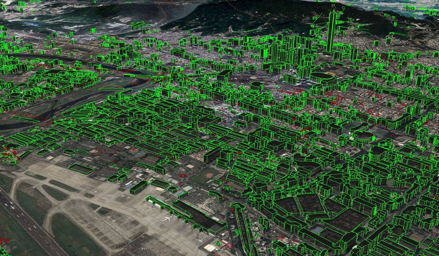
Electronic Terrain and Obstacle Data (eTOD)
It is now essential to integrate cutting-edge technologies into urban development to meet the issues brought on by the fast-changing urban scene.
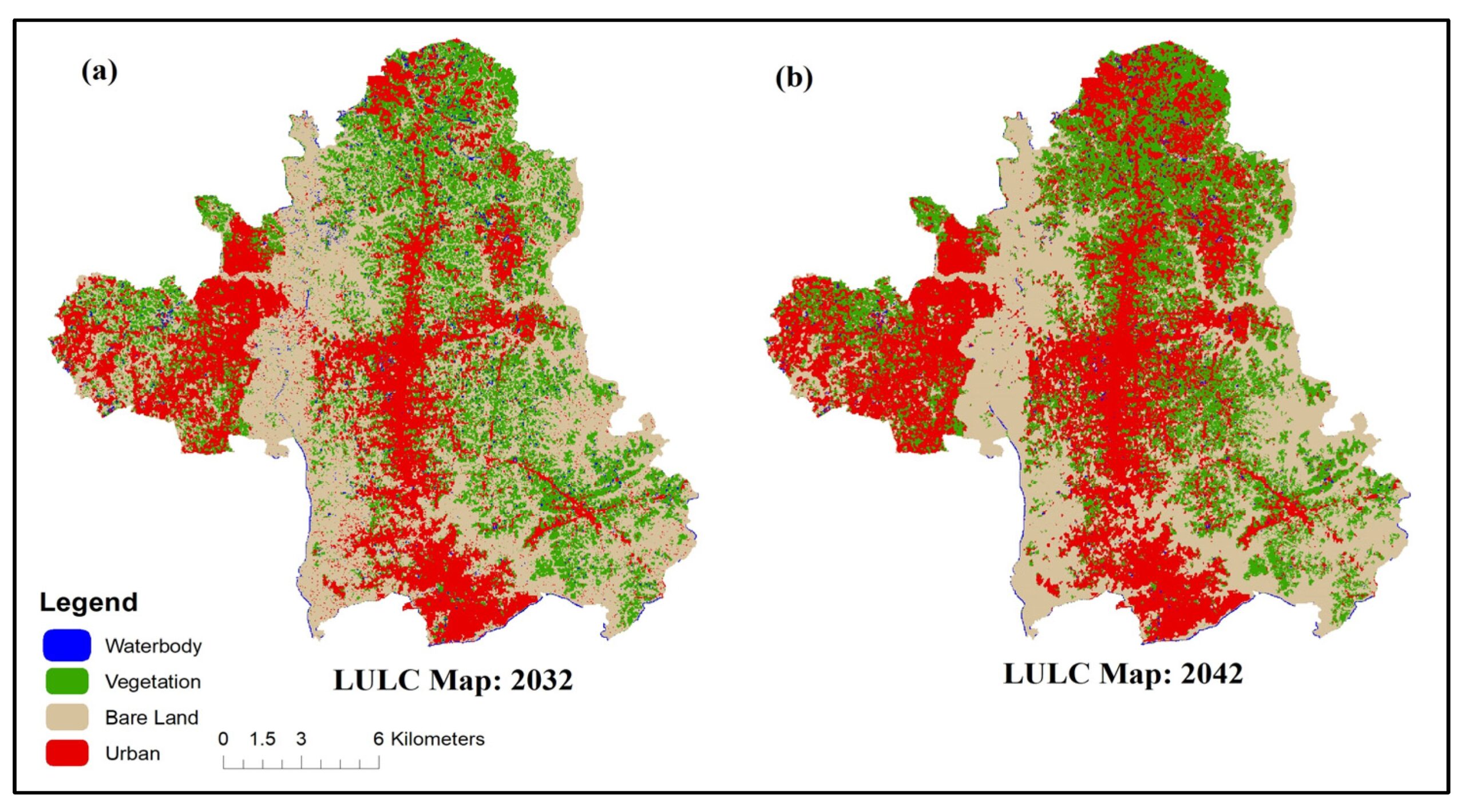
Land Use and Land Cover (LULC)
The term Land Use and Land Cover (LULC) refers to the physical and human characteristics-based classification and categorization of the Earth’s surface.
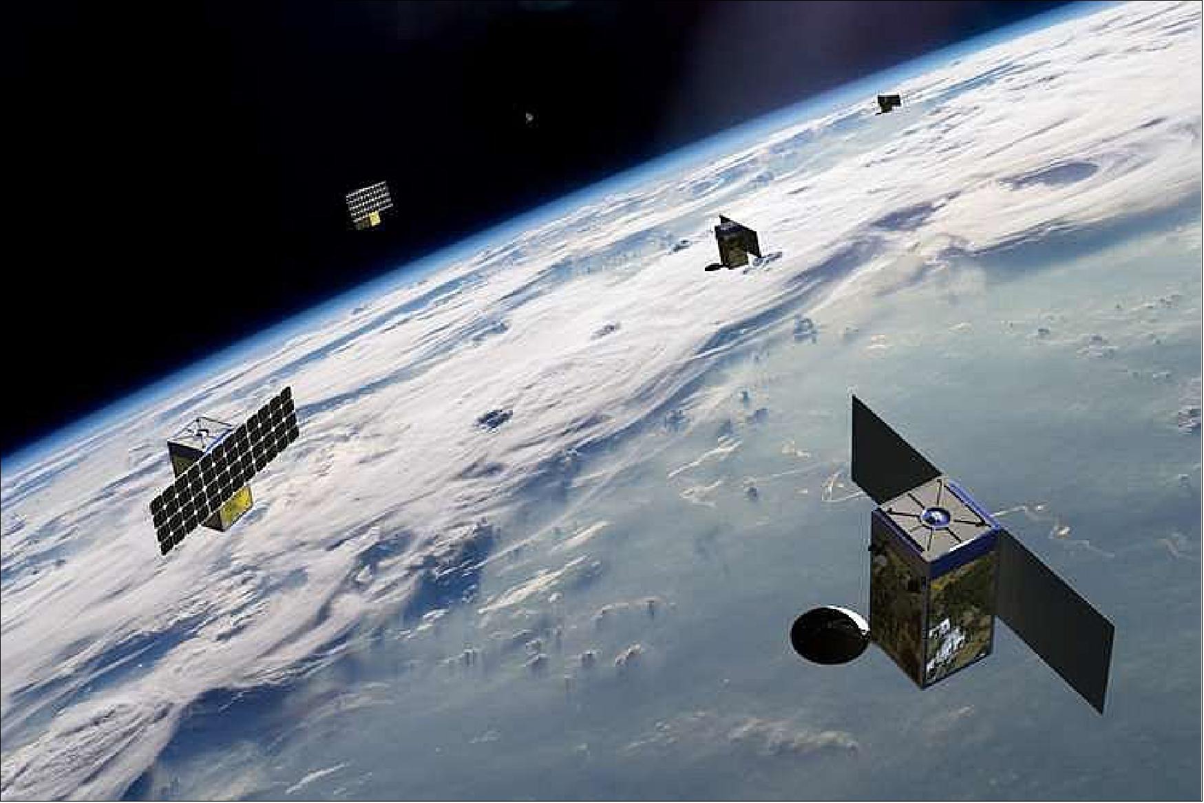
BLACKSKY
What is a BlackSky satellite? One name has come to light as a beacon of creativity and accuracy in the quickly changing
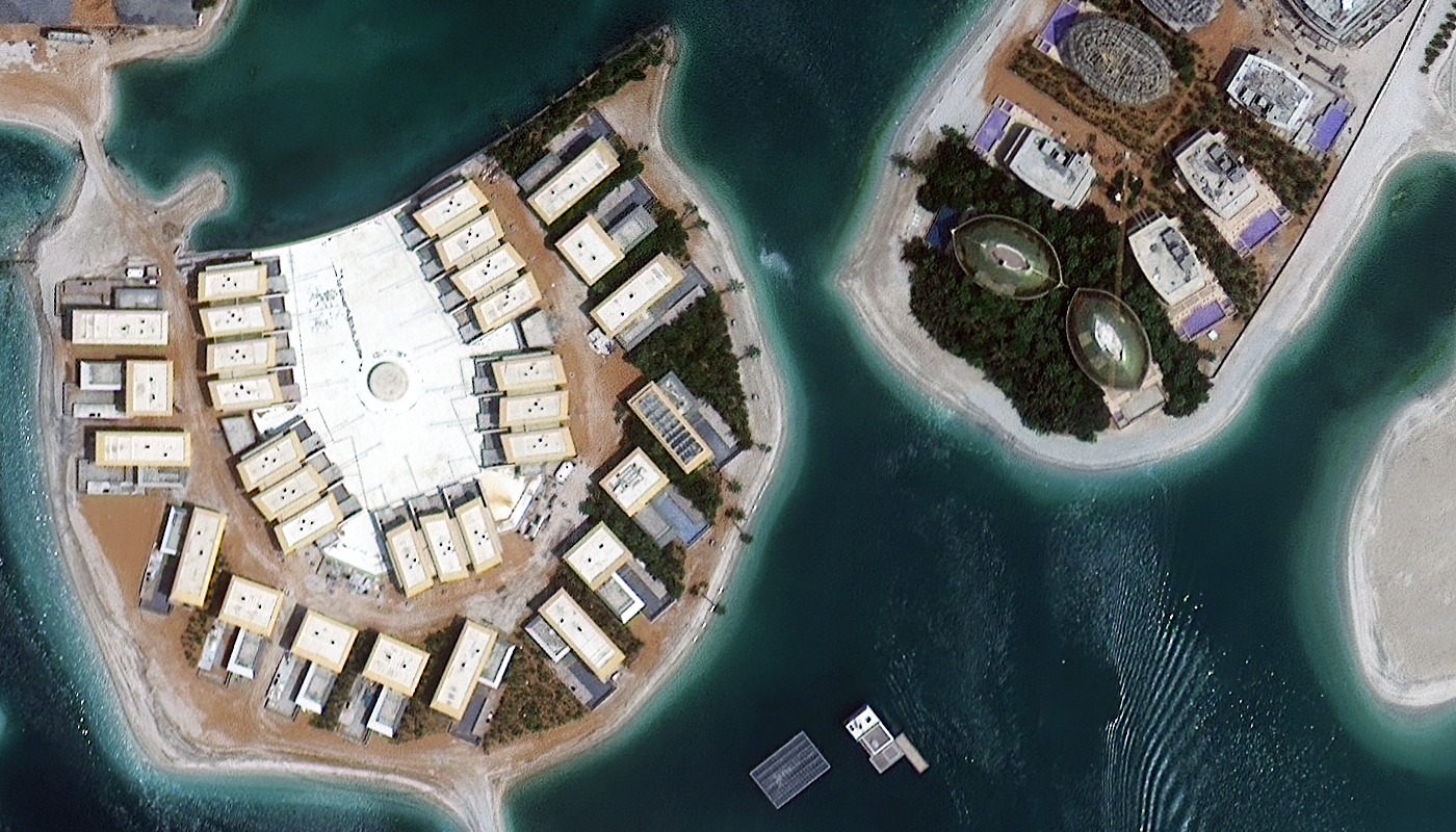
Superview Satellite Imagery
The collection of high-resolution satellite images from the SuperView constellation which is mostly made up of the GF 1, GF 2, and

AXELSPACE
The demand for high-resolution, timely and accurate satellite imagery has never been higher where AXELSPACE, a pioneering player in the space technology

Remote Sensing and Application in civil engineering
The term “remote sensing” describes the process of gathering information about a thing or phenomenon from a distance usually using satellites or