The concepts of triangulation and stereoscopy are the foundation of photogrammetry where triangulation entails calculating the angles created by the point being observed, another point with known coordinates and a camera. Contrarily, stereoscopy uses minute variations in perspective between two photos taken from various angles to produce the illusion of three dimensions.
What is Photogrammetry?
Photogrammetry is a sophisticated technology that uses remote sensing concepts to extract spatial information from photos and to measure and understand characteristics on the surface of the Earth, the process entails taking and evaluating pictures. Photogrammetry is the process of converting 2D photographs into precise 3D models using mathematical and computer procedures which allows for the development of precise geospatial data.
Types of Photogrammetry
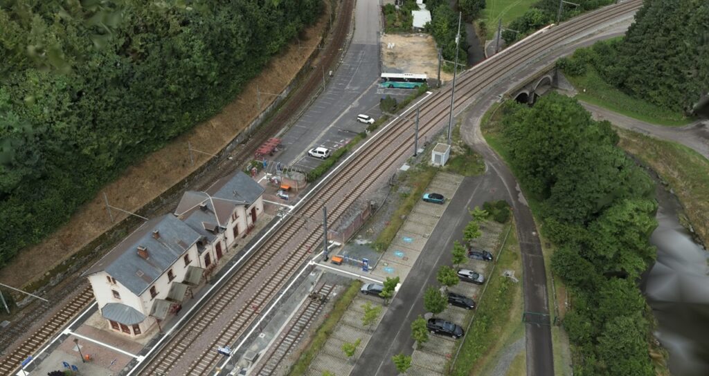
Aerial photogrammetry: This type of photogrammetry entails taking pictures from aerial platforms like drones or airplanes where large-scale mapping operations, land surveying and environmental monitoring all frequently use this technique. Stereoscopic photography is used in aerial photogrammetry to generate 3D models and obtain accurate measurements of topographical characteristics.
Close-range Photogrammetry: Close-range Photogrammetry, sometimes referred to as terrestrial or architectural photogrammetry is used in situations where it’s necessary to record precise details about small objects or structures which makes use of close-up photos captured with either handheld or stationary camera equipment.
Digital photogrammetry: This type of photogrammetry processes and analyzes photos using digital cameras and sophisticated software and because of this method’s accuracy and efficiency, traditional analog photogrammetry has been substantially supplanted. Applications for digital photogrammetry include change detection, topographic mapping and disaster response.
Satellite Photogrammetry: This technique makes use of images taken by high-resolution sensor-equipped Earth-observing satellites where large-scale mapping, environmental monitoring and disaster assessment all benefit from this technique. In particular, satellite photogrammetry helps evaluate vast geographic areas as it offers a worldwide viewpoint.
What are the features of Photogrammetry?
Stereo Imaging: Stereo imaging which is the process of taking two overlapping pictures of a scene from various angles is essential to photogrammetry where the extraction of depth information which is necessary to build three-dimensional models is made possible by these stereo pairings. Analysts can accurately reconstruct the terrain’s topology thanks to the integration of these photos.
Bundle adjustment: Bundle adjustment is a crucial photogrammetric approach that maximizes the spatial correlations between ground control points, camera positions and pictures and by making this change, the overall accuracy of the spatial model is improved and errors generated during the data collection process are minimized.
Ground Control Points (GCPs): These are reference locations with established coordinates that are positioned strategically on the surface of the Earth and in the photogrammetric process, these dots act as anchors to help the imagery correlate with actual locations.
Orthorectification: This technique produces photos with a constant scale and few geometric mistakes by eliminating distortions brought on by camera tilt and landscape relief. This feature makes sure that spatial data is appropriately shown on a plane, which makes integrating it with other GIS information easier.
Point Cloud Generation: Dense sets of three-dimensional points that depict an object’s or terrain’s surface are created using photogrammetry where point clouds help create 3D models that are incredibly lifelike by capturing minute details. This capability is especially useful for applications related to forestry, archaeology and urban planning.
Applications of Photogrammetry
3D City Modeling and Urban Planning: Photogrammetry helps in the development of intricate 3D city models in urban planning and these models are used to optimize city layouts, simulate and analyze urban landscapes and evaluate possible effects of future developments. Photogrammetry’s accuracy guarantees accurate and trustworthy depictions.
Infrastructure Development: The planning and design of infrastructure projects including pipelines, bridges and roadways frequently makes use of photogrammetry and photogrammetric data is used by engineers to evaluate potential obstacles, plan alignments and analyze the topography to execute projects more accurately and efficiently.
Disaster Response and Management: Photogrammetry is essential to disaster response since it provides precise and current data quickly and following natural catastrophes like earthquakes or floods, photogrammetric techniques are used to analyze aerial pictures to plan rescue operations, assess damage and assist with recovery efforts.
Precision Agriculture: Photogrammetry plays a role in precision farming techniques in agriculture where farmers can monitor crop health, evaluate field variability and allocate resources more efficiently by analyzing aerial imagery which will boost crop yields and promote sustainable agricultural practices.
Archaeological Documentation: Photogrammetry is a useful tool for archaeologists to record and conserve cultural heritage locations and through the creation of intricate 3D models of objects and archaeological sites, scholars can accurately investigate and examine ancient architecture.
Future Trends in Photogrammetry
Automation and AI: Increasing automation and incorporating artificial intelligence (AI) are key components of photogrammetry’s future and by automating tasks like feature extraction, point cloud classification and terrain modeling, AI systems can cut down on processing time and human intervention. Additionally, picture matching and 3D reconstruction accuracy are enhanced by machine learning models.
Multi-Sensor Integration: Enhancing the richness and completeness of spatial information is possible by combining data from many sensors including LiDAR and hyperspectral imaging where combining data from several sources enables more comprehensive analysis and better understanding of the terrain, structures and environmental conditions.
3D GIS and Augmented Reality (AR): Photogrammetry is increasingly being integrated with 3D GIS and AR technology which provides a realistic and interactive depiction of the world enabling immersive visualization experiences and improving the understanding of geographical data.
Standardization and Interoperability: As the photogrammetry sector develops, standardization and interoperability are becoming more and more important where open standards and common data formats enable smooth data interchange and cooperation between various hardware and software platforms.
A key component of the GIS sector, photogrammetry offers a potent tool for the analysis and visualization of spatial data and its uses are numerous and constantly growing ranging from topographic mapping to disaster relief. With continued developments in automation through artificial intelligence (AI), LiDAR integration and the proliferation of unmanned aerial vehicles (UAVs), photogrammetry offers even more efficiency and accuracy in gathering and analyzing geospatial data in the future. The capabilities of photogrammetry will develop along with technology influencing the field of GIS applications in a variety of industries.


