The term “satellite imagery” describes the image of the Earth’s surface that is obtained by satellites in orbit and these photos are taken with sensors that record information at different wavelengths enabling the production of hyperspectral or multispectral imaging. These photos are fundamental datasets for mapping, tracking and examining the dynamic aspects of Earth in a GIS environment. Geographic Information Systems have been transformed by satellite photography which offers unmatched insights into the Earth’s surface and permits a wide range of applications across numerous industries. This process dives into the complex world of satellite imaging examining its technological foundations, its function in geographic information systems and the various uses that make use of this potent instrument.
Development of Satellite Imaging Technology
The development of imaging technology on Earth-observing satellites marks the beginning of the voyage of satellite images in GIS where early spacecraft such as Landsat 1 which was launched in 1972 were able to take pictures in the visible and near-infrared spectrums. More and more complex data collecting is now possible thanks to the proliferation of sensors with different spectral bands and spatial resolutions that have been made possible by technical improvements throughout time.
Resolution of Spatial Information: An image’s observable level of detail is referred to as its spatial resolution and with the ability to map and analyze details as fine as 31 cm on the Earth’s surface, high-resolution satellites like WorldView-3 make precise mapping and analysis possible. On the other hand, satellites with medium and low resolutions provide more coverage but less detail.
Spectral Bands: Different spectral bands of electromagnetic radiation are detected by satellite sensors and each one yields a different set of data about the surface of the Earth. Sentinel-2’s multispectral sensors, for example, collect data in visible, near-infrared and shortwave infrared wavelengths. This allows for more sophisticated vegetation monitoring, land cover classification and environmental evaluation.
Temporal Resolution: The frequency with which a satellite returns to a specific area is referred to as temporal resolution and this is essential for tracking dynamic processes like crop growth, natural disasters and changes in land usage. Polar-orbiting satellites such as Terra and Aqua’s MODIS (Moderate Resolution Imaging Spectroradiometer) offer daily worldwide coverage making near-real-time monitoring possible.
Using Satellite Imageries for GIS Uses:
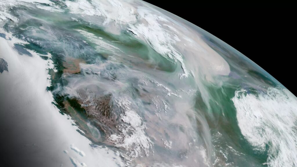
Environmental Monitoring: Monitoring environmental changes such as deforestation, urbanization and land degradation is greatly aided by satellite imaging. GIS technologies combine satellite data with trend analysis, hotspot identification and support for sustainable resource management and Sentinel satellites of the European Space Agency, for example, provide important data for tracking deforestation in the Amazon jungle.
Agriculture and Precision Farming: Precision farming makes use of satellite imagery to track crops, forecast yields and identify diseases where high-resolution photography helps with crop stress detection, irrigation optimization and general farm management enhancement. Farmers and agronomists can access and evaluate satellite data for informed decision-making using platforms like Google Earth Engine.
Disaster Management: An invaluable resource for catastrophe preparedness and response is satellite imagery and satellites offer quick and thorough assessments of damaged areas following natural disasters like hurricanes, earthquakes or floods. Emergency responders can more effectively plan evacuation routes, evaluate damage and coordinate relief activities with the use of GIS tools.
Development of Infrastructure and Urban Planning: GIS is essential for infrastructure development and urban planning when combined with satellite photography. Planning for future growth, evaluating infrastructure and mapping land usage are all made easier with the use of high-resolution images and GIS technology is used in smart cities to improve overall urban sustainability, monitor air quality and optimize transportation networks.
Importances
Earth Observation Satellites – The Technological Backbone: Earth observation satellites which are outfitted with advanced sensors that can take high-resolution pictures across the electromagnetic spectrum, are the central component of the GIS-satellite synergy and these sensors which include radar, infrared and optical systems are essential for gathering the information that underpins GIS applications. Optical sensors produce finely detailed photographs of the Earth’s surface by capturing visible and near-infrared light. These photos help with urban sprawl analysis, vegetation monitoring and land cover classification in GIS. Conversely, infrared sensors make it possible to detect even minute temperature changes which is beneficial for environmental research and agricultural evaluations whereas radar sensors are weather and daylight-independent devices that can see through clouds and give important information for mapping terrain, responding to emergencies and tracking subsidence.
Environmental Monitoring and Conservation: Global environmental change monitoring and management depend heavily on satellite photography and with the use of these images, GIS applications can monitor biodiversity shifts, deforestation and land degradation. Satellites help identify ecological hotspots and measure the effects of climate change since they can collect data over wide areas at regular intervals. For example, scientists may watch the movement of wildlife, examine changes in ocean currents and keep an eye on the melting of the polar ice caps by integrating satellite data into GIS and with the help of this abundance of data, decision-makers can create conservation plans that work and tackle environmental issues using a data-driven methodology.
Climate Change Research and Analysis: The intricacies of climate change necessitate ongoing observation and examination of environmental factors. Satellite imaging is a vital resource for studying climate change because it can record significant changes in the environment over time. Applications for geographic information systems use satellite data to examine trends in temperature, sea level rise, and vegetation cover and by aiding in the creation of climate models, these analyses enable scientists to forecast patterns and create plans for reducing the effects of climate change. A thorough grasp of the interconnectedness of climatic systems is made easier by the incorporation of satellite-derived climate data into GIS platforms.
Satellite imagery provides a plethora of knowledge on the dynamic surface of our world and applications for satellite images are numerous and significant ranging from agricultural and urban planning to environmental monitoring and catastrophe response. The combination of satellite data and geographic information systems is expected to revolutionize our comprehension of the planet and spur advancements across numerous industries as technology advances. The narrative of exploration through satellite photography is continuous, opening up new possibilities and promoting sustainable global growth.


