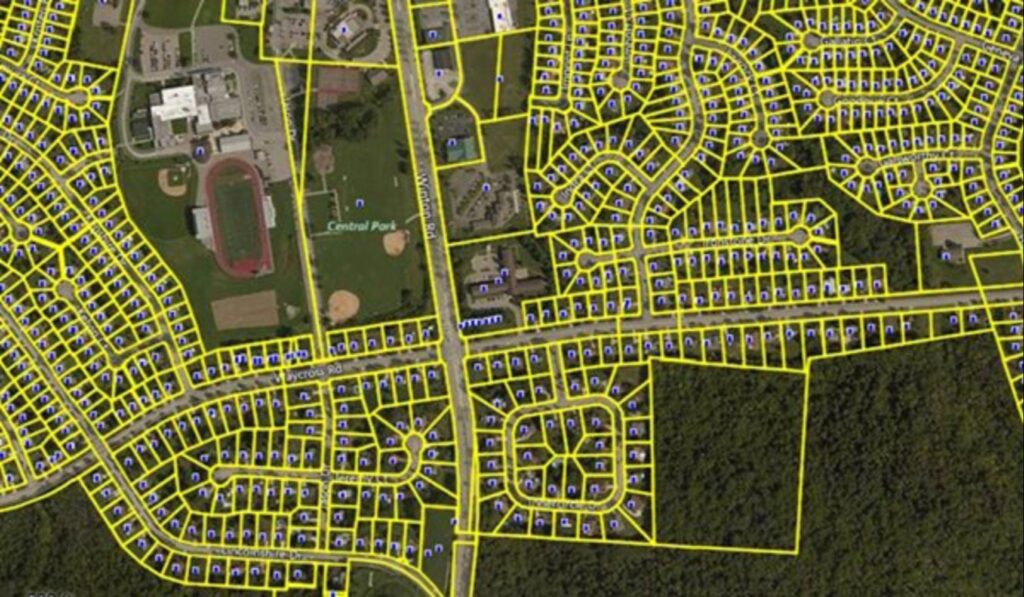
Delineating and recording land parcels, along with their boundaries, ownership details and geographical characteristics is known as cadastral mapping. Establishing a thorough and accurate record of land ownership and use is the main goal to support effective land administration, taxation, and urban planning. In Geographic Information Systems, cadastral mapping is essential because it offers a methodical and comprehensive depiction of land parcels, their borders and related data and this process delves into the complex realm of cadastral mapping examining its importance, approaches and technology as well as its wider implications for land administration and management.
Important Elements:
Parcel limits: Using survey information and legal descriptions, precisely defining the limits of a piece of land.
Ownership Information: Specifics regarding the people who own the land such as their names, addresses and entitlements.
Spatial attributes are geographic details about land parcels including their location, size and shape.
Approaches for Cadastral Mapping:
Cadastral Surveying
Geodetic Surveys: Control points are established and precise spatial referencing is ensured by employing high-precision surveying techniques.
Remote sensing: Using aerial photography and satellite data to make a preliminary assessment of land features.
Gathering and Combining Data
Global Positioning System (GPS): GPS stands for global positioning system and it is used to collect data in the field and provide real-time positioning.
Field surveys: Measurements and data gathering were conducted on-site with the aid of Total Stations, GNSS receivers and other surveying tools.
Integrating cadastral data with other geospatial information to provide a comprehensive picture is known as data integration.
Technologies
Geographic Information System (GIS):
Database management: Database management is the process of storing cadastral data in a geographical database for quick and easy access and analysis.
Spatial analysis: Spatial analysis is the process of examining spatial relationships, carrying out overlay analyses and finding patterns in cadastral data using GIS technologies.
Web-Based Cadastral Systems
Online Platforms: Creating web-based platforms to improve transparency and provide cadastral information to the general public.
Interactive Maps: Designing approachable user interfaces to query and visualize cadastral information.
Blockchain Technology
Smart Contracts: Using programmable contracts and blockchain to enable safe and open real estate transactions.
Immutable Recordkeeping: Preserving the durability and integrity of cadastral information while lowering the possibility of fraud.
Some Case Studies
Modernizing Cadastral Records in Estonia: When it comes to successfully utilizing GIS for cadastral mapping, Estonia is a shining example. This case study explores the innovative e-Land Register project in Estonia which digitized cadastral data and combined them with an intuitive GIS platform and by ensuring the security and transparency of land transactions, blockchain technology was implemented revolutionizing the cadastral system’s dependability and efficiency.
Cadastral Mapping for Disaster Management in Japan: Japan is a prime example of how GIS technology may improve cadastral mapping for disaster preparedness and response where the country is prone to natural disasters. This case study investigates how Japan’s cadastral mapping system when combined with real-time data from several sensors, facilitates prompt evacuation preparation, damage assessment and recovery efforts following a disaster. The cadastral system with GIS capabilities is a helpful tool for reducing the effects of earthquakes, tsunamis and other disasters.
Land Tenure Mapping in Rwanda: A thorough cadastral mapping program was a component of Rwanda’s post-genocide rehabilitation efforts. This case study looks at how GIS technology made it easier to draw boundaries between properties so that residents may have secure land tenure where the local communities were allowed to actively engage in the mapping process through the inclusion of participatory GIS approaches which promoted a sense of ownership and enhanced social and economic stability.
Future Trends
Blockchain Technology in Cadastral Mapping: Blockchain integration is one of the biggest themes influencing cadastral mapping in the future. Unprecedented security and transparency in real estate transactions are provided by blockchain’s decentralized, tamper-resistant ledger technology where blockchain technology can be used for cadastral mapping to improve land record trust, expedite property registration, and lower fraud.
Advanced Remote Sensing Methods: The development of remote sensing technology is closely linked to the future of cadastral mapping and data acquisition for cadastral mapping is being revolutionized by hyperspectral photography, LiDAR (Light Detection and Ranging) and high-resolution satellite imagery. The precise demarcation of property boundaries and enhanced land parcel identification are made possible by these sophisticated procedures which offer more accurate and thorough spatial information.
Artificial Intelligence (AI) and Machine Learning (ML) in Parcel Recognition: Significant progress is being made in automating parcel recognition in cadastral mapping by use of AI and ML algorithms and by enabling meaningful information to be extracted from large datasets, these systems lessen the amount of manual labor needed for parcel identification. Automated object detection, pattern analysis and feature extraction help to make cadastral mapping procedures more precise and quick.
3D Cadastre for Urban Planning: The use of three-dimensional (3D) cadastral mapping is revolutionizing both cadastral mapping and urban planning where the two-dimensional representation of properties in traditional cadastral maps restricts their capacity to depict the intricacy of urban settings. A more thorough picture is made possible by 3D cadastre models which also make accurate analysis easier for planning infrastructure, zoning and urban development.
Cadastral mapping is essential since it lays the groundwork for efficient land management and administration and the combination of GIS, blockchain, AI and other cutting-edge technologies holds the potential to completely transform cadastral mapping as technology develops providing more precise, transparent and effective answers to the problems posed by the shifting ownership and usage of land. Governments, IT companies and the general public must work together to realize the full potential of this important field as we navigate the future of cadastral mapping.


