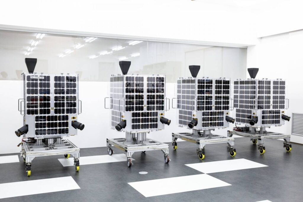
GRUS is a significant advancement in satellite technology created to satisfy the expanding needs of the GIS sector where the satellite which was created by top space technology firms in association with GIS specialists has several qualities that distinguish it in the fiercely competitive satellite industry. The satellite’s ultra-high-definition (UHD) imaging equipment allows it to take pictures with previously unheard-of levels of detail and clarity. The GRUS satellite is a vital tool for GIS experts and researchers because of its ability to distinguish minute details on the Earth’s surface with a spatial resolution of less than one meter.
Key Components of GRUS
Sensor Technology
At the heart of the GRUS lies cutting-edge sensor technology designed to capture high-resolution imagery with exceptional precision. Multispectral and hyperspectral sensors onboard GRUS enable the satellite to collect data across various spectral bands, offering unparalleled insights into Earth’s surface characteristics. These sensors play a crucial role in monitoring environmental changes, detecting land use patterns, and assessing the health of vegetation. The multispectral capabilities of GRUS sensors allow for the simultaneous capture of data in multiple wavelengths, facilitating the creation of composite images that enhance the interpretation of land features. Additionally, hyperspectral sensors offer an even finer spectral resolution, enabling detailed analysis of specific materials and environmental conditions.
Data Transmission Systems
Efficient data transmission is paramount in satellite technology, and GRUS excels in this aspect. The satellite employs advanced communication systems, including high-frequency radio transmitters and receivers, to relay data back to ground stations. The utilization of high-frequency bands ensures faster data transfer rates, enabling the timely delivery of valuable information for GIS applications. Furthermore, GRUS incorporates advanced error-correction techniques to enhance the reliability of data transmission, ensuring that the spatial data received on Earth is accurate and intact. This is particularly crucial in applications where precise information is essential, such as disaster monitoring, urban planning, and agricultural management.
Onboard Processing Units
The GRUS satellite is equipped with powerful onboard processing units that enable real-time data analysis and image processing. This capability significantly reduces the dependency on ground-based processing, allowing for rapid extraction of valuable insights from the collected spatial data. The onboard processing units facilitate quick decision-making in time-sensitive applications, such as emergency response and disaster management. The integration of advanced algorithms within the processing units enables the satellite to autonomously identify and categorize land features, detect changes over time, and generate thematic maps. This on-the-fly processing capability enhances the efficiency and effectiveness of GIS applications, making GRUS a versatile tool for diverse industries.
Attitude and Orbit Control System
To ensure precise data acquisition, the GRUS satellite is equipped with a sophisticated Attitude and Orbit Control System (AOCS). This system maintains the satellite’s orientation and position in space, allowing the sensors to capture imagery with high spatial accuracy. The AOCS incorporates gyroscopes, accelerometers, and reaction wheels to stabilize the satellite and compensate for external disturbances such as gravitational forces and atmospheric drag. The precise control exerted by the AOCS enables the GRUS satellite to follow predefined orbits and revisit specific locations at regular intervals. This revisit capability is particularly valuable for applications requiring frequent monitoring, such as agriculture, forestry, and infrastructure development.
Uses of GRUS
Precision Agriculture: In the realm of precision agriculture, the GRUS satellite plays a pivotal role in optimizing crop management and resource allocation. By leveraging multispectral imagery, these satellites can monitor crop health, detect diseases, and assess soil conditions. The high spatial resolution of GRUS imagery enables farmers to make informed decisions regarding irrigation, fertilization, and pest control, ultimately maximizing yields and minimizing environmental impact.
Urban Planning and Infrastructure Development: GRUS satellites contribute significantly to urban planning and infrastructure development by providing detailed information about land use, land cover, and topography. Urban planners use this data to assess the expansion of cities, plan transportation networks, and make informed decisions about the allocation of resources. The ability to monitor construction activities and changes in infrastructure in near real-time enhances the efficiency of urban development projects.
Disaster Management and Response: The real-time monitoring capabilities of GRUS satellites are instrumental in disaster management and response. Whether it’s tracking the progression of a wildfire, assessing the extent of a flood, or monitoring the aftermath of an earthquake, these satellites provide critical information for emergency responders. Rapid and accurate data acquisition enables quick decision-making and efficient allocation of resources during crises.
Navigation and Mapping: The integration of GRUS satellite data enhances the accuracy and reliability of navigation systems and mapping applications. Autonomous vehicles, precision agriculture machinery, and navigation devices leverage high-precision geospatial information for optimal route planning and positioning. Additionally, GRUS satellites contribute to the creation and updating of detailed maps, supporting a wide range of industries from logistics to tourism.
GRUS represents the pinnacle of technological progress thanks to its unmatched capacity to acquire high-resolution imagery and serve a wide range of applications. It has a revolutionary effect on charting land usage, responding to disasters, monitoring the environment, and developing infrastructure. Global decision-making and spatial analysis will continue to be shaped by the industry’s future developments as long as GIS professionals use GRUS satellite data in their workflows. To appropriately utilize the full potential of GRUS satellite technology, the GIS community must address issues of uniformity and ethics.


