Drone surveys have been around since the early 20th century but they have come of age as a GIS powerhouse in the last 20 years. The early drones were simple and lacked the features that modern drones have but thanks to technological advancements, ultra-vehicular asteroids (UAVs) with sophisticated sensors, cameras and GPS modules have become a reality. Drone surveys are easily integrated with GIS systems providing a dynamic synergy that improves data processing and mapping and because of the integration, real-time data collecting is made easier giving GIS experts access to current information to make informed judgments. Drone technology incorporation into surveying methods has revolutionized the GIS sector in recent years. Unmanned aerial vehicle (UAV) surveys, sometimes referred to as drone surveys have grown to be an indispensable instrument due to their exceptional accuracy, efficacy and economy.
Applications of Drone Surveys
Topographic Mapping: Creating high-resolution topographic maps is a strength of drone surveys where they record precise information about the topography such as elevation, land cover and contours. With the use of this data, GIS specialists can precisely model landscapes which helps with infrastructure development, environmental monitoring and urban planning.
Precision Agriculture: Drones using thermal and multispectral sensors transform agriculture by giving farmers useful information. This data is processed using GIS programs which increase agricultural output by creating maps of crop health locating disease outbreaks and allocating resources as efficiently as possible.
Environmental Monitoring: In light of climate change, ecological monitoring and preservation are essential and an effective way to acquire information on habitat conditions, water quality and vegetation health is through drone surveys. With the use of GIS tools, this data is processed to produce detailed environmental models.
Infrastructure Inspection: Inspections of vital infrastructure including pipelines, electrical lines and bridges are now greatly aided by drone surveys and to guarantee the security and dependability of infrastructure networks, GIS specialists use the data they have gathered to evaluate structural integrity, spot possible problems and schedule maintenance tasks.
Technical Components of Drone Surveys:
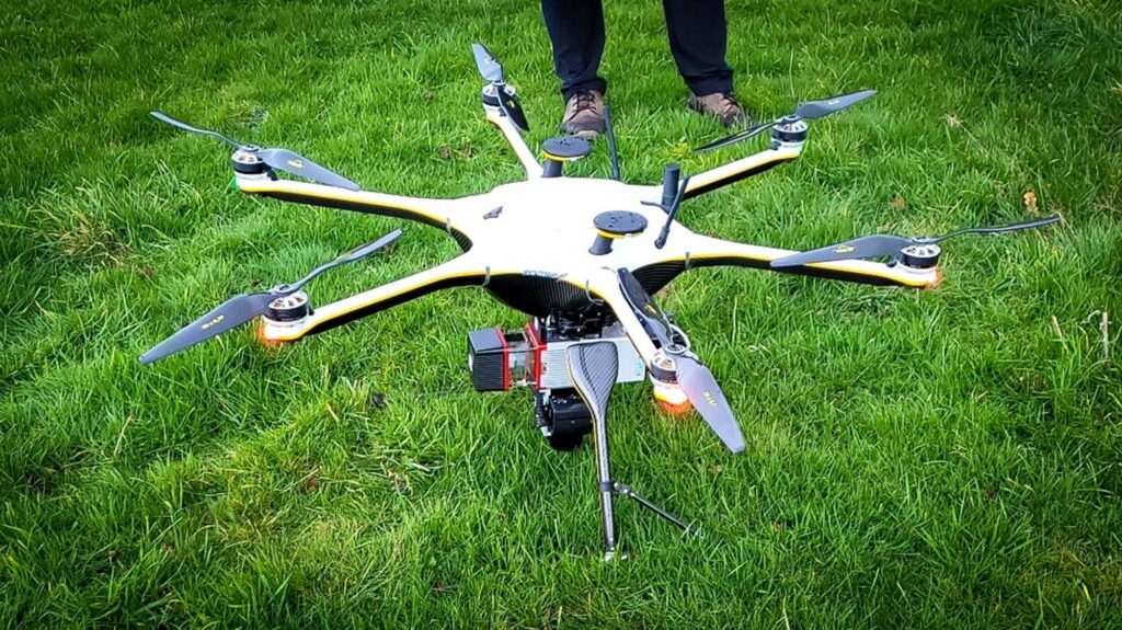
UAV Platforms: Contemporary drones are available in a variety of sizes and forms, each suited to meet particular survey needs. Drones with fixed wings are effective in covering wide areas but quadcopters offer stability and flexibility for in-depth examinations and the advantages of both are combined in hybrid models.
Sensors and Cameras: Numerous sensors and cameras including LiDAR, RGB, multispectral and thermal cameras are installed aboard drones where these sensors record a variety of data kinds which enables GIS experts to retrieve comprehensive data for their mapping and analysis assignments.
GPS and GNSS Technology: Accurate georeferencing is essential for GIS uses where drones precisely locate themselves using technology from the Global Positioning System (GPS) and Global Navigation Satellite System (GNSS) guaranteeing that the data they collect matches coordinates in the real world.
Data Processing Software: Drone surveys generate enormous amounts of data which calls for sophisticated processing methods. GIS software transforms unprocessed data into useful information in conjunction with photogrammetry and remote sensing applications and this is a critical step in producing precise models and maps.
Benefits of Drone Surveys
Cost Efficiency: Conventional surveying techniques frequently include high expenses for labor, supplies and time and an affordable substitute is a drone survey which lowers costs while boosting productivity and data accuracy.
Rapid Data Collection: Drones quickly cover wide regions and enable quick data collection where this speed is especially helpful in emergency response scenarios as it allows for prompt evaluations of areas affected by disasters.
Enhanced Safety: Drone surveying removes the need for manual inspections in dangerous or difficult-to-reach areas which improves worker safety when conducting surveys and makes it possible to gather more comprehensive data in difficult-to-reach places.
Improved Data Accuracy: Drone survey data accuracy is unmatched because of the marriage of sophisticated sensors and exact GPS technology and for GIS specialists, this precision is critical because it directly affects how reliable mapping and modeling projects are.
Drone survey integration with GIS processes has ushered in a new era of efficiency, accuracy and creativity for the sector where the integration of cutting-edge UAV technology, superior sensors and potent GIS tools has opened up previously unheard-of opportunities for analysis, mapping and decision-making. Drones and GIS working together will surely have a significant impact on future spatial data collecting and analysis impacting everything from infrastructure management and urban planning to environmental conservation as technology develops. It is not just a matter of choice for GIS experts to embrace the possibilities of drone surveys; doing so is strategically necessary if they are to effectively negotiate the intricate terrain of the contemporary world.


