A topographical survey is an intricate mapping procedure that records and depicts a landscape’s physical characteristics encompassing both natural and artificial components where making an accurate and thorough representation of the terrain’s surface is the main goal to facilitate precise spatial analysis and well-informed decision-making. Topographical surveys are essential foundations that offer priceless information for a variety of uses starting from environmental management to urban planning.
What are the Objectives of a Topographic Survey?
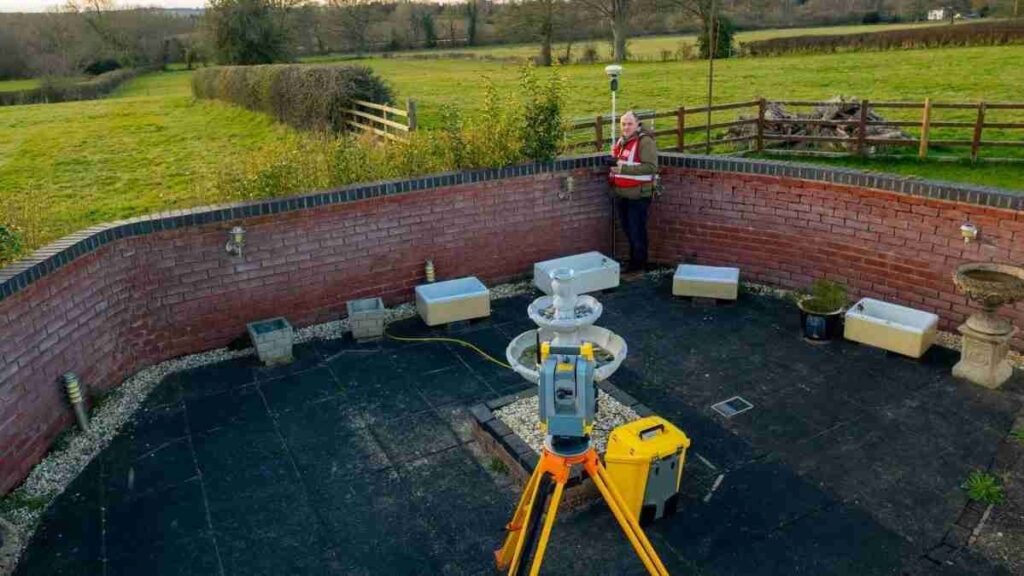
Accurate Spatial Data Collection: Gathering precise spatial data about the target area is the main goal of a topographical survey which calls for the use of sophisticated surveying tools like Total Station equipment, LiDAR (light detection and ranging) and GPS (global positioning system). With the aid of these tools, surveyors can record exact topographical features like elevation and coordinates.
Terrain Modeling and Visualization: Detailed terrain models and representations are frequently among the goals where surveyors can transform gathered data into three-dimensional landscape representations by using sophisticated GIS software. This helps planners and decision-makers make more informed decisions by improving comprehension and communication of the topographical aspects.
Land Use and Land Cover Identification: The purpose of topographical surveys is to locate and record patterns of land use and land cover within the surveyed area where mapping vegetation, water features, structures, roads and other infrastructure components are all included in this. GIS specialists can plan infrastructure development, evaluate environmental impact and make judgments about land management by having a thorough understanding of these characteristics.
Accuracy in Elevation Data: An essential component of topographical surveys is elevation data where the elevation-related goals center on taking exact measurements to produce precise contour maps. These maps are very helpful for determining drainage patterns, estimating slope gradients and designing construction projects that take the topography into account.
Methods of Topographic Surveying
LiDAR Technology: LiDAR technology measures the separation between a sensor and the surface of the Earth using laser beams and by using an airborne or ground-based device, LiDAR creates extremely precise three-dimensional point cloud data by scanning the environment. Detailed topographical maps are made using this data as a basis.
Aerial Photography: Aerial photography is the process of taking detailed pictures of the Earth’s surface using drones or airplanes and after that, information about the topography and elevation is extracted from these photos. When it comes to efficiently covering broad regions, aerial surveys are especially useful.
GPS and GNSS (Global Navigation Satellite System): These technologies enable exact location data collection during field surveys by providing accurate positioning information. Using GPS data in conjunction with other survey techniques improves topographical maps’ overall accuracy.
Surveying Tools: For ground-level measurements in topographical surveys and traditional surveying tools like total stations and theodolites are still used where these tools support the thorough data collection procedure when paired with contemporary technologies.
Uses of Topographical Surveys
Urban Planning: Topographical surveys are essential for giving comprehensive information about the infrastructure, elevation and land characteristics that are currently in place. City planners can use this data to help them make well-informed decisions about infrastructure development, transit networks and zoning.
Environmental Management: To evaluate and track changes in the environment, GIS experts use topographical surveys. Knowing the topography of the area is useful for planning conservation initiatives, identifying places that are vulnerable to erosion and evaluating the effects of natural disasters.
Infrastructure Development: Topographical surveys are used by engineers and architects to plan infrastructure projects and for building roads, bridges and other constructions that blend in smoothly with the surrounding environment, precise elevation data and terrain information are essential.
Natural Resource Management: Topographical surveys play a significant role in the sustainable management of natural resources including water bodies and forests where authorities can put into practice efficient conservation and resource utilization policies by having a thorough awareness of the terrain.
Benefits of Topographical Survey
Precision Mapping and Data Accuracy: The capacity to produce extremely precise and thorough mapping of the terrain is fundamental to topographical surveys and with the use of sophisticated surveying tools like GPS receivers and Total Stations, GIS specialists are able to record elevation information, contours and land features with unmatched accuracy. Because of its high degree of precision, the GIS databases are filled with trustworthy data which paves the way for solid spatial analysis and modeling.
Terrain Analysis and Hydrological Modeling: Hydrological modeling and terrain analysis are made possible by topographical surveys which are essential for GIS applications where GIS experts can identify possible locations vulnerable to erosion or landslides by carefully gathering elevation data which they can then use to create precise digital elevation models (DEMs) and perform slope analyses.
The foundation of GIS applications is topographical surveys which offer a precise and comprehensive depiction of the Earth’s surface where the creation of incredibly detailed and educational maps has been made possible by the revolutionary combination of cutting-edge technologies like GPS, LiDAR and remote sensing. Topographical surveys play a crucial part in forming our perception of the real world and assisting with well-informed decision-making in a variety of fields, even as the GIS sector develops.


