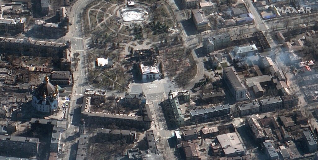
MAXAR operates the WorldView-1, WorldView-2, WorldView-3 and WorldView-4 advanced satellite constellations where modern imaging sensors on these satellites allow them to take high-resolution images with previously unheard-of levels of detail. With a spatial resolution of 31 cm, WorldView-3, for example, enables GIS experts to identify minute features on the surface of the Earth. The necessity for high-resolution satellite imagery has never been more critical. Offering state-of-the-art satellite imagery that transforms our understanding of and ability to assess the Earth’s surface, MAXAR, a prominent supplier of Earth Intelligence products, has become a major player in this field.
Technical Specifications
Spatial Resolution: The spatial resolution of MAXAR’s satellite imagery is remarkable and this is an important GIS metric that indicates the detail recorded in an image where GIS experts can see fine details and sharp visuals with MAXAR imagery with resolutions as fine as 30 centimeters. This allows them to identify complex features on the surface of the Earth. Applications including environmental evaluation, infrastructure monitoring and urban planning require this level of precision.
Spectral Bands: A major factor in MAXAR’s adaptability is its multispectral capability where GIS analysts can extract useful data regarding vegetation health, geological features and land cover by integrating several spectral bands such as visible, near-infrared and shortwave infrared. The possibility for thorough analysis across a range of industries including forestry, agriculture and environmental monitoring is improved by this spectral variety.
Radiometric Resolution: A crucial component of satellite images is radiometric resolution which is a measurement of the sensitivity to various brightness levels where the accuracy of capturing tiny fluctuations in surface reflectance is ensured by MAXAR’s high radiometric resolution. This feature is especially helpful for activities that require exact radiometric information such as land cover categorization and change detection.
Revisit Frequency: MAXAR’s constellation of high-resolution satellites guarantees an exceptional revisit frequency for dynamic GIS applications that demand regular updates where MAXAR enables near real-time monitoring which is crucial for applications like disaster response, agricultural management and infrastructure development. It does this by capturing photos of the same site numerous times a day.
Some Applications
Urban Planning and Development: Urban planners leverage MAXAR imagery to assess land use, infrastructure and changes in urban environments where the high spatial resolution enables the identification of building footprints, transportation networks and green spaces. GIS experts use MAXAR data to conduct accurate land cover classifications and monitor urban growth facilitating effective city planning and development.
Disaster Response and Management: In the wake of natural disasters, MAXAR imagery becomes a crucial tool for emergency response and management where GIS professionals utilize rapid and high-resolution satellite imagery to assess the extent of damage, identify affected areas and plan rescue operations. This aids in quick decision-making and resource allocation during critical times.
Environmental Monitoring: MAXAR imagery contributes significantly to environmental monitoring by providing detailed insights into ecosystems, deforestation and changes in land cover where GIS specialists can conduct habitat assessments, track wildlife migration patterns and monitor environmental changes over time. This information is vital for conservation efforts and sustainable land management practices.
National Security and Defense: Governments and defense organizations utilize MAXAR imagery for national security and defense applications where the detailed satellite imagery helps monitor borders, assess geopolitical situations and identify potential threats. GIS professionals working in these domains leverage MAXAR’s capabilities for strategic planning and situational awareness.
Future Trends
High-Resolution Satellite Imaging: MAXAR is at the forefront of providing high-resolution satellite imagery and this trend is expected to intensify in the future. The demand for finer details in mapping and analysis is driving the development of satellites with enhanced spatial resolutions which allows GIS professionals to capture and analyze intricate features on the Earth’s surface with unprecedented clarity facilitating more accurate decision-making processes.
Advancements in Artificial Intelligence (AI) and Machine Learning (ML): The integration of AI and ML into MAXAR Imagery is revolutionizing the way GIS professionals extract information from satellite data. These technologies enable automated feature recognition, change detection and object classification, significantly reducing the time and effort required for data analysis. As algorithms become more sophisticated, MAXAR Imagery will provide increasingly valuable insights unlocking new possibilities for GIS applications.
Cloud-Based GIS Platforms: The future landscape of MAXAR Imagery is closely tied to the rise of cloud-based GIS platforms where storing and processing massive amounts of satellite data in the cloud enhances accessibility and collaboration among GIS professionals. Cloud platforms also facilitate the integration of MAXAR Imagery with other geospatial datasets enabling a more holistic and interconnected approach to spatial analysis.
The picture produced by MAXAR is proof of how the GIS sector is changing and with its multispectral capabilities, high resolution and sophisticated analytical tools, MAXAR has established itself as a vital instrument for scientists and professionals trying to comprehend and handle the complexity of our changing planet. The GIS sector should expect more technological advancements in the future which will improve our capacity to use Earth Intelligence for a sustainable and knowledgeable future.


