Within the dynamic field of Geographic Information Systems, satellite technology is essential for gathering, analyzing and sharing geospatial data. The Korea Multi-Purpose Satellite (KOMPSAT) series is one such technological marvel that has been creating waves in the geographic information system business and the development of remote sensing and geographical analysis has been greatly aided by the Korea Aerospace Research Institute (KARI) and its KOMPSAT satellites. We go into the technical details of KOMPSAT in this extensive piece, examining its uses, potential and influence on the GIS sector. South Korea launched the KOMPSAT program with the main goal of creating a self-sufficient satellite system for Earth observation. The program includes several satellites each intended to fulfill a particular role in Earth observation and distant sensing. South Korea entered the satellite-based Earth observation market with the launch of its first satellite, KOMPSAT-1 in 1999.
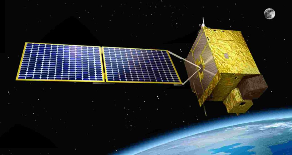
KOMPSAT Satellites
The KOMPSAT series comprises multiple satellites, each outfitted with sophisticated imaging sensors and instrumentation designed for particular uses and KOMPSAT-3, KOMPSAT-3A and KOMPSAT-5 are among the constellation’s more notable members as of the most recent data available.
KOMPSAT-3: KOMPSAT-3 was launched in 2012 and is well known for its ability to capture optical imagery with high resolution and its multispectral camera allows it to take pictures with a spatial resolution of up to 50 centimeters which enables an in-depth examination of the surface of the planet. The satellite’s versatility and short revisit durations make it useful for a range of tasks such as monitoring disasters, agriculture and urban planning.
KOMPSAT-3A: Launched in 2015, KOMPSAT-3A is yet another powerful addition to the constellation and this satellite expands on the imaging capabilities and revisits the frequency of KOMPSAT-3 building on its success. Its enhanced spectral resolution multispectral camera allows for a more precise examination of changes in flora, land cover and the surrounding environment.
KOMPSAT-5: Launched in 2013, KOMPSAT-5 incorporates synthetic aperture radar (SAR) technology departing from the optical focus of its predecessors and its high spatial resolution, day and night, all-weather Earth observation is made possible by SAR. Because of this, KOMPSAT-5 is especially useful for applications where optical sensors might not be ideal, such as forestry, infrastructure evaluation and catastrophe monitoring.
Technical Specifications and Capabilities
Imaging Sensors: The KOMPSAT satellites’ image sensors play a crucial role in gathering the data that underpins GIS applications where multispectral cameras are crucial for optical satellites such as KOMPSAT-3 and KOMPSAT-3A. The ability of these cameras to take pictures in a variety of electromagnetic spectrum bands makes them useful tools for a range of analyses such as the classification of land cover, the tracking of vegetation and the identification of changes. The synthetic aperture radar (SAR) sensor is the focal point of KOMPSAT-5. SAR technology is a vital tool for applications requiring all-weather surveillance since it uses microwave signals to cut through clouds and darkness. The capacity to obtain SAR pictures with high resolution makes it possible to map terrain in great detail, identify ground deformation and keep an eye on natural disasters.
Spatial Resolution: The degree of detail obtained in an image is referred to as spatial resolution and it is commonly expressed in terms of the size of a ground pixel. The great spatial resolution of KOMPSAT satellites is well known for enabling viewers to see minute features on the surface of the planet. For example, KOMPSAT-3 has an impressive 50-centimeter spatial resolution which allows users to precisely detect and evaluate small-scale characteristics. In GIS applications, spatial resolution plays a crucial role in determining the precision of mapping, change detection and land use classification and because KOMPSAT satellites provide high-resolution pictures, geospatial data becomes more valuable and useful for a wider range of sectors.
Spectral Bands: Optical satellites such as KOMPSAT-3 and KOMPSAT-3A are outfitted with multispectral cameras that are sensitive to distinct light wavelengths. These bands help provide multispectral images which makes it easier to extract data on changes in the environment, vegetation health and land cover. For instance, because they capture the reflectance traits of healthy plants, the spectral bands in the near-infrared range are very helpful for vegetation monitoring and these bands are used by GIS specialists to calculate vegetation indices such as the Normalized Difference Vegetation Index (NDVI) which helps with ecological research, deforestation assessments and crop health evaluations.
Applications of KOMPSAT in GIS
Crop Monitoring and Agriculture: Accurate and timely information regarding crop health, land use and environmental factors is essential to precision agriculture. KOMPSAT satellites provide high-resolution optical images that are a substantial contribution to agricultural and crop monitoring and because of the multispectral capabilities, vegetation indices may be created which helps agronomists and farmers evaluate crop vigor, spot disease outbreaks and improve irrigation techniques. In areas where cloud cover or unfavorable weather conditions make it difficult to acquire optical imagery, KOMPSAT-5’s SAR technology is quite useful. Regardless of the weather, it makes it easier to continuously monitor agricultural regions, giving farmers access to vital data for well-informed decision-making.
Environmental Monitoring and Change Detection: A key component of GIS is the tracking of environmental changes over time and KOMPSAT satellites are excellent in this area where KOMPSAT offers a comprehensive perspective of dynamic environmental conditions with its high-resolution imagery and frequent return intervals which are useful for tracking deforestation, measuring changes in land cover and monitoring natural disasters. GIS specialists can spot illicit logging operations, track the effects of climate change and detect changes in land cover because of their capacity to collect comprehensive optical imagery. Furthermore, the KOMPSAT-5’s SAR technology improves the tracking of ground deformations and aids in the evaluation of geological threats like subsidence and landslides.
Future Developments
Future improvements and developments to the KOMPSAT program are probably in store as technology keeps moving forward. Enhancements in spectral capabilities, data processing speed and geographical resolution are all anticipated by the GIS sector. Furthermore, automated image analysis using AI and machine learning techniques may become more common which would simplify the process of extracting valuable data from KOMPSAT photos and joint satellite missions and the exchange of geospatial data could result from partnerships and collaborations in the field of Earth observation between South Korea and other countries. This international cooperation may open the door to more thorough and well-coordinated approaches to disaster relief, sustainable development and environmental issues.
South Korea’s dedication to developing Earth observation capabilities and supporting the GIS sector is demonstrated by the KOMPSAT series and KOMPSAT satellites, whether optical or SAR-based, have advanced to the forefront of remote sensing technologies due to their technical brilliance. Globally, GIS experts utilize the KOMPSAT satellites’ high-resolution imagery and varied applications to tackle intricate problems in urban planning, agriculture, environmental monitoring and disaster management. Future developments in Earth observation appear possible as long as the KOMPSAT program is allowed to continue evolving and because of its capacity to deliver precise and fast geospatial data, KOMPSAT continues to play a significant role in forming the field of GIS and affecting our comprehension and management of the planet’s dynamic character.


