As the global population continues to grow, the agriculture industry faces the pressing challenge of meeting the rising demand for food while minimizing its environmental impact and in this era of rapid technological advancement, digital farming solutions, underpinned by Geographic Information System technologies have emerged as a key driver for achieving sustainable agriculture practices. A Geographic Information System is a powerful tool that allows farmers to collect, analyze and interpret spatial data related to their fields and by utilizing various data layers including soil type, weather patterns and crop health, GIS enables farmers to make informed decisions for optimizing agricultural processes. This integration of location-based information enhances precision farming techniques, leading to more sustainable and efficient agricultural practices.
Precision Farming and Resource Optimization
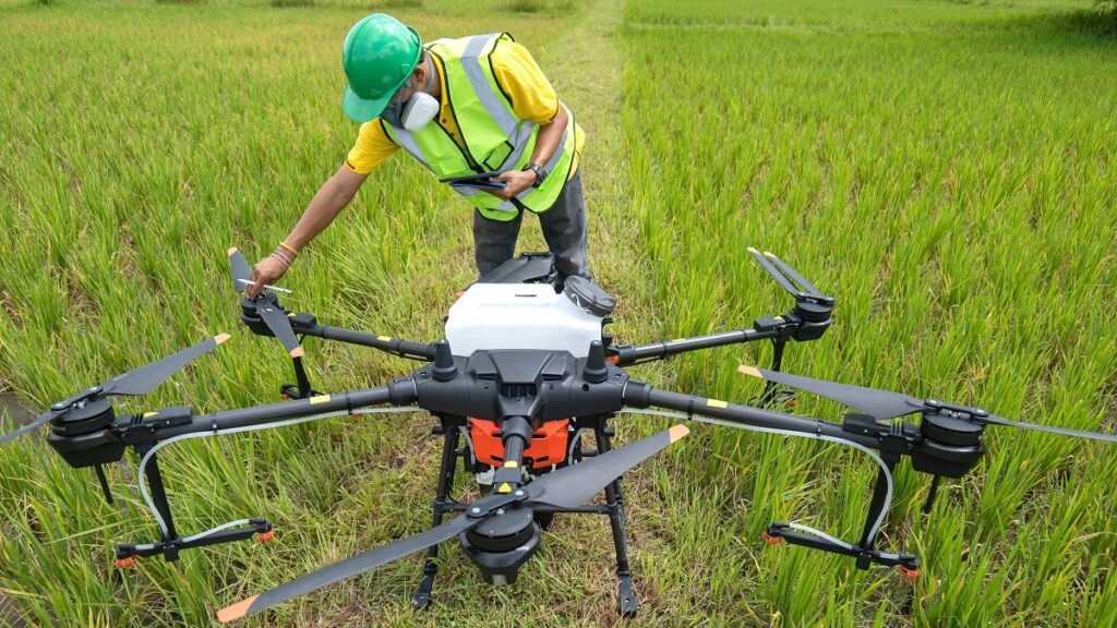
Precision farming, also known as precision agriculture is a farming management concept that uses GIS technologies to optimize field-level management about crop farming and by employing GPS guidance systems, sensors and data analytics, farmers can precisely manage variability within fields ensuring that resources such as water, fertilizers and pesticides are used efficiently. GIS applications help farmers create detailed maps of their fields showing variations in soil properties and nutrient levels. This information enables farmers to implement variable rate applications adjusting inputs based on specific field conditions. For example, if a certain area of the field has higher nutrient levels, farmers can reduce fertilizer application in that region minimizing waste and environmental impact.
Climate-Smart Agriculture
The agriculture sector is particularly vulnerable to climate change with shifting weather patterns, unpredictable rainfall and extreme events impacting crop production where GIS plays a crucial role in climate-smart agriculture by providing tools for monitoring and adapting to changing climate conditions. GIS technologies can analyze historical weather data, predict future climate trends and provide valuable insights to farmers and by understanding how climate change may affect their region, farmers can make informed decisions on crop selection, planting times and irrigation practices. This proactive approach helps mitigate the risks associated with climate variability and ensures the long-term sustainability of agricultural practices.
Water Management
Water scarcity is a growing concern in agriculture and efficient water management is essential for sustainable farming where GIS technologies assist farmers in optimizing water usage through precise irrigation practices. By integrating data on soil moisture levels, weather forecasts and topography, farmers can implement irrigation strategies that minimize water wastage and maintain soil health. GIS also facilitates the monitoring of water resources helping farmers identify areas prone to water stress and this information enables the implementation of targeted water conservation measures such as the introduction of drought-resistant crops or the adoption of water-saving irrigation techniques.
Crop Health Monitoring
Monitoring the health of crops is vital for the early detection of diseases and pests allowing farmers to take timely action to prevent widespread damage where GIS technologies contribute to crop health monitoring by integrating data from various sources including satellite imagery, drones and on-the-ground sensors. Remote sensing technologies such as satellite imagery, provide high-resolution data on crop conditions. GIS applications analyze this data identifying areas of potential concern such as pest infestations or nutrient deficiencies and by pinpointing these issues, farmers can apply targeted interventions reducing the need for broad-spectrum pesticides and promoting sustainable pest management practices.
Supply Chain Optimization
The integration of GIS in agriculture extends beyond the farm gate to optimize the entire supply chain where GIS technologies facilitate better logistics, planning and decision-making throughout the agricultural supply chain starting from production to distribution. For example, GIS can assist in route optimization for transporting agricultural products reducing fuel consumption and carbon emissions and by analyzing transportation routes, GIS helps streamline the supply chain, minimizing delays and ensuring the timely delivery of fresh produce to markets. This not only enhances efficiency but also reduces the environmental impact associated with transportation.
Policy Support and Land Use Planning
GIS technologies provide valuable support for policymakers and land-use planners in making informed decisions related to agriculture and by mapping and analyzing land-use patterns, GIS helps identify areas suitable for agriculture taking into account factors such as soil quality, topography and water availability. Governments can use GIS to develop policies that promote sustainable land use practices protecting valuable agricultural land from urbanization or degradation. Additionally, GIS aids in the identification of ecologically sensitive areas ensuring the conservation of biodiversity while promoting responsible agricultural practices.
Digital farming solutions, empowered by GIS technologies, are at the forefront of driving sustainable agriculture practices and the ability to collect and analyze spatial data enables farmers to make informed decisions, optimize resource usage and adapt to the challenges posed by climate change. As the world grapples with the need to feed a growing population while preserving the environment, the role of GIS in agriculture becomes increasingly pivotal and by embracing digital farming solutions, we can pave the way for a more sustainable and resilient future in agriculture.


