What Is High Resolution?
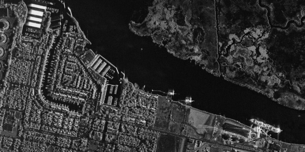
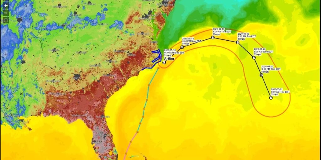
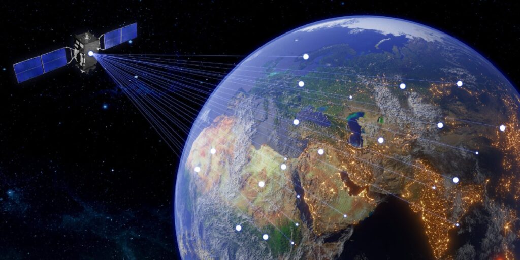
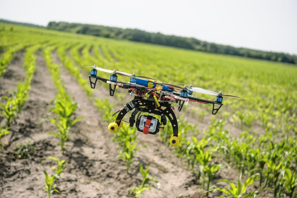
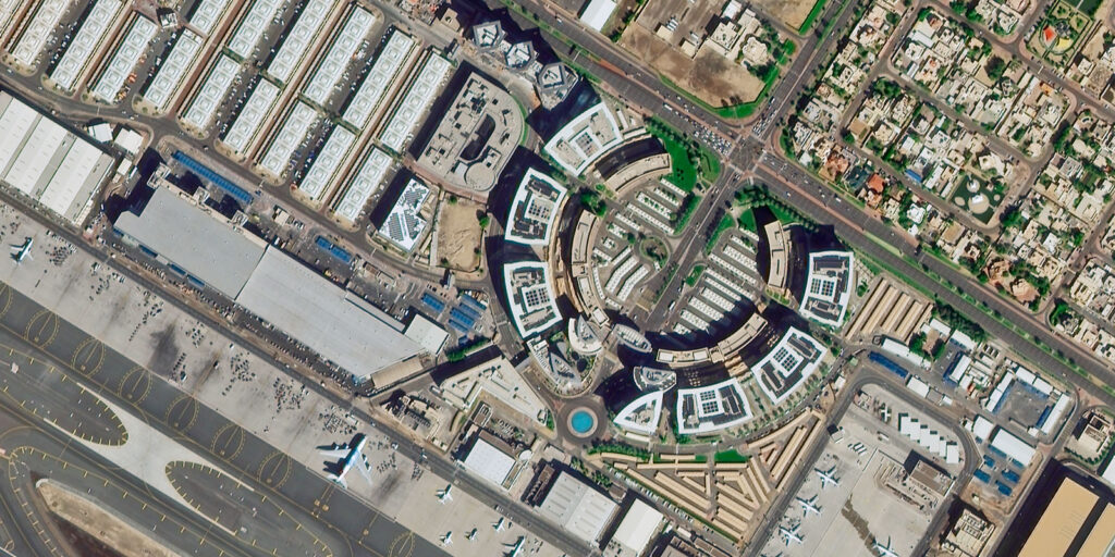
Resolution in the GIS world relates to that of the quality and accuracy of spatial data. Resolution, referring to the amount of detail, is what geographic features are represented with in GIS terms. High resolution data plays a very important role in various industries and has applications in remote sensing, cartography, environmental monitoring, and urban planning. High resolution in GIS usually refers to not only the spatial resolution of imagery but also the resolution of other forms of spatial data, such as vector layers. Types of Resolution Spatial Resolution The most common type of resolution is the spatial resolution, which is associated with a GIS. This refers to the size of the smallest object detected in an image or the level of detail that a map or satellite image contains. For raster data, the size of each pixel in an image is known as spatial resolution. Therefore, an image having 1-meter spatial resolution means that all pixels in such an image represent a 1-meter by 1-meter area on the ground. High spatial resolution means that images possess a high resolution detail for even smaller features on the Earth’s surface. Typically high resolutions range from 0.3 meters to 5 meters per pixel and are applied in such application areas as: Urban Planning: Detecting building outlines and road networks and other infrastructure. Precision Agriculture: Crop health monitoring and fine-scale farm management. Disaster Management: Identifying structural damage or mapping affected areas after a disaster. Any GIS professional whose project demands close observations on Earth’s surface will always cherish a higher spatial resolution. However, the cost of this resolution is the size of data: together with the extra pixels come increased storage, transmission, and processing time. Spectral Resolution Spectral resolution is generally defined as the capacity of a sensor to record data from different parts of the electromagnetic spectrum. The more bands a sensor can differentiate and the narrower these bands are, the greater the spectral resolution. It is an important element in remote sensing and environmental monitoring where it is required to differentiate between different materials such as soil and vegetation, or water. In high-resolution spectral data, differences in reflectance can be picked at finer scales between wavelengths, hence yielding more accurate materials and land cover analysis. Some of the common uses include: Vegetation Mapping: The ability to distinguish healthy and stressed crops through the use of high spectral resolution. Water Quality Monitoring: Suspended sediments, chlorophyll, and other contents in water can be differentiated. Mineral Exploration: The particular content involved can be recognized based on its unique spectral signature. Classification at high spectral resolution also requires advanced processing techniques for handling the large data volumes generated by multi-spectral and hyper-spectral sensors. Temporal Resolution Temporal resolution is defined by how often data or image acquisition takes place for a given location over time. High Temporal Resolution In such case, data is collected at more frequent times. This is especially important in watching changes take place in very fast-evolving phenomena, including but not limited to: Weather Patterns: Frequent satellite data helps track storms, cloud formations, and temperature changes. Land Use Changes: Monitoring deforestation, urbanization, or shifts in agricultural patterns. Emergency Response: Monitoring peak flood levels, spread of a wildfire, or movement of a hurricane. High Temporal Resolution Satellites Satellites with high temporal resolution are especially valuable for time-series analysis that shows how a given area is changing over time. However there needs to be a balance between temporal and spatial resolution. Higher frequency captures lower spatial details. Radiometric Resolution Radiometric resolution refers to how sensitive a sensor is to variation in the intensity of the electromagnetic radiation reflected or emitted from a given surface. Usually it is quoted in bits. Thus, an 8-bit sensor will record 256 shades of gray, while its 16-bit counterpart will record up to 65,536 shades. High radiometric resolution: This implies that the sensor will be so sensitive to detect even tiny reflected differences. This is quite critical in applications where detailed surface analysis of the levels of detail of the subject is required, such as: Soil Moisture Detection: Higher radiometric resolution allows detection of varying levels of moisture in soils, which helps agricultural management. Thermal Imaging: Excellent resolution in temperature variation across surfaces, useful in environmental and urban heat island studies. Where higher radiometric resolution improves the ability to make fine distinctions, it increases data volume from images, thereby increasing the file size of images and requiring more CPU-intensive computational power in analyzing. Applications of High Resolution Urban Planning and Infrastructure Development: High spatial resolution imagery allows planners and engineers to envision and map urban environments with spectacular detail. From observing the exact location of buildings and roads to deducing green spaces and transportation networks, there is enough granularity provided by high-resolution data to understand urban infrastructure planning. Precision Agriculture: With high-resolution satellite imagery and drone data, farmers can track crop health, analyze soil conditions, and better manage water resources. Precision agriculture relies highly on spatial, spectral, and temporal resolution data to optimize farming practices, reduce costs, and increase yields. Environmental Monitoring: Remote sensing data of high resolution is hence needed to track environmental changes including desertification, deforestation, and coastal erosion. Agencies concerned with the environment use such data to monitor protected areas, analyze biodiversity, and thus implement conservation strategies. Disaster Management: Satellite imagery of high resolution can be utilized in the event of natural disasters such as hurricanes, floods, or earthquakes to allow responders to take assessments of damage, coordinate rescue efforts, and subsequently manage the recovery operations. In this way, there are real- or near-time insights into the scale of the disaster; they also help in making authoritative decisions. Mapping and Cartography: Cartography experts and mapping professionals use data of high resolutions for preparing maps that are necessary for varied applications. From the topographic maps used by hikers to the detailed road maps necessary for navigation in cities, high resolution ensures that maps are precise and informative. High resolution in GIS simply means that the sensors or
What Is High Resolution? Read More »