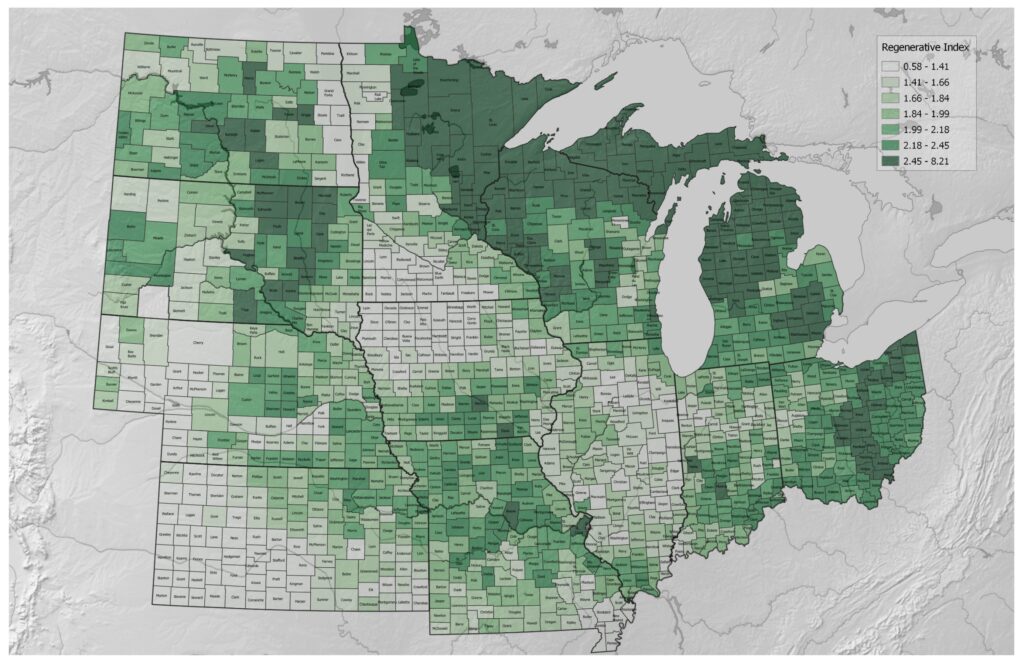
GIS mapping involves the integration of geographic data with various layers of information to create visual representations of agricultural landscapes where these maps are dynamic tools that enable the investigation of spatial linkages, patterns and trends that are essential for agricultural decision-making rather than just static images.
Why do we need an agriculture map?
Using Geographic Information System (GIS) technology, an agriculture map is essential to contemporary farming methods where it supports the best crop selection and management by offering vital insights into soil composition, topography and climate trends. Farmers can make well-informed decisions on crop rotation, fertilization and irrigation by superimposing data layers such as soil pH, precipitation levels and temperature gradients.
Additionally, it makes precision farming easier increasing production and resource efficiency where proactive intervention tactics are empowered by the real-time monitoring of pest infestations and crop health made possible by GIS tools. An agriculture map is essentially the foundation of data-driven sustainable farming methods that promote environmental stewardship and productivity.
What is Field Mapping in Agriculture?
In the world of agriculture, field mapping is the process of creating intricate spatial representations of agricultural fields using Geographic Information System (GIS) technology where it entails obtaining information on a range of topics including crop health, irrigation schedules, pest infestations and soil type then superimposing this data on computerized maps.
Farmers may carefully assess and manage their crops maximizing resource allocation and raising yields by using equipment like GPS, remote sensing and drones and by using field mapping, farmers can increase the efficiency and sustainability of their agricultural practices by making well-informed decisions about planting, fertilizer and pest control. In the end, it reduces environmental effects while increasing production.
Precision Agriculture Mapping
Geographic Information Systems are used in precision agriculture mapping to maximize farming techniques where this cutting-edge method uses GPS, data analytics and remote sensing to produce intricate maps of crop health, environmental variables and soil variability. GIS tools help farmers make informed decisions by accurately defining boundaries, evaluating topography and analyzing spatial patterns.
Precision agricultural mapping optimizes crop output, lowers resource usage and lessens environmental impact by integrating data on soil composition, moisture levels and plant health where this creative way of farming transforms farming by encouraging efficiency and sustainability in contemporary agriculture with the flexibility to customize treatments to particular locations.
Soil Zone Maps, Crop Yield and Green Vegetation Indices (NDVI Maps)
Soil Zone Maps, generated through GIS, delineate various soil types, moisture levels and nutrient distribution across agricultural landscapes and by analyzing these maps, farmers can optimize their land use employing tailored irrigation and fertilization strategies to maximize crop yield while minimizing resource usage.
Crop yield estimation, a critical aspect of agricultural planning is significantly enhanced through GIS-based analyses and by integrating soil zone maps with climate data, crop type information and historical yield records, GIS models can accurately predict future yields which enables farmers to make informed decisions regarding planting schedules, crop selection and investment in agricultural inputs.
Green Vegetation Indices, particularly the Normalized Difference Vegetation Index (NDVI) are key indicators of vegetation health and vigor where NDVI maps, derived from satellite imagery and GIS techniques provide valuable insights into crop growth patterns and overall land productivity. By monitoring NDVI fluctuations over time, farmers can identify areas of stress, disease outbreaks or inadequate irrigation allowing for targeted interventions to optimize crop health and yield.
GIS mapping is a paradigm change in agriculture management that gives land managers and farmers previously unheard-of opportunities to maximize profitability, sustainability and production and in order to ensure the long-term sustainability of our food systems in a world that is always changing, stakeholders may confidently traverse the intricacies of modern agriculture by utilizing geographical data, sophisticated analysis techniques and collaboration platforms.


