- All Blogs
- Back
GIS Drone Photography – The field of geospatial data capture has seen a dramatic change as a result of the incorporation of drone photography and video…
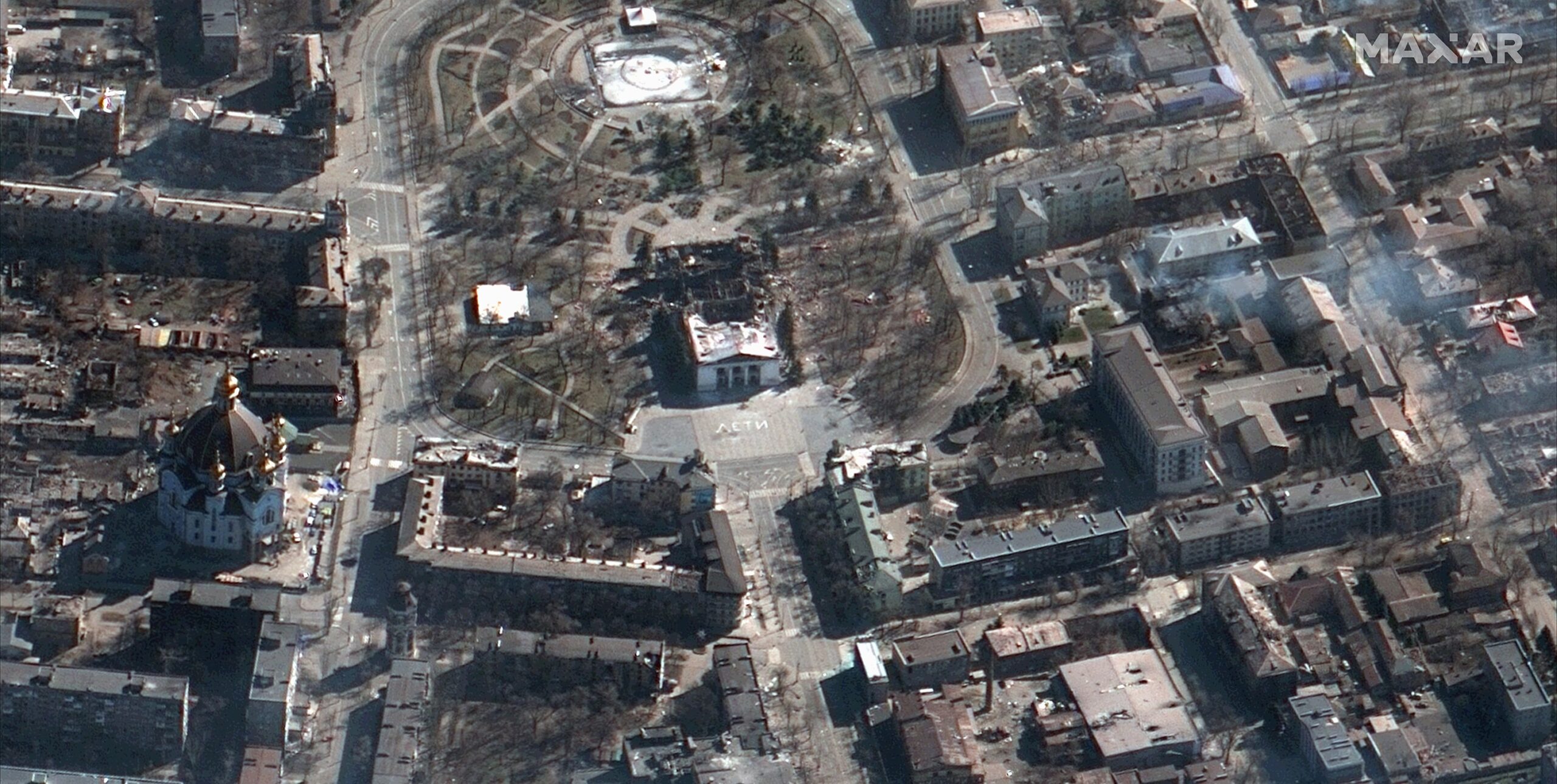
MAXAR operates the WorldView-1, WorldView-2, WorldView-3 and WorldView-4 advanced satellite constellations where modern imaging sensors on these satellites allow them to take high-resolution images with previously…
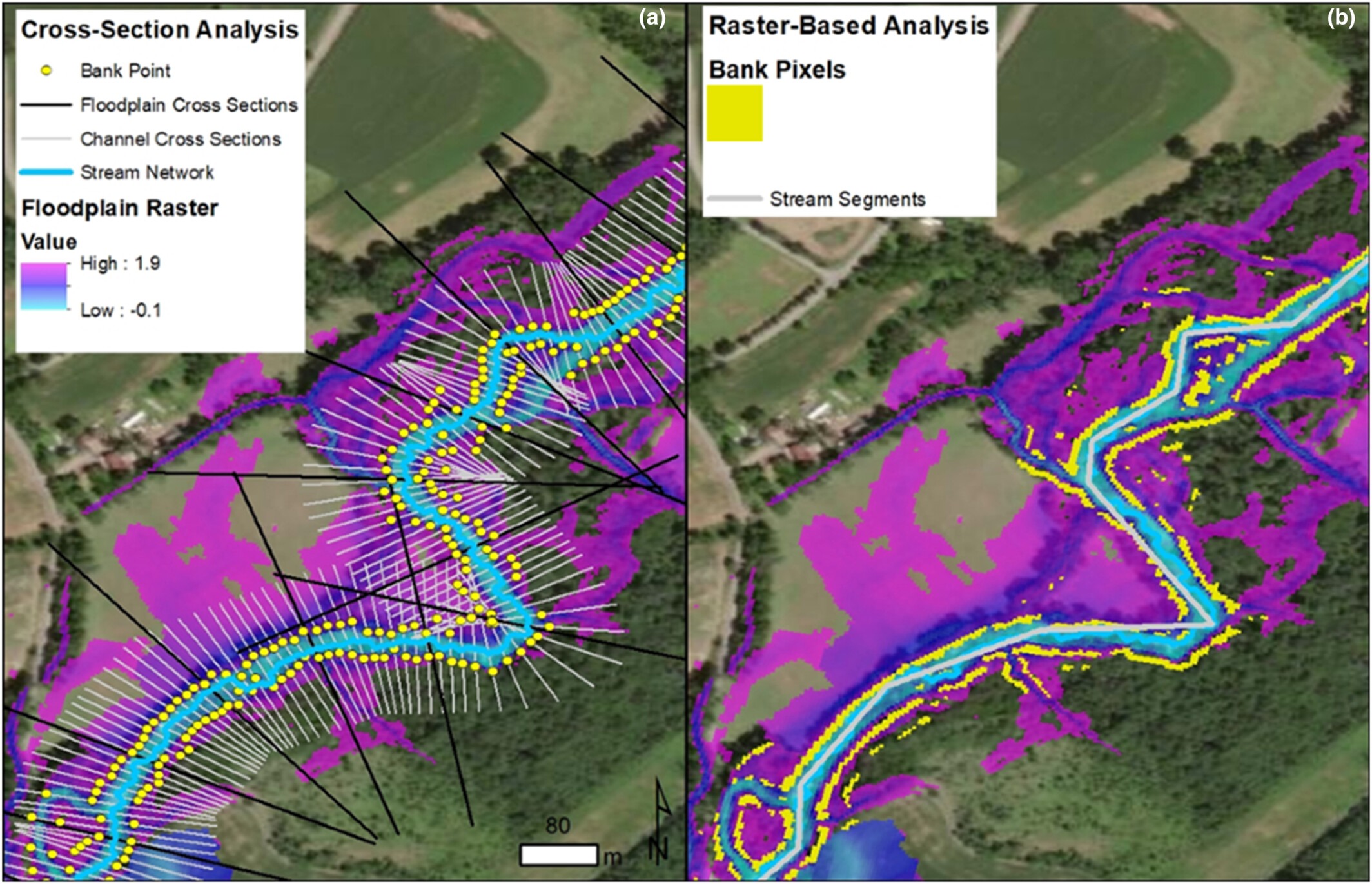
Floodplain mapping is a critical aspect of disaster management and urban planning leveraging advanced GIS technologies. Floods have been perennial threats to human settlements causing immense…
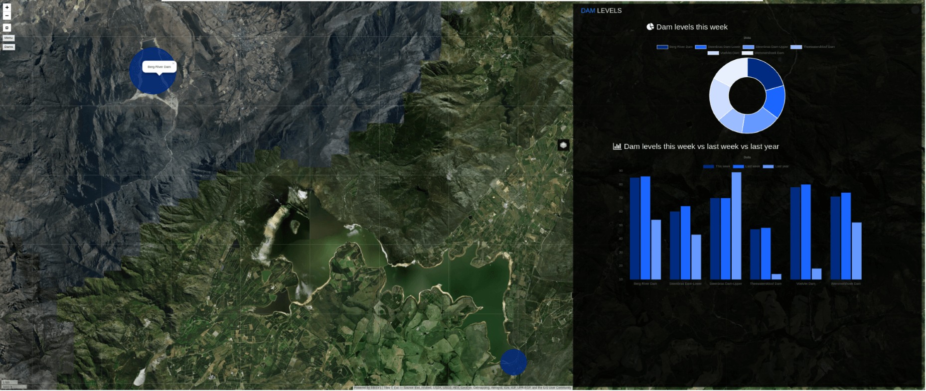
Web GIS: Technologies and Its Applications The word “web GIS,” which stands for “web geographic information systems,” refers to the way that GIS technology is combined…
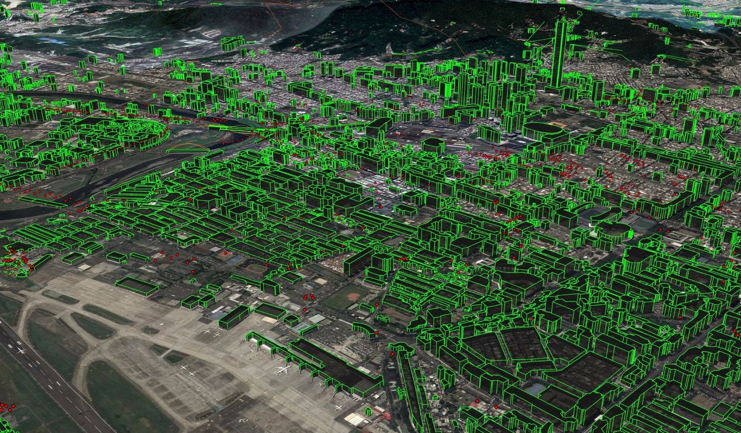
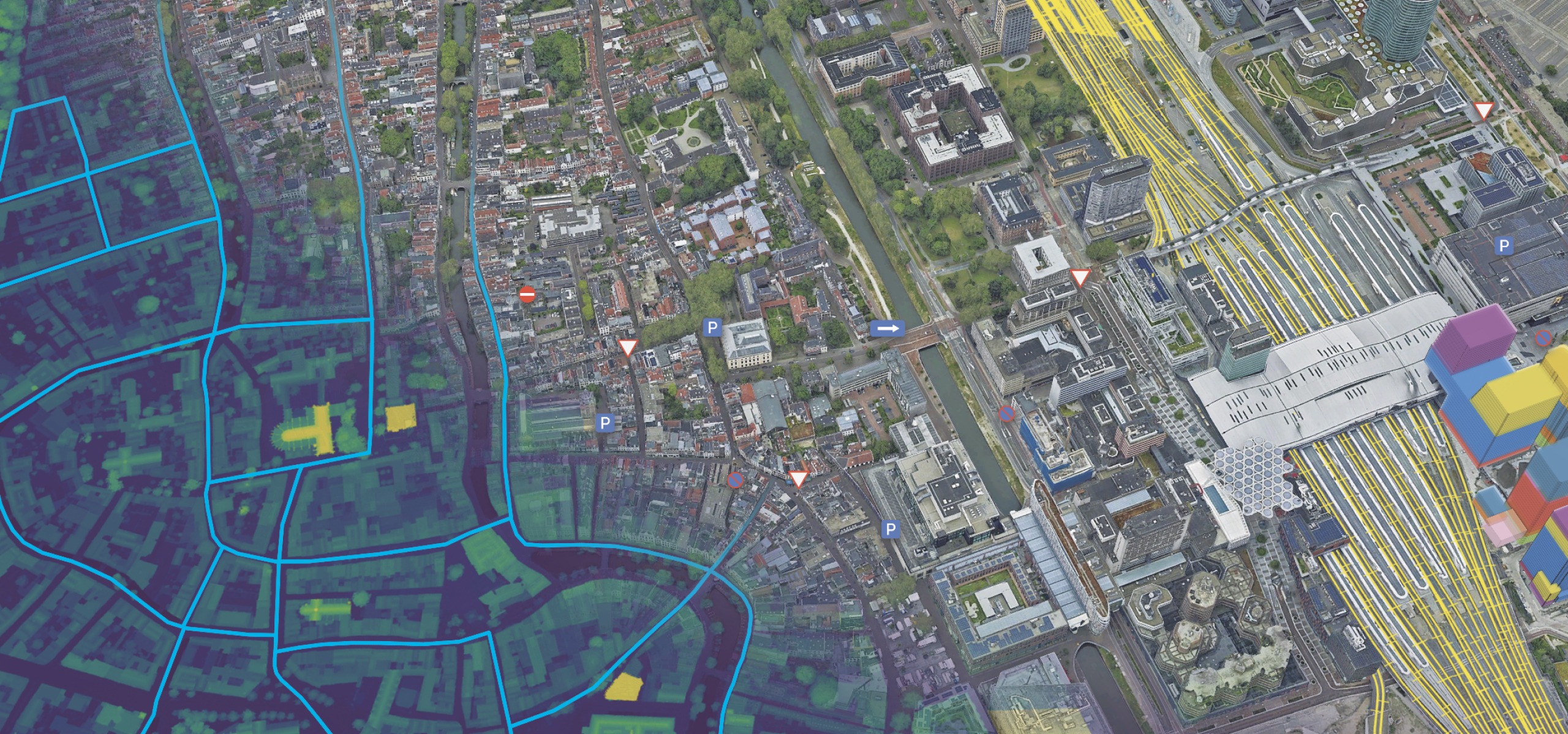
It is now essential to integrate cutting-edge technologies into urban development to meet the issues brought on by the fast-changing urban scene. eTOD, or electronic Transit-Oriented…
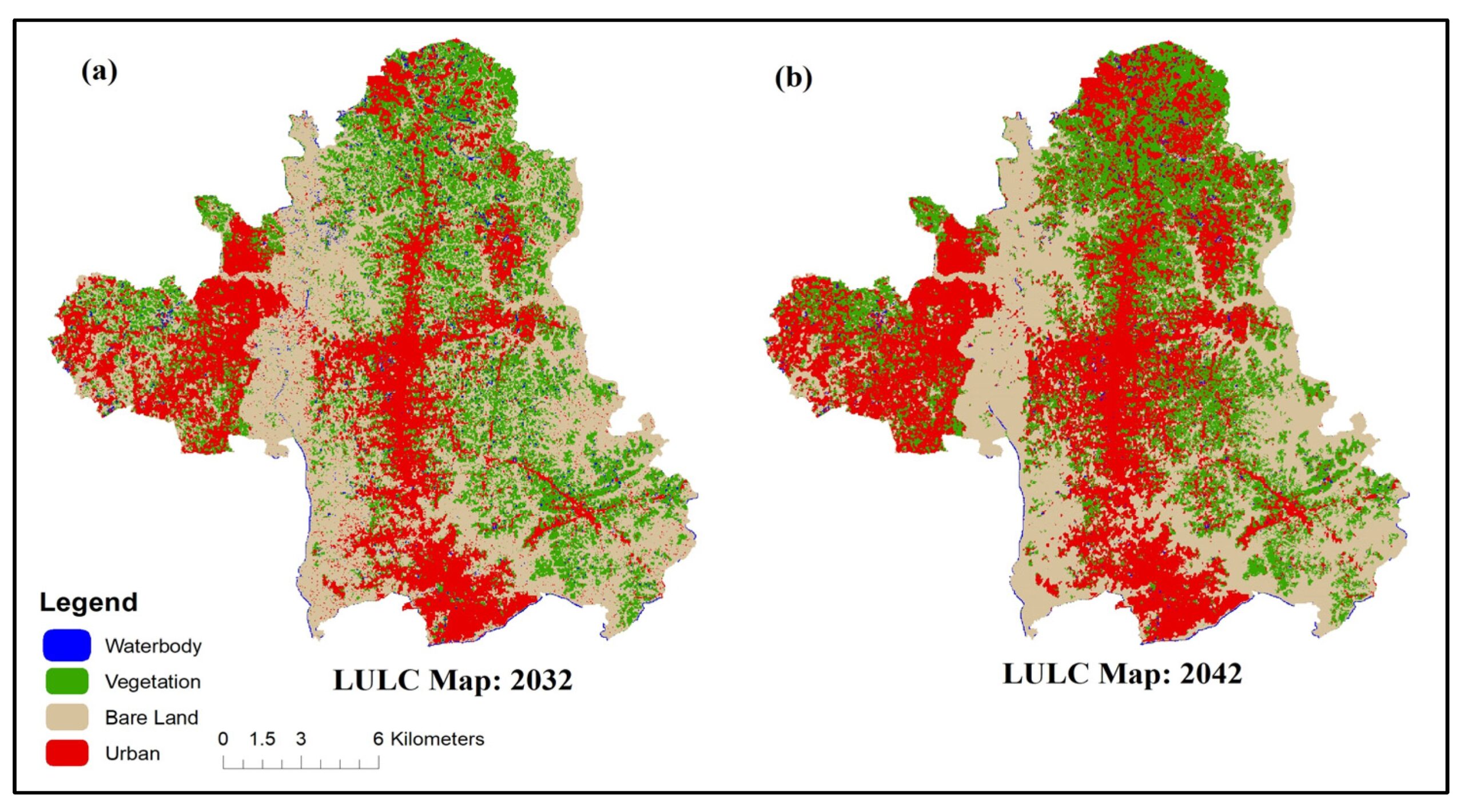
The term Land Use and Land Cover (LULC) refers to the physical and human characteristics-based classification and categorization of the Earth’s surface. In this comprehensive study,…
What is a BlackSky satellite? One name has come to light as a beacon of creativity and accuracy in the quickly changing field of geographic intelligence…
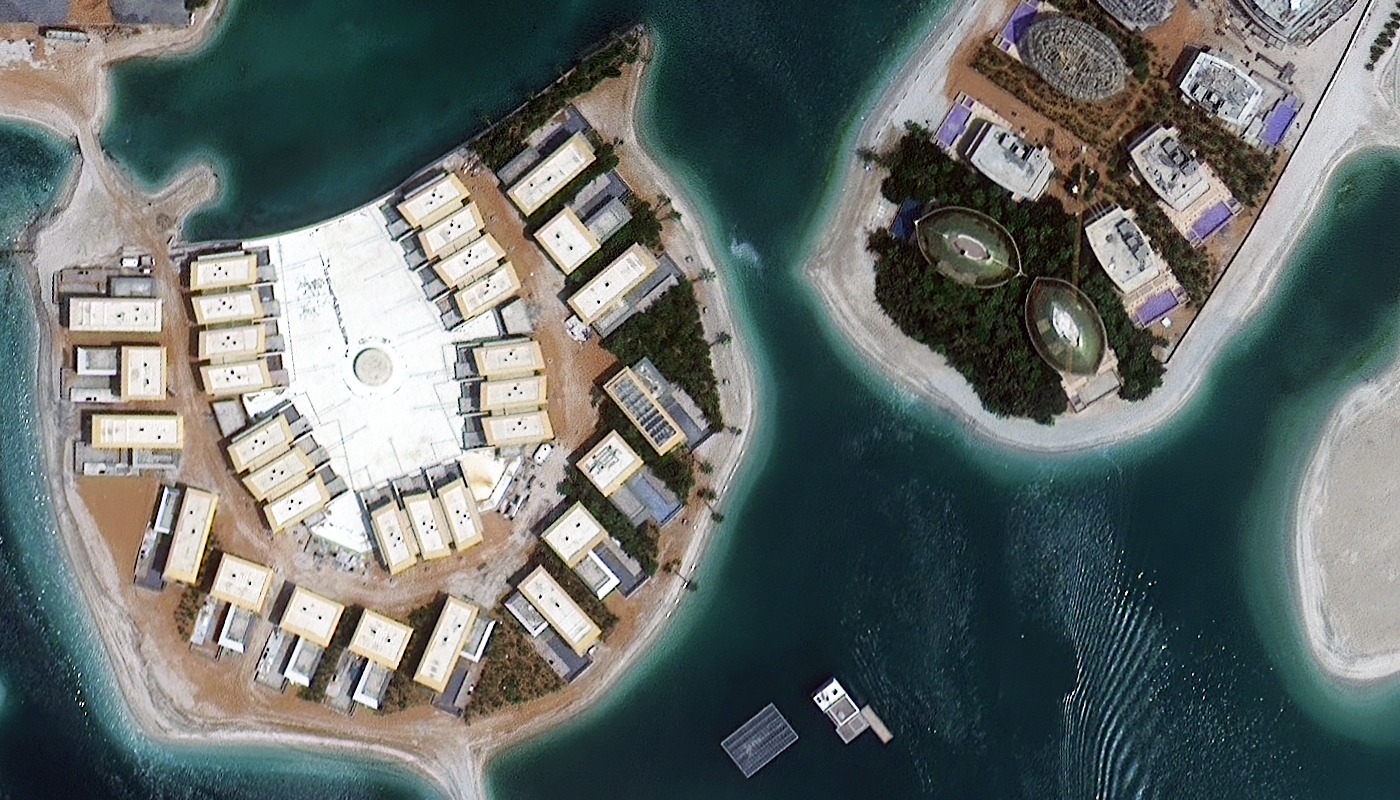
The collection of high-resolution satellite images from the SuperView constellation which is mostly made up of the GF 1, GF 2, and GF 4 satellites is…

The demand for high-resolution, timely and accurate satellite imagery has never been higher where AXELSPACE, a pioneering player in the space technology arena has emerged as…