satpalda

Temporal Resolution

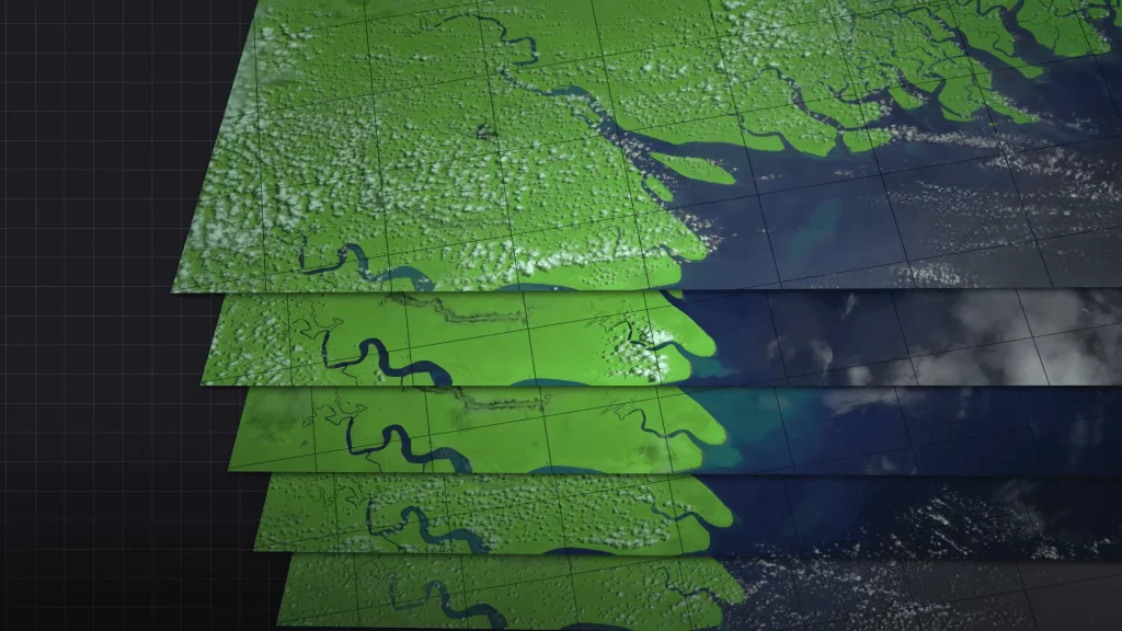
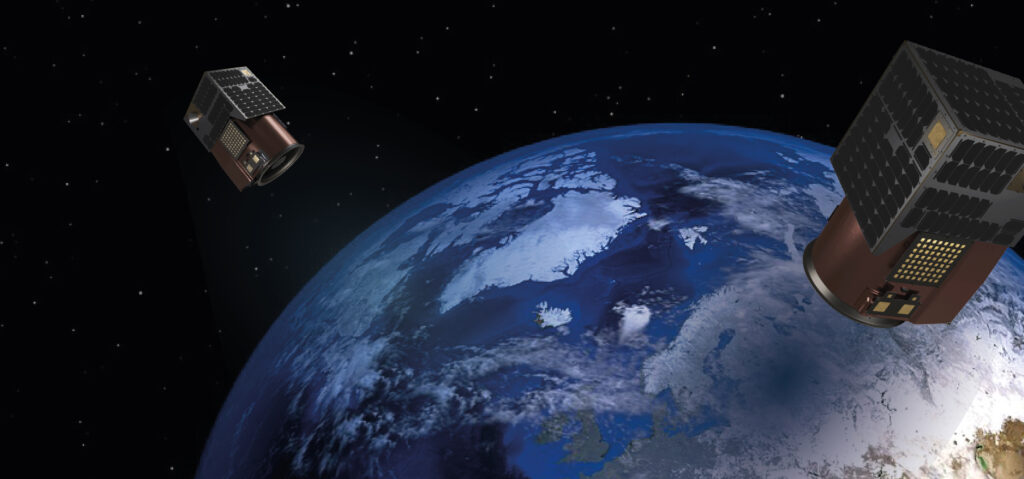
Geographic Information Systems emphasize the importance of the term “temporal resolution.” The frequency at which data has to be captured or observed above a given location on the Earth’s surface is known as temporal resolution. The time gap between two successive images or data acquisitions taken above the same geographic area can be defined as temporal resolution. This has played a crucial role in many applications ranging from environmental monitoring to urban planning, and agriculture. The definition of temporal resolution in remote sensing refers to how many times a sensor can capture information of the same area at different times. Sensors carried onboard satellite or aircraft platforms periodically photograph or measure the Earth, and the time difference between the two observations determines the resolution. High resolution relates to data gathered often and low resolution relates to data gathered sporadically. Why is Temporal Resolution Important? Disaster Management: Such events, such as hurricanes or floods, require a high temporal resolution to monitor the event in real-time. For instance, in a wildfire, it is critical to employ remote sensing systems more frequently to observe changes in the pattern of the fire and update the teams responsible for the emergency response. Satellites, such as NASA’s MODIS (Moderate Resolution Imaging Spectroradiometer), provide near-daily observations, thus offering vital data in such rapidly moving events. Climate Monitoring: Global climate models rely on time-resolution data to track some of the events influencing environmental change, such as sea surface temperature fluctuation and melting of glaciers and vegetation cycles. Sensors such as Landsat and Sentinel 2 provide routine datasets that allow for monitoring environmental long-term alterations over space and time. These are essential observations of seasonal patterns and trends over the long term in weather and climate conditions. Agriculture: One of the critical things in precision agriculture is detailed temporal data to track crop health, water usage, and soil conditions. The farmer will have enough information on the crop growth stages to make timely decisions about irrigation, fertilizer, and pest controls after frequent assessments of the crop growth stages. High-frequency temporal data has put NDVI at the forefront of tools in agriculture, effectively assisting in assessing crop growth stages and early signs of stress. Urban Expansion and Land Use: Temporal data is very instrumental in monitoring changes within urban expansion and land use over time. For instance, high temporal resolution satellite images can be utilized to monitor projects and developments on transportation in the urbanized regions, and population growth among other related changes. Monitoring these early changes informs city planners appropriately on decisions in infrastructure and resource management. Forest Monitoring and Deforestation: High temporal resolution of satellite imagery is vital to closely monitor forest health and detection of deforestation. Though it occurs gradually, the frequent collection of data will enable the forest managers to identify what parts are being threatened and, consequently, take corresponding responses to some extent that may help curb the illegal logging activity. LIDAR and high-temporal resolution imagery are generally used to monitor forest dynamics. Determinants of Temporal Resolution Orbit type: This is, however, a primary characteristic in deciding the temporal resolution. Geostationary satellites, for instance, weather satellites have continuous views of an area and consequently, very high temporal resolution. Satellites in polar orbits pass over an area much fewer times; thus, their temporal resolution is much less. Sun-synchronous orbits – one type of polar orbit – provide regular temporal spacing, but the number of observations varies and generally depends on the specific application. Swath Width: The swath width of a satellite sensor defines the Earth’s surface width, which is covered by the sensor with one pass. Satellites with a wide swath width will cover more ground, and consequently, have shorter revisit times for a particular location while increasing the temporal resolution. However, sometimes this may compromise the spatial resolution. Cloud Cover: Other weather-related effects include cloud cover, which in some ways impacts the temporal resolution of optical remote sensing. While a satellite might image a given location an infinite number of times, particularly dense cloud cover may often be present, meaning that its useful, real-world temporal resolution for optical sensors could be much lower. This is one reason why SARs (Synthetic Aperture Radar), which do not need to cloud-penetrate data-gathering capabilities, are as important for that type of consistent temporal monitoring. Trade-offs in Temporal Resolution In some cases, there is a trade-off between spatial, temporal, and spectral resolutions. For example, a sensor with high spatial and spectral resolution can have relatively low temporal resolution because of large data processing and storage capacity. On the other hand, satellites such as MODIS with rather poor spatial resolution can still possess daily observations with high temporal resolution. This depends on the application of what resolution is most preferred. For instance, if rapid environmental changes are to be monitored, then high temporal resolution is favored and high spatial resolution is not favored. Conversely, if detailed analysis of land cover is a prerequisite, then spatial resolution is favored over temporal resolution. Examples of High Temporal Resolution Satellites MODIS (Moderate Resolution Imaging Spectroradiometer): This sensor is on board the NASA Terra and Aqua Satellites and delivers a daily global dataset. It is one of the most important tools for environmental monitoring. GOES (Geostationary Operational Environmental Satellite): From a Geostationary Orbit, GOES provides a continuous view of weather patterns and atmospheric events in near real-time. Sentinel-2: Sentinel-2 is part of the European Space Agency’s Copernicus Program, providing high spatial and spectral resolution data with a revisit time of five days, which makes it very effective in monitoring the changes in vegetation and land use. Temporal resolution is critical for any GIS and remote sensing data whereby the rate at which data is collected would depend on the temporal resolution. Also, it affects the capacity to monitor changes over time. High temporal resolution will offer dynamic views of the Earth’s surface for disaster management, precision agriculture, and climate studies with timely decision-making and better resource management. It is important to understand detail in

What Is Spatial Resolution?

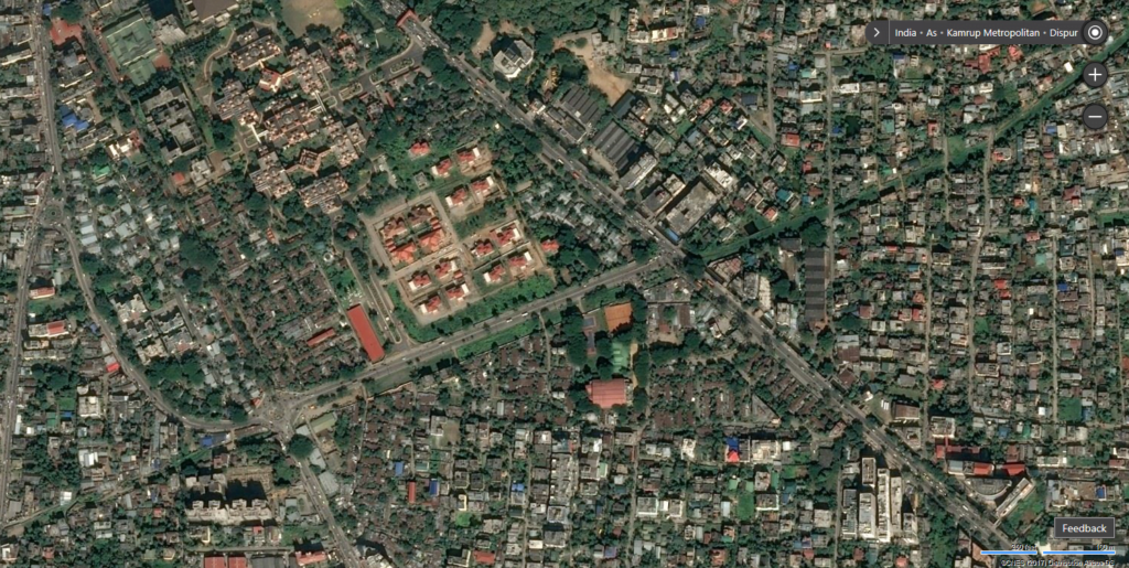
GIS and remote sensing define spatial resolution as one of the definitions: it represents the degree of spatial detail in an image or dataset. It is represented by the minimum object that may be detected by a sensor on the image. Spatial resolution, therefore is the clue to knowing the level of precision with which we may view features on Earth’s surface, be it mapping or environmental monitoring, urban planning, agriculture, or whatever. Concept: Spatial resolution is the region of ground under the area that one pixel in the satellite or aerial image measures. It is just the smallest unit of size of a digital image that represents an area on the Earth’s surface. For example, it could be said that the spatial resolution of an image is 1 meter, meaning that one pixel indicates a square of 1×1 meter on the ground. Then, the spatial resolution of the low-resolution image will be about 30 meters, that is, each pixel covers an area of 30×30 meters. In this fashion, the smaller the pixel size, the higher the spatial resolution and perhaps even more detail. Measurement of Spatial Resolution The spatial resolution is defined in terms of meters, usually described in terms of the smallest object or feature that can be detected by a sensor. This is described with the term Ground Sample Distance, which is the distance between two adjacent pixel centers on the ground. The greater is GSD, the lesser the spatial resolution. For instance, when the spatial resolution of an image is 10 meters, things of sizes less than 10 meters cannot be seen in the image. While at a resolution of 1 meter, it will be possible to see smaller objects like cars, profiles of buildings, and even individual trees. Factors Influencing Spatial Resolution Sensor Characteristics: The type and capability of a sensor installed on a satellite or in an aerial platform determine the resolution. The high-resolution sensors could take images with much better detail. Altitude: The second reason spatial resolution is a function of altitude-orbit height is because normally, sensors at greater altitudes will have larger areas to be covered but with low spatial resolution. Very small altitudes near the Earth’s surface could yield a greater resolution over much smaller areas. Lens and Optics: The sensor resolution depends mostly on the quality and design of its optics. Complex optical systems can achieve much finer resolutions with features that are more accurately detected. Types of Spatial Resolution High Spatial Resolution: Images with a spatial resolution of less than 5 meters are considered high resolution. High-resolution imagery is used in applications that demand detailed information, such as urban mapping, precision agriculture, or managing a disaster. For example, one can differentiate between two or more trees, vehicles, and buildings seen from the images captured by WorldView-3 or GeoEye-1. Medium Spatial Resolution: Images are 5-30 meters. This is a highly used medium resolution for land cover mapping, environmental monitoring, and assessments for agriculture. The very wide applications of this series of Landsat satellites at spatial resolutions of 30 meters in large-scale applications for environmental and resource management. Low Spatial Resolution It comprises images having a spatial resolution greater than 30 meters. The low-resolution images are mostly used in applications involving broad scales like a study of global climates and ocean studies. Most satellites, for example, MODIS (Moderate Resolution Imaging Spectroradiometer), provide data with spatial resolutions between 250 meters and 1 kilometer and assist in studying big environmental phenomena. Importance of Spatial Resolution Mapping and Cartography: It requires a maximum spatial resolution so maps have to be as high-resolution as possible. For instance, while a city’s infrastructure and other utilities, buildings, etc. were being planned and designed, good spatial resolution imagery is required. The finer the spatial resolution, the more precise the map. Precision Agriculture: Spatial resolution in agriculture tracks crop health, soil conditions, and water usage; therefore, imagery with high resolution shall manifest rich observations about individual fields and encourage better choices by farmers in planting, fertilizing, and irrigating. Precision agriculture uses only medium to high spatial-resolution images for mapping. Environmental monitoring: With remote sensing, various environments have been monitored with data varying in spatial resolutions. Like above, while medium-resolution imagery forms the backbone tool of land-cover research, especially issues relating to deforestation and desertification, high-resolution images are necessary for the detection of small-scale environmental change at localized levels, like wetland degradation. Disaster Management: In disaster management, such high-resolution imagery would be extremely advantageous in finding out the damage caused to the infrastructure by earthquakes, floods, or hurricanes within moments. One can respond better to disasters by being able to identify a much smaller feature much faster for the right assessment determinations. Urban Development: High-resolution imagery is widely used in the urban development and planning process. Municipal administrations and government agencies use spatial data to determine land use, track growth trends, and thus outline a strategy for proposed infrastructure projects. This way, planning officials can very effectively analyze the impact developments have on transportation systems, public utilities, and housing. Climate Studies: Applications to Climate Despite the low spatial resolution images lacking in high spatial detail they are extremely useful for global applications. Low-resolution satellite data are frequently used by climate research in environmental variations: the large-scale heating and cooling of oceans as well as deforestation and carbon fluxes. These latter aspects require large spatial coverage areas that can be offered by low spatial resolution sensors. One of the concepts considered in both remote sensing and GIS is that of spatial resolution, acting as a determining factor to set the amount of detail in imagery and accuracy in analysis. Thus, any application ranging from precision agriculture to metropolitan planning, or environmental monitoring to disaster management, demands an overall comprehension of spatial resolution so that the proper dataset for the application can be picked up. This way, knowing how spatial resolution influences the quality and utility of spatial data assures GIS professionals are best placed to develop decision options that will

What Is High Resolution?

Resolution in the GIS world relates to that of the quality and accuracy of spatial data. Resolution, referring to the amount of detail, is what geographic features are represented with in GIS terms. High resolution data plays a very important role in various industries and has applications in remote sensing, cartography, environmental monitoring, and urban planning. High resolution in GIS usually refers to not only the spatial resolution of imagery but also the resolution of other forms of spatial data, such as vector layers. Types of Resolution Spatial Resolution The most common type of resolution is the spatial resolution, which is associated with a GIS. This refers to the size of the smallest object detected in an image or the level of detail that a map or satellite image contains. For raster data, the size of each pixel in an image is known as spatial resolution. Therefore, an image having 1-meter spatial resolution means that all pixels in such an image represent a 1-meter by 1-meter area on the ground. High spatial resolution means that images possess a high resolution detail for even smaller features on the Earth’s surface. Typically high resolutions range from 0.3 meters to 5 meters per pixel and are applied in such application areas as: Urban Planning: Detecting building outlines and road networks and other infrastructure. Precision Agriculture: Crop health monitoring and fine-scale farm management. Disaster Management: Identifying structural damage or mapping affected areas after a disaster. Any GIS professional whose project demands close observations on Earth’s surface will always cherish a higher spatial resolution. However, the cost of this resolution is the size of data: together with the extra pixels come increased storage, transmission, and processing time. Spectral Resolution Spectral resolution is generally defined as the capacity of a sensor to record data from different parts of the electromagnetic spectrum. The more bands a sensor can differentiate and the narrower these bands are, the greater the spectral resolution. It is an important element in remote sensing and environmental monitoring where it is required to differentiate between different materials such as soil and vegetation, or water. In high-resolution spectral data, differences in reflectance can be picked at finer scales between wavelengths, hence yielding more accurate materials and land cover analysis. Some of the common uses include: Vegetation Mapping: The ability to distinguish healthy and stressed crops through the use of high spectral resolution. Water Quality Monitoring: Suspended sediments, chlorophyll, and other contents in water can be differentiated. Mineral Exploration: The particular content involved can be recognized based on its unique spectral signature. Classification at high spectral resolution also requires advanced processing techniques for handling the large data volumes generated by multi-spectral and hyper-spectral sensors. Temporal Resolution Temporal resolution is defined by how often data or image acquisition takes place for a given location over time. High Temporal Resolution In such case, data is collected at more frequent times. This is especially important in watching changes take place in very fast-evolving phenomena, including but not limited to: Weather Patterns: Frequent satellite data helps track storms, cloud formations, and temperature changes. Land Use Changes: Monitoring deforestation, urbanization, or shifts in agricultural patterns. Emergency Response: Monitoring peak flood levels, spread of a wildfire, or movement of a hurricane. High Temporal Resolution Satellites Satellites with high temporal resolution are especially valuable for time-series analysis that shows how a given area is changing over time. However there needs to be a balance between temporal and spatial resolution. Higher frequency captures lower spatial details. Radiometric Resolution Radiometric resolution refers to how sensitive a sensor is to variation in the intensity of the electromagnetic radiation reflected or emitted from a given surface. Usually it is quoted in bits. Thus, an 8-bit sensor will record 256 shades of gray, while its 16-bit counterpart will record up to 65,536 shades. High radiometric resolution: This implies that the sensor will be so sensitive to detect even tiny reflected differences. This is quite critical in applications where detailed surface analysis of the levels of detail of the subject is required, such as: Soil Moisture Detection: Higher radiometric resolution allows detection of varying levels of moisture in soils, which helps agricultural management. Thermal Imaging: Excellent resolution in temperature variation across surfaces, useful in environmental and urban heat island studies. Where higher radiometric resolution improves the ability to make fine distinctions, it increases data volume from images, thereby increasing the file size of images and requiring more CPU-intensive computational power in analyzing. Applications of High Resolution Urban Planning and Infrastructure Development: High spatial resolution imagery allows planners and engineers to envision and map urban environments with spectacular detail. From observing the exact location of buildings and roads to deducing green spaces and transportation networks, there is enough granularity provided by high-resolution data to understand urban infrastructure planning. Precision Agriculture: With high-resolution satellite imagery and drone data, farmers can track crop health, analyze soil conditions, and better manage water resources. Precision agriculture relies highly on spatial, spectral, and temporal resolution data to optimize farming practices, reduce costs, and increase yields. Environmental Monitoring: Remote sensing data of high resolution is hence needed to track environmental changes including desertification, deforestation, and coastal erosion. Agencies concerned with the environment use such data to monitor protected areas, analyze biodiversity, and thus implement conservation strategies. Disaster Management: Satellite imagery of high resolution can be utilized in the event of natural disasters such as hurricanes, floods, or earthquakes to allow responders to take assessments of damage, coordinate rescue efforts, and subsequently manage the recovery operations. In this way, there are real- or near-time insights into the scale of the disaster; they also help in making authoritative decisions. Mapping and Cartography: Cartography experts and mapping professionals use data of high resolutions for preparing maps that are necessary for varied applications. From the topographic maps used by hikers to the detailed road maps necessary for navigation in cities, high resolution ensures that maps are precise and informative. High resolution in GIS simply means that the sensors or

What is Aerial Remote Sensing?

Aerial remote sensing is an essential technology meant for extracting information from the Earth’s surface using airborne onboard sensors. It is actually about receiving, measuring, and interpreting energy reflected or radiated by any object at the Earth’s surface that is exposed to any portion of the electromagnetic spectrum. Aerial remote sensing is of much significance in agriculture, forestry, urban planning, environmental monitoring, and disaster management. Core Concepts of Aerial Remote Sensing The fundamental core of aerial remote sensing is the acquisition of spatial data by using air-based platforms like airplanes, helicopters or even drone platforms referred to as Unmanned Aerial Vehicles or UAVs. Sensors generally operate over wavelengths on the visible, infrared, and microwave parts of the electromagnetic spectrum. In the principle of aerial remote sensing, each material reflects and absorbs electromagnetic energy differently, providing every material with a unique spectral signature, which can be detected and analyzed by an instrument of remote sensing. The following is a summary of the most common forms of data obtained through aerial remote sensing: Optical Imagery: It is gathered with sensors that are capable of sensing visible light; the images are produced almost as if they had been captured with a run-of-mill camera. Multispectral Imagery: This is gathered in several specific wavelengths of the electromagnetic spectrum; further, both visible bands and infrared bands are mapped. This has a higher resolution level. Hyperspectral Imagery: This goes beyond multispectral imaging to acquire information in hundreds of very narrow spectral bands; therefore, an even finer detail about material identification. Thermal Imagery: Measures Infrared Radiation emitted by objects on Earth. Most generally, it is applied in detecting heat and temperature. Types of Aerial Remote Sensing Platforms Manned Aircraft: Conventional aircraft, such as planes and helicopters use advanced sensor arrays. Whenever it matters, it is preferable to use manned aircraft for filling large areas when sensitive applications such as forestry management, urban planning, or environmental monitoring are involved over large areas. Data generation of high resolution also suits well in manned aircraft. UAS/Drones (UAVs): UAVs have found extensive applications in low-altitude aerial remote sensing within the last decade due to cost-effectiveness, flexibility, and ease of operation. Suitable applications requiring high spatial resolutions. Amenable to UAV studies where manned aircraft cannot reach the location. Excellent tools for short-term, site-specific studies. Balloons or kites: Though not in great demand, these platforms do exist and find specific niche applications, especially in environmental and ecological monitoring where long-duration, low-altitude flights are involved. Sensors Used in Aerial Remote Sensing Passive Sensors: These sensors depend on the power available from other sources, primarily but not solely the sun, for measuring the reflected energy of the Earth’s surface. Most applications for optical, multispectral, and hyperspectral remote sensing take advantage of passive sensors that incorporate the only source of illumination necessary to acquire an image. Active Sensors: Active sensors generate their power through beams of radar or laser and measure the returned backscattered energy. Typical examples include LiDAR, Light Detection and Ranging, and SAR, Synthetic Aperture Radar. LiDAR is applied in topographic mapping since it can also measure distances up to precision due to calibration of return pulses of laser pulses. SAR operates on the principle of microwave radiation to calculate the high-resolution images of the Earth’s surface and, hence, is particularly well-suited for applications such as mapping vegetation or surface deformation. Data Processing in Airborne Remote Sensing Radiometric Correction It removes sensor noise, atmospheric interference, and illumination non-uniformities. In simple words, it ensures that brightness values in the imagery reflect real surface properties. Geometric correction represents the process through which remote sensing data are aligned in the framework of a coordinate system so that they can gain positional accuracy in geospatial positioning. Geometric correction corrects distortion caused by the movement of the sensor or curvature of the Earth so that remote sensing data may be made to map accurately onto a GIS platform. Image Classification: The algorithms classify various surface features with known spectral signatures. Supervised classification entails known data trained by the algorithm, and in unsupervised classification, groupings of such pixels based on their spectral properties are relied on without an external guide. Change Detection: The comparison of data gathered in two different periods can allow for measurements of change in land covers, vegetation, and other water bodies. In this case, such technology can very resourcefully be helpful to the environment in identifying change, urban expansion, and deforestation. Applications of Aerial Remote Sensing in GIS Agricultural: This type of data used in aerial scanning enables the practice of Precision Agriculture, which monitors crop health and nutrient deficiencies in crops using multispectral and hyperspectral data. It also scans to map soil properties and detects pest infestations much before they appear above the ground. Forestry Management: Aerial remote sensing provides a means for monitoring forest health – tree canopy density and other illegal logging. It has been used in the mapping of biomass in forests, carbon storage, and other contributions toward climate change studies. Urban Planning: The most valuable tool in applying aerial images toward urban planning and land use analysis is high-resolution aerial imagery. It will help identify growth patterns within the city, as well as point out areas that are experiencing infrastructural development, and trace changes occurring over time in the land. Disaster Management: The most important activities during disaster response and recovery are aerial remote sensing. Areas devastated by flood disasters, wildfires, earthquakes, and the like can be rapidly assessed. This helps provide a basis for immediate determination of the scope of damage, relief planning, and prioritizing efforts for recovery. Environmental Monitoring: Information coming from remote sensing data feeds environmental monitoring and includes information in terms of coastline erosion, desertification, and melting of glaciers. At the same time, it also accommodates water resource management with applications in mapping watersheds, water quality monitoring, and river and stream flow measurement. Mineral and Geological Surveying: Aerial remote sensing, which includes hyperspectral and radar data, may be used for surface mineral detection and surface mineral mapping

Remote Sensing

What is Remote Sensing?

Remote sensing is a vital technology that revolutionized how we observe, understand, and interact with the Earth’s surface and atmosphere. It encompasses the acquisition, processing, and interpretation of information about objects or areas from a distance, typically through the use of satellite or airborne sensors. The science of remote sensing plays a central role in fields such as geography, environmental science, meteorology, and various applications within Geographic Information Systems (GIS). Types of Remote Sensing Passive Remote Sensing: Passive remote sensing systems rely on natural energy, typically the Sun’s radiation, to illuminate the Earth’s surface. Most optical remote sensing systems, such as satellite imaging sensors and aerial cameras, are passive. They capture the energy reflected from the surface during the day when the Sun is present. Active Remote Sensing: Active remote sensing systems, on the other hand, emit their energy (usually in the form of microwaves or lasers) and measure the backscatter or return of that energy after it interacts with the surface. These systems can function day and night and are less affected by atmospheric conditions like clouds or fog. Remote Sensing Platforms Satellite Platforms: Satellites are widely used in remote sensing because of their ability to cover large areas over regular time intervals. Satellite orbits can be geostationary, remaining fixed relative to the Earth’s surface, or polar-orbiting, passing over the poles and covering the entire Earth’s surface as the planet rotates. Airborne Platforms: Airborne remote sensing involves sensors mounted on aircraft, drones (UAVs), or balloons. This method allows for higher spatial resolution and flexibility in the area and timing of the data collection, making it suitable for detailed mapping and site-specific studies. Applications of Remote Sensing in GIS Environmental Monitoring: One of the most prominent uses of remote sensing is in monitoring environmental changes and trends, including deforestation, desertification, water quality, and biodiversity loss. Remote sensing can track these changes on a global scale, providing critical information for conservation efforts and policy-making. Disaster Management: Remote sensing is an invaluable tool in disaster management, from predicting and mitigating risks to assessing damage and coordinating relief efforts. Satellites can monitor hurricanes, floods, wildfires, and earthquakes, providing timely data to support emergency response. Agriculture: Remote sensing allows for precision agriculture, where farmers can monitor crop health, soil moisture, and nutrient levels on a field-by-field basis. Vegetation indices like NDVI can inform irrigation and fertilization practices, improving crop yields and resource efficiency. Urban Planning and Land Use: Urban planners utilize remote sensing for land use mapping, infrastructure development, and monitoring urban sprawl. High-resolution imagery aids in detecting changes in the built environment, and LiDAR can be used to create detailed 3D models of urban areas. Climate Change Studies: Remote sensing data is crucial for studying climate change, particularly in tracking global phenomena like sea level rise, glacier melting, and shifting weather patterns. Long-term datasets from satellites like Landsat and Sentinel provide a continuous record of environmental changes over time. Remote sensing is an indispensable technology that enables us to observe and monitor the Earth’s surface and atmosphere with unprecedented accuracy and scale. Its integration with GIS has further enhanced its capabilities, providing valuable insights for addressing global challenges, from environmental degradation to urbanization and disaster management. As technology advances, remote sensing will continue to evolve, playing a crucial role in sustainable development and resource management in the 21st century.

Synthetic Aperture Radar

Synthetic Aperture Radar

The term  Synthetic Aperture  refers to the technique SAR uses to achieve high spatial resolution where by moving the radar along a flight path and combining the signals over time, Synthetic Aperture Radar effectively synthesizes a large antenna aperture increasing the resolution beyond what a real antenna of similar size could achieve. This results in highly detailed images, often with spatial resolutions as fine as one meter or better. Key Technical Concepts of SAR Backscatter Coefficient (σ°): The backscatter coefficient, also known as sigma nought (σ°), is a measure of the radar signal’s intensity reflected by the Earth’s surface. It is typically expressed in decibels (dB) and is critical for interpreting SAR data. The backscatter coefficient depends on various factors, including surface roughness, dielectric properties, and the angle of incidence of the radar signal. In GIS, σ° values help in classifying land cover types, detecting surface changes, and monitoring phenomena like soil moisture, flooding, or deforestation. Polarimetry: Polarimetry in SAR refers to the analysis of the polarization states of radar signals, which can be either horizontally or vertically polarized. Dual-polarization (HH, HV, VV, VH) and quad-polarization SAR systems capture data in different polarization combinations, providing additional information about surface features. Polarimetric SAR (PolSAR) is especially valuable in differentiating between vegetation types, soil conditions, and built-up areas. For instance, double-bounce scattering from buildings produces distinct polarimetric signatures compared to volume scattering from forests enabling accurate land cover classification in GIS. Interferometry: SAR interferometry (InSAR) is a technique that utilizes two or more SAR images taken from slightly different positions to measure surface displacement and by comparing the phase differences between the images, InSAR can detect ground movement with centimeter-level accuracy. This technique is widely used in monitoring earthquakes, landslides, subsidence, and glacier movements. In GIS, InSAR data can be integrated with other spatial datasets to assess risk and develop mitigation strategies for geohazards. Resolution: Resolution in SAR refers to the level of detail that can be observed in the resulting imagery. SAR resolution can be divided into two components: range resolution and azimuth resolution. Range resolution is determined by the pulse width of the radar signal and the slant range distance, while azimuth resolution is controlled by the synthetic aperture process. High-resolution SAR systems can capture fine details such as individual buildings, vehicles, and infrastructure, which are invaluable for urban mapping, disaster response, and infrastructure monitoring in GIS. Speckle: Speckle is a type of granular noise inherent in SAR images due to the coherent nature of radar signals. It occurs when the radar signal reflects off multiple small surface elements within a single pixel, causing constructive and destructive interference. While speckle can reduce the visual quality of SAR images, it also carries useful information about surface roughness and heterogeneity. GIS professionals often apply speckle filtering techniques, such as the Lee or Frost filter, to improve the interpretability of SAR data while preserving important details. As SAR technology continues to evolve, with advancements in polarimetry, interferometry, and data processing, its role in the GIS industry will only grow. By integrating SAR data with other spatial datasets, GIS professionals can develop more accurate models, make informed decisions, and contribute to the sustainable management of natural resources and infrastructure. Despite the challenges associated with SAR data interpretation and processing, the benefits of this powerful technology far outweigh the limitations, making SAR an essential tool for the future of GIS and Earth observation. SAR’s unique capabilities have revolutionized how we monitor and understand the Earth’s surface, providing critical insights for decision-makers across a wide range of industries. With continued advancements in SAR technology and the increasing availability of SAR data, the GIS community is well-positioned to harness the full potential of this innovative remote sensing tool.

Digital Elevation Maps

Digital Elevation Maps

A Digital Elevation Model is essentially a raster dataset that stores elevation data for a geographic region. Each pixel (or cell) in the raster contains a value representing the elevation at that specific location. DEMs are typically represented as a grid, with rows and columns corresponding to latitude and longitude. The resolution of the DEM as defined by the size of the pixel or grid cell dictates the accuracy and level of detail available in the dataset. Higher-resolution DEMs have smaller grid cells and provide more detailed representations of the terrain. DEM Data Sources Remote Sensing: Satellites and aerial platforms equipped with sensors can capture data to produce DEMs. One of the most widely known sources is the Shuttle Radar Topography Mission (SRTM), which generated DEMs for much of the world using synthetic aperture radar (SAR). Another notable source is ASTER (Advanced Spaceborne Thermal Emission and Reflection Radiometer), which also provides global DEM coverage. LiDAR (Light Detection and Ranging): LiDAR is a laser-based technology used to collect highly accurate elevation data. By emitting laser pulses and measuring the time it takes for them to return to the sensor after reflecting off the surface, LiDAR systems can generate precise 3D point clouds. These point clouds are then interpolated to create detailed DEMs. LiDAR is highly regarded for its ability to penetrate vegetation, making it a reliable source for generating DTMs in forested areas. Photogrammetry: This method uses high-resolution imagery captured from aerial or satellite platforms. By analyzing the parallax between images taken from different angles, photogrammetry can generate 3D models of terrain. While photogrammetry can achieve good results in open areas, it is less effective in areas with heavy vegetation or complex urban environments. Ground-based Surveys: Traditional surveying methods, such as total stations and GPS (Global Positioning System) surveying, are still used for generating DEMs, particularly for small-scale, high-precision projects. These surveys can offer the most accurate data but are labor-intensive and limited in coverage. Applications of Digital Elevation Maps Hydrological Modeling: DEMs are extensively used in hydrological applications to model watersheds, simulate surface water flow, and predict flooding. By analyzing the slope, aspect, and flow accumulation, GIS software can delineate watersheds and determine water flow paths, which is critical for flood risk management, water resource planning, and erosion modeling. Terrain Analysis: DEMs enable terrain analysis to calculate attributes such as slope, aspect (the direction the slope faces), and curvature. These parameters are essential for environmental modeling, soil analysis, and land use planning. For example, slope analysis is used to assess landslide risk, while aspect analysis is important for understanding solar radiation exposure, which influences vegetation growth and habitat suitability. Urban Planning and Development: DEMs are used in urban planning to model land surfaces for infrastructure development, site suitability analysis, and zoning. They are essential for 3D city modeling, solar potential analysis (for placing solar panels), and flood risk assessment in urban environments. Disaster Risk Management: DEMs play a crucial role in assessing risks from natural disasters such as landslides, floods, and earthquakes. They are used to model terrain stability, identify high-risk areas, and simulate the impacts of potential disasters. For instance, DEMs can be used to simulate tsunami wave propagation and predict the areas that will be affected by inundation. Environmental Conservation: In ecology and conservation, DEMs are used to model habitats, predict species distribution, and analyze the impacts of climate change on ecosystems. For example, slope and aspect derived from DEMs can be used to determine suitable habitats for certain plant and animal species, as these factors influence temperature and moisture conditions. Transportation and Infrastructure: DEMs are vital for the design and construction of transportation networks, such as roads, railways, and airports. They help in determining the optimal routes, calculating cut-and-fill volumes for road construction, and assessing the visual impact of new infrastructure on the landscape. Digital Elevation Maps (DEMs) are foundational to the GIS industry, providing the essential elevation data required for a wide array of spatial analyses. Their applications span multiple fields, including environmental conservation, urban planning, hydrology, and disaster risk management. As technology continues to advance, DEMs will become even more accurate and accessible, opening new possibilities for innovation in terrain analysis and geospatial modeling. The future of DEMs promises higher precision, faster updates, and integration with emerging technologies like AI and crowdsourcing, ensuring that they remain a vital tool in the toolkit of geospatial professionals for years to come.

What Is Satellite Imagery And Its Use

What Is Satellite Imagery And Its Use?

Satellite imagery is a critical component of the Geographic Information Systems (GIS) industry, offering a bird’s-eye view of the Earth’s surface. This technology captures images from space via satellites equipped with advanced sensors, providing detailed information that is invaluable for a variety of applications. Satellite imagery refers to images of the Earth or other planets collected by imaging satellites operated by governments and businesses around the world. These images are captured using different types of sensors that can detect a range of wavelengths beyond what the human eye can see, including infrared and thermal bands. The data collected by these sensors is then transmitted back to Earth for processing and analysis. Types of Satellite Imagery Optical Imagery: This type captures images using visible light, similar to a conventional camera. Optical satellites provide high-resolution images and are often used for mapping and land-use planning. However, they can be hindered by cloud cover and limited to daylight hours. Radar Imagery: Radar satellites use synthetic aperture radar (SAR) to send radio waves toward the Earth’s surface and capture the reflected signals. This type of imagery can penetrate clouds and is not affected by lighting conditions, making it useful for all-weather and night-time monitoring. Infrared Imagery: Infrared sensors capture thermal radiation emitted by the Earth’s surface. These images are valuable for detecting heat variations, making them useful for applications such as monitoring vegetation health, detecting wildfires, and assessing thermal pollution. Uses of Satellite Imagery Environmental Monitoring Deforestation and Land Use Change: By analyzing satellite images over time, researchers can monitor deforestation rates, identify illegal logging activities, and track changes in land use. Climate Change: Satellites provide data on global temperature trends, sea level rise, ice cover changes, and greenhouse gas concentrations, aiding in climate change research and policy-making. Disaster Management: During natural disasters like hurricanes, floods, and wildfires, satellite imagery provides real-time data for assessing damage, coordinating relief efforts, and planning recovery operations. Agriculture Crop Monitoring: Multispectral and hyperspectral imagery can assess crop health, detect diseases, and monitor growth stages, enabling farmers to make informed decisions about irrigation, fertilization, and pest control. Soil Moisture Mapping: Satellite data helps in mapping soil moisture levels, which is crucial for efficient water management and irrigation planning. Yield Prediction: By analyzing satellite images throughout the growing season, farmers can predict crop yields and plan for storage and distribution. Urban Planning and Management Land Use Mapping: High-resolution images help in mapping land use patterns, identifying areas of urban sprawl, and planning for sustainable development. Infrastructure Monitoring: Satellite imagery is used to monitor the condition of roads, bridges, and buildings, enabling timely maintenance and upgrades. Disaster Preparedness: Urban areas prone to natural disasters can benefit from satellite data for risk assessment, emergency planning, and evacuation route optimization. Defense and Intelligence Surveillance and Reconnaissance: High-resolution images are used for monitoring military installations, tracking troop movements, and assessing potential threats. Border Security: Satellites help in monitoring border areas, detecting illegal activities, and managing cross-border conflicts. Disaster Response: In conflict zones or areas affected by natural disasters, satellite imagery aids in assessing damage, planning humanitarian aid, and ensuring the safety of personnel. Natural Resource Management Forest Monitoring: Satellite images help in tracking forest cover changes, assessing biodiversity, and managing forest resources sustainably. Water Resource Management: Satellites provide data on water availability, quality, and usage, aiding in efficient water resource management and planning. Mineral Exploration: Remote sensing techniques help in identifying potential mineral deposits, reducing the need for extensive field surveys. Weather and Climate Weather Prediction: Satellites provide real-time data on cloud cover, precipitation, temperature, and wind patterns, improving the accuracy of weather forecasts. Climate Monitoring: Long-term satellite data helps in studying climate patterns, understanding global warming, and predicting future climate scenarios. Storm Tracking: Satellites track hurricanes, cyclones, and other severe weather events, providing early warnings and helping to mitigate their impact. Oceanography Sea Surface Temperature Mapping: Satellites monitor sea surface temperatures, aiding in climate studies, marine ecosystem management, and fisheries. Ocean Current Analysis: Satellite data helps in understanding ocean currents, which are crucial for navigation, climate studies, and marine biology. Marine Pollution Monitoring: Satellites detect oil spills, plastic waste, and other pollutants, supporting efforts to protect marine environments. Satellite imagery is a powerful tool with a wide range of applications across various fields. From environmental monitoring and agriculture to urban planning and national security, satellite images provide critical data and insights that drive informed decision-making and sustainable development. As technology advances, the potential of satellite imagery will continue to grow, opening up new possibilities and transforming how we understand and interact with our planet.

GIS in Disaster Management

GIS in Disaster Management

GIS is a technology that enables the collection, analysis and visualization of spatial data and in the context of disaster management, GIS helps in mapping hazards, assessing vulnerabilities and coordinating response efforts. The technology leverages various data sources including satellite imagery, sensor networks and field surveys to create dynamic maps and models that support decision-making at all stages of disaster management. Applications of GIS in Disaster Management Hazard Mapping and Risk Assessment- GIS is crucial in identifying and mapping natural hazards such as earthquakes, floods, hurricanes and wildfires and by analyzing historical data and environmental conditions, GIS can predict the likelihood of future events and their potential impact. For example, flood risk maps can be generated using hydrological models and topographic data to identify areas prone to inundation. Emergency Preparedness and Planning- Effective disaster preparedness involves creating comprehensive plans that consider various scenarios where GIS supports this by enabling scenario modeling and simulation. Emergency planners can use GIS to design evacuation routes, allocate resources and establish emergency shelters. Additionally, GIS-based drills and training exercises help responders practice and refine their skills in a controlled environment. Real-Time Monitoring and Early Warning Systems- One of the most significant advantages of GIS in disaster management is its ability to integrate real-time data from multiple sources where this capability is essential for early warning systems that alert communities to impending threats. For instance, GIS can process data from weather stations, seismic sensors and social media to provide timely updates on storm tracks, earthquake epicenters and other hazards. Disaster Response and Recovery- During and after a disaster, GIS aids in coordinating response efforts and assessing damage where emergency responders can use GIS to navigate affected areas, locate survivors and deliver aid. Post-disaster, GIS helps in damage assessment by comparing pre-and post-event imagery facilitating the allocation of resources for rebuilding and recovery efforts. Technical Components of GIS in Disaster Management Data Collection and Integration- GIS relies on accurate and up-to-date data from various sources where remote sensing technologies such as satellites and drones provide high-resolution imagery and environmental data. Ground-based sensors and IoT devices offer real-time information on weather conditions, air quality and other critical parameters and integrating these diverse data streams into a GIS platform ensures a comprehensive understanding of the disaster landscape. Spatial Analysis and Modeling- Spatial analysis is a core function of GIS enabling the examination of geographical patterns and relationships and in disaster management, spatial analysis involves overlaying different data layers such as population density, infrastructure and hazard zones to assess risk and vulnerability. Advanced modeling techniques including hydrological, seismic and climate models simulate disaster scenarios and predict their impacts. Visualization and Mapping- Effective communication of complex data is vital in disaster management where GIS excels in creating intuitive maps and visualizations that convey critical information to decision-makers and the public. Interactive maps, 3D models and dashboards allow users to explore data dynamically facilitating better understanding and faster response. Decision Support Systems- GIS-based decision support systems (DSS) integrate data, models and analytics to provide actionable insights where these systems help emergency managers evaluate different response strategies, optimize resource allocation and monitor ongoing operations. By providing a holistic view of the disaster situation, GIS-based DSS enhances situational awareness and supports informed decision-making. Benefits of GIS in Disaster Management Enhanced Situational Awareness- GIS provides a comprehensive view of the disaster landscape integrating data from various sources into a unified platform and this enhanced situational awareness enables emergency managers to understand the scope and scale of the disaster, identify critical areas and prioritize response efforts. Improved Decision-Making- By providing real-time data, advanced analytics and visualization tools, GIS supports informed decision-making where emergency managers can evaluate different scenarios, assess risks and develop effective response strategies. GIS-based decision support systems streamline the decision-making process reducing response times and improving outcomes. Efficient Resource Allocation- GIS helps optimize the allocation of resources such as personnel, equipment and supplies and by analyzing spatial data on population density, infrastructure and hazard zones, GIS ensures that resources are directed to the most critical areas. This efficiency is crucial in minimizing the impact of disasters and accelerating recovery efforts. Community Engagement and Communication- GIS facilitates communication and engagement with the public and other stakeholders where interactive maps and dashboards provide real-time updates on disaster status helping communities stay informed and take appropriate actions. GIS also supports public education and awareness campaigns promoting preparedness and resilience. GIS has transformed disaster management by providing powerful tools for hazard mapping, risk assessment, emergency preparedness, real-time monitoring and response coordination. Its ability to integrate diverse data sources, perform spatial analysis and create dynamic visualizations has revolutionized how agencies understand and mitigate the impacts of disasters. As GIS continues to evolve, it will play an increasingly vital role in safeguarding communities and enhancing global disaster management efforts.

Satellite Communication

Satellite Communication

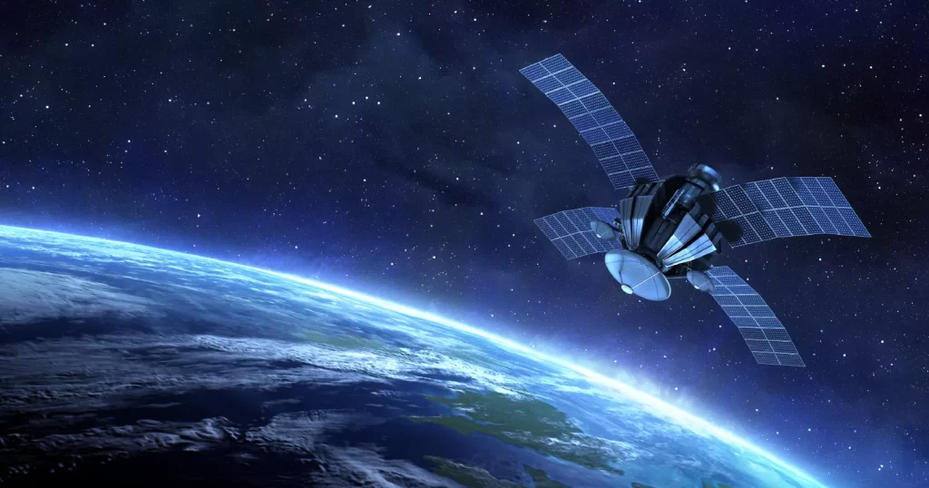
Satellite communication involves the use of artificial satellites to provide communication links between various points on Earth and this technology is crucial for global telecommunications, broadcasting, weather forecasting and navigation. In the context of GIS, satellite communication enables the acquisition, transmission and dissemination of geospatial data which is vital for various applications ranging from environmental monitoring to urban planning. Key Components of Satellite Communication Satellites: Artificial satellites used in communication are categorized based on their orbits such as geostationary (GEO), medium Earth orbit (MEO) and low Earth orbit (LEO) where each orbit type has its advantages and is chosen based on the application’s specific requirements. Ground Stations: These are terrestrial communication facilities that transmit and receive signals from satellites where ground stations play a crucial role in processing and managing data before it is distributed to end-users. Transponders: These are devices on satellites that receive signals from the Earth, amplify them and retransmit them back to the Earth where transponders are essential for maintaining the quality and strength of the communication signals. Frequency Bands: Satellite communication operates in various frequency bands such as L-band, C-band, Ku-band and Ka-band where each band offers different characteristics in terms of bandwidth, coverage and susceptibility to atmospheric interference. Satellite Communication in GIS Data Acquisition and Transmission: One of the primary applications of satellite communication in GIS is the acquisition and transmission of geospatial data where satellites equipped with remote sensing instruments capture high-resolution imagery and data across large geographic areas. This data is crucial for creating detailed maps and conducting spatial analysis. Remote Sensing: Remote sensing involves the use of satellite-borne sensors to capture data about the Earth’s surface and this data includes imagery, spectral information and other geophysical parameters. Remote sensing is essential for monitoring environmental changes, natural disasters and land use patterns. Optical Sensors: These sensors capture visible, infrared and thermal imagery where they are used for applications such as agriculture monitoring, urban planning and environmental conservation. Radar Sensors: Synthetic Aperture Radar (SAR) sensors provide all-weather, day-and-night imaging capabilities where they are used for applications such as terrain analysis, forestry and maritime surveillance. Data Processing and Analysis: After acquiring data through remote sensing, GIS professionals use satellite communication to transmit this data to ground stations for processing and analysis where advanced software tools and algorithms are employed to extract meaningful information from raw satellite data. Geospatial Data Integration: Satellite communication facilitates the integration of various geospatial datasets enabling GIS professionals to create comprehensive and accurate maps. This integration involves combining data from different sources such as satellite imagery, aerial photographs and ground-based surveys. Spatial Analysis: Spatial analysis involves examining geographic patterns and relationships within geospatial data where satellite communication provides the data necessary for conducting spatial analysis which is essential for applications such as disaster management, resource allocation and infrastructure development. Satellite Communication Applications Climate Change: Satellite data is used to monitor changes in temperature, sea levels and greenhouse gas concentrations and this information is vital for understanding the impacts of climate change and developing mitigation strategies. Biodiversity Conservation: Satellites enable the monitoring of ecosystems and wildlife habitats aiding in the conservation of endangered species and the preservation of biodiversity. Early Warning Systems: Satellites play a key role in early warning systems for natural disasters such as hurricanes, tsunamis and earthquakes where they provide timely data that enable authorities to issue warnings and evacuate affected areas. Damage Assessment: After a disaster, satellite imagery is used to assess the extent of damage to infrastructure and natural resources where this information is essential for planning recovery and reconstruction efforts. Infrastructure Development: Satellites provide data for planning and monitoring infrastructure projects such as roads, bridges and utilities. This information helps ensure that projects are completed efficiently and sustainably. Land Use Planning: Satellite data is used to analyze land use patterns and make informed decisions about zoning and development which helps balance the needs of urban growth with environmental conservation. Future Trends in Satellite Communication Automated Feature Extraction: AI can automate the extraction of features from satellite imagery such as roads, buildings and vegetation. This capability enhances the accuracy and efficiency of GIS applications. Predictive Analytics: AI-powered predictive analytics can forecast future trends and events based on historical satellite data. This capability is valuable for applications such as climate modeling, disaster prediction and urban planning. Remote Monitoring: Satellite communication enables the remote monitoring of IoT devices in areas with limited terrestrial connectivity. This capability is valuable for applications such as agriculture, forestry, and infrastructure management. Data Integration: Satellites provide the connectivity needed to integrate IoT data with other geospatial datasets, enabling comprehensive analysis and decision-making. High-Resolution Imaging: New satellite sensors offer higher-resolution imaging, enabling more detailed mapping and analysis. This capability is valuable for applications such as precision agriculture, urban planning, and environmental monitoring. Hyperspectral Imaging: Hyperspectral sensors capture data across a wide range of wavelengths, providing detailed information about the composition and condition of Earth’s surface. This capability is valuable for applications such as mineral exploration, vegetation analysis, and water quality assessment. Satellite communication is a vital component of the GIS industry, providing essential data and connectivity for a wide range of applications. Despite the challenges of data volume, connectivity, and cost, advancements in technology and collaborative efforts are addressing these issues and unlocking new opportunities. As satellite communication continues to evolve, it will play an increasingly important role in enhancing the capabilities of the GIS industry and addressing global challenges.