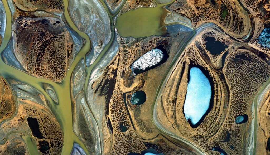
Satellite imagery is a critical component of the Geographic Information Systems (GIS) industry, offering a bird’s-eye view of the Earth’s surface. This technology captures images from space via satellites equipped with advanced sensors, providing detailed information that is invaluable for a variety of applications. Satellite imagery refers to images of the Earth or other planets collected by imaging satellites operated by governments and businesses around the world. These images are captured using different types of sensors that can detect a range of wavelengths beyond what the human eye can see, including infrared and thermal bands. The data collected by these sensors is then transmitted back to Earth for processing and analysis.
Types of Satellite Imagery
Optical Imagery: This type captures images using visible light, similar to a conventional camera. Optical satellites provide high-resolution images and are often used for mapping and land-use planning. However, they can be hindered by cloud cover and limited to daylight hours.
Radar Imagery: Radar satellites use synthetic aperture radar (SAR) to send radio waves toward the Earth’s surface and capture the reflected signals. This type of imagery can penetrate clouds and is not affected by lighting conditions, making it useful for all-weather and night-time monitoring.
Infrared Imagery: Infrared sensors capture thermal radiation emitted by the Earth’s surface. These images are valuable for detecting heat variations, making them useful for applications such as monitoring vegetation health, detecting wildfires, and assessing thermal pollution.
Uses of Satellite Imagery
Environmental Monitoring
Deforestation and Land Use Change: By analyzing satellite images over time, researchers can monitor deforestation rates, identify illegal logging activities, and track changes in land use.
Climate Change: Satellites provide data on global temperature trends, sea level rise, ice cover changes, and greenhouse gas concentrations, aiding in climate change research and policy-making.
Disaster Management: During natural disasters like hurricanes, floods, and wildfires, satellite imagery provides real-time data for assessing damage, coordinating relief efforts, and planning recovery operations.
Agriculture
Crop Monitoring: Multispectral and hyperspectral imagery can assess crop health, detect diseases, and monitor growth stages, enabling farmers to make informed decisions about irrigation, fertilization, and pest control.
Soil Moisture Mapping: Satellite data helps in mapping soil moisture levels, which is crucial for efficient water management and irrigation planning.
Yield Prediction: By analyzing satellite images throughout the growing season, farmers can predict crop yields and plan for storage and distribution.
Urban Planning and Management
Land Use Mapping: High-resolution images help in mapping land use patterns, identifying areas of urban sprawl, and planning for sustainable development.
Infrastructure Monitoring: Satellite imagery is used to monitor the condition of roads, bridges, and buildings, enabling timely maintenance and upgrades.
Disaster Preparedness: Urban areas prone to natural disasters can benefit from satellite data for risk assessment, emergency planning, and evacuation route optimization.
Defense and Intelligence
Surveillance and Reconnaissance: High-resolution images are used for monitoring military installations, tracking troop movements, and assessing potential threats.
Border Security: Satellites help in monitoring border areas, detecting illegal activities, and managing cross-border conflicts.
Disaster Response: In conflict zones or areas affected by natural disasters, satellite imagery aids in assessing damage, planning humanitarian aid, and ensuring the safety of personnel.
Natural Resource Management
Forest Monitoring: Satellite images help in tracking forest cover changes, assessing biodiversity, and managing forest resources sustainably.
Water Resource Management: Satellites provide data on water availability, quality, and usage, aiding in efficient water resource management and planning.
Mineral Exploration: Remote sensing techniques help in identifying potential mineral deposits, reducing the need for extensive field surveys.
Weather and Climate
Weather Prediction: Satellites provide real-time data on cloud cover, precipitation, temperature, and wind patterns, improving the accuracy of weather forecasts.
Climate Monitoring: Long-term satellite data helps in studying climate patterns, understanding global warming, and predicting future climate scenarios.
Storm Tracking: Satellites track hurricanes, cyclones, and other severe weather events, providing early warnings and helping to mitigate their impact.
Oceanography
Sea Surface Temperature Mapping: Satellites monitor sea surface temperatures, aiding in climate studies, marine ecosystem management, and fisheries.
Ocean Current Analysis: Satellite data helps in understanding ocean currents, which are crucial for navigation, climate studies, and marine biology.
Marine Pollution Monitoring: Satellites detect oil spills, plastic waste, and other pollutants, supporting efforts to protect marine environments.
Satellite imagery is a powerful tool with a wide range of applications across various fields. From environmental monitoring and agriculture to urban planning and national security, satellite images provide critical data and insights that drive informed decision-making and sustainable development. As technology advances, the potential of satellite imagery will continue to grow, opening up new possibilities and transforming how we understand and interact with our planet.


