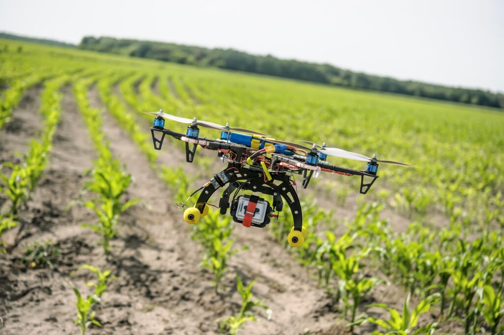
Drones, also known as Unmanned Aerial Vehicles (UAVs), have become increasingly popular in agriculture due to their ability to collect high-resolution aerial data quickly and efficiently. Equipped with advanced sensors and imaging technologies, drones can capture detailed information about crops, soil, and environmental conditions. This data is invaluable for precision agriculture, which aims to optimize field-level management based on specific crop needs and variability.
Advantages of Drones in Agriculture
Rapid Data Collection: Drones can survey large areas of farmland in a fraction of the time it would take using traditional methods. This speed is crucial for time-sensitive agricultural decisions, such as identifying pest infestations or nutrient deficiencies.
High-Resolution Imaging: Drones are equipped with cameras that capture images in visible and non-visible spectra (such as infrared and multispectral). These images provide detailed insights into plant health, moisture levels, and soil conditions.
Cost-Effectiveness: Compared to manned aircraft or satellite imagery, drones offer a more affordable solution for obtaining high-quality aerial data. They require less fuel and maintenance, making them accessible to a wide range of farmers.
Precision and Accuracy: Drones can fly at low altitudes and follow precise flight paths, allowing for highly accurate data collection. This precision is essential for identifying small-scale variations within fields.
Real-Time Monitoring: With drones, farmers can monitor their crops in real time, enabling them to respond quickly to emerging issues and make proactive management decisions.
Applications in Agriculture
Crop Mapping and Analysis: Drones equipped with multispectral sensors can capture images that reveal variations in crop health. GIS software processes these images to generate crop maps that highlight areas of stress, disease, or nutrient deficiency. Farmers can use this information to implement targeted interventions, such as applying fertilizers or pesticides only where needed.
Soil Analysis and Management: GIS allows farmers to create soil maps that identify variations in soil properties, such as pH, moisture content, and organic matter. By understanding soil variability, farmers can optimize irrigation, drainage, and soil amendment practices to improve crop yields.
Yield Prediction and Monitoring: GIS models can analyze historical and current data to predict crop yields accurately. By monitoring crop growth throughout the season, farmers can make informed decisions about harvesting and marketing their produce.
Pest and Disease Management: Drones equipped with thermal and multispectral sensors can detect early signs of pest infestations and diseases. GIS software analyzes this data to identify hotspots and trends, enabling farmers to implement timely pest control measures and reduce crop losses.
Irrigation Management: Efficient water management is critical in agriculture, especially in regions prone to drought. GIS-based irrigation models help farmers optimize water usage by identifying areas with high water stress and recommending targeted irrigation strategies.
Case Studies
Vineyard Management in California
In California’s wine country, vineyard managers are using drone technology to monitor grapevine health and optimize irrigation practices. Drones equipped with multispectral cameras capture images that reveal variations in vine vigor and stress levels. GIS software processes this data to create detailed vigor maps, helping vineyard managers make informed decisions about irrigation, pruning, and harvesting. By targeting interventions based on real-time data, vineyards can improve grape quality and increase yields.
Rice Farming in Southeast Asia
Rice farmers in Southeast Asia are utilizing drone technology to improve crop management and increase productivity. Drones equipped with thermal cameras monitor soil moisture levels and identify areas with water stress. GIS analysis helps farmers optimize irrigation schedules and reduce water usage. Additionally, drones with multispectral sensors detect early signs of pest infestations and diseases, allowing farmers to implement timely control measures. This proactive approach has led to significant yield improvements and reduced input costs.
Wheat Production in the United States
In the United States, wheat farmers are adopting drone technology to enhance precision agriculture practices. Drones capture high-resolution images of wheat fields, enabling farmers to assess crop health and detect nutrient deficiencies. GIS software analyzes this data to create nutrient maps, guiding farmers in applying fertilizers only where needed. By reducing fertilizer use and optimizing application rates, farmers can improve environmental sustainability while maximizing yields.
Drone technology, in combination with GIS, is transforming the agricultural landscape by enabling precision farming practices that enhance productivity and sustainability. By providing real-time, high-resolution data, drones empower farmers to monitor crops, manage resources efficiently, and make informed decisions that optimize yields and reduce environmental impact. As the world faces the challenges of feeding a growing population and addressing climate change, the integration of drone technology and GIS in agriculture will play a pivotal role in shaping the future of farming. With continued innovation and collaboration between technology providers and the agricultural community, the potential for drones to revolutionize agriculture is boundless.


