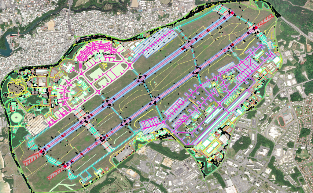
n AMDB is a spatial database of an airport. An AMDB dataset describes the spatial layout of an aerodrome in terms of features (e.g. runways, taxiways,and parking stands) with geometry described as points, lines, or polygons and with attributes (e.g. Surface type). Pro-geometry is described as points,lines, or polygons and is exchanged as datasets using global standards.
AMDBs are produced and exchanged as datasets using global standards and tools of mainstream Geographic Information System (GIS) technology.AMDBs represent a collection of aerodrome information that is organized and arranged for ease of electronic storage and retrieval in systems that support aerodrome movements, training, charting, and planning.