Airport Mapping Database
Airport Mapping Database
. Airport Mapping Databases (AMDBs) have become essential resources for the Geographic Information System (GIS) sector significantly contributing to the efficiency and safety of aviation travel. The complexity of AMDBs is examined in this process along with their architecture, data sources and numerous applications that have made them indispensable to contemporary aviation.
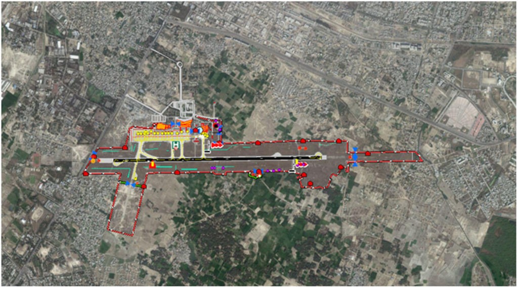
An AMDB is a sophisticated geospatial information repository that gathers and arranges vital airport-related data. It is more than just a digital map where the three-dimensional depiction of airport elements such as runways, taxiways, aprons and terminal buildings forms the basis of an AMDB. These databases are made with extreme accuracy in mind precisely representing actual conditions. GIS technology which makes it possible to create, manage, analyze and visualize spatial data is at the core of every AMDB. Aeronautical charts and topographical data can be integrated with other datasets using GIS technologies and when these data layers are integrated, it offers an all-encompassing picture of the airport environment, which helps air traffic controllers and airport officials make decisions.
The quality of data sources determines the correctness and dependability of AMDBs. These databases incorporate information from a variety of sources including surveys carried out with cutting-edge geospatial technology, LiDAR (Light Detection and Ranging) scans and satellite imagery. The amalgamation of information from these heterogeneous sources guarantees that the AMDB consistently reflects the dynamic airport environment. Airports are ever-changing, constantly expanding phenomena and because of their adaptability, AMDBs are updated frequently to reflect changes to taxiways, runways and other infrastructure. Sustaining the greatest levels of safety in aircraft operations requires the capacity to dynamically update AMDBs.
Applications of Airport Mapping Databases
Flight Planning: For accurate navigation during takeoff, landing and taxiing, pilots rely on AMDBs where pilots can make better decisions by using the three-dimensional representation of airport characteristics especially when visibility is low.
Air Traffic Management: To maximize the flow of air traffic on the ground, air traffic controllers employ AMDBs where these databases give controllers access to real-time data that helps them manage aircraft movements, ease traffic and lower the chance of runway incursions.
Emergency Response: AMDBs are essential resources for emergency response teams in times of crisis such as aircraft mishaps or unfavorable weather and effective and secure evacuation protocols are supported by comprehensive information on airport infrastructure.
Airport Planning and Design: Whether creating a new airport or expanding an existing one, AMDBs are essential to the process where architects and planners may optimize infrastructure layouts and ensure safety rules are followed with the use of geospatial data.
Wildlife Management: Wildlife hazards are a common source of problems for airports where the integration of data on wildlife migration patterns and habitats into AMDBs helps airport authorities create risk-reducing wildlife management plans.
Airport Mapping Databases are examples of how GIS technologies and the aviation sector work well together. AMDBs will become more important in determining the direction of safe and effective air transport as aviation continues to develop. The GIS sector is ready to push the accuracy of AMDBs to new levels through standardization, technology breakthroughs and ongoing cooperation guaranteeing that the skies will always be navigable with unmatched precision.