


High-resolution earth observation imagery is evolving from static maps into dynamic, predictive decision engines. By pairing satellite data with advanced deep learning models, organizations can turn millions of raw pixels into real-time geospatial intelligence.
Transforming Pixels into Spatial Intelligence
This case study focuses on AI-powered automated feature extraction and land-use/land-cover (LULC) classification, demonstrating how satellite imagery can be transformed into structured geospatial information for urban development, infrastructure mapping, environmental monitoring, and resource management.
The Challenge
High-resolution satellite imagery contains extensive information about the built and natural environment. However, manually interpreting and digitizing features across large geographic areas requires substantial time, human effort, and operational budget.
- Manually tracing individual buildings, roads, and tree canopies.
- Classifying large areas according to land-use and land-cover types.
- Processing extensive satellite scenes efficiently across multi-gigabyte files.
- Maintaining high mapping consistency when working across broad geographic regions.
- Converting complex imagery into structured information that can support spatial decision-making.
The Solution
AI and Machine Learning provide an automated approach to interpreting satellite imagery. Trained models scan large satellite scenes and analyze spatial patterns to identify, delineate, and extract key features automatically.
- Buildings & Rooftops: Footprint mapping and structural inventory counts.
- Transportation Networks: Automated road network tracing and corridor updates.
- Environmental Features: Tree canopy assessment, vegetation tracking, and water body isolation.
- Land Allocation: Agricultural field mapping and broad urban land-cover classification.
- Data Transformation: Converts complex raw pixels into structured spatial databases ready for GIS decision support.
Core Use Case: Automated Feature Extraction
From Pixels to Mappable Features
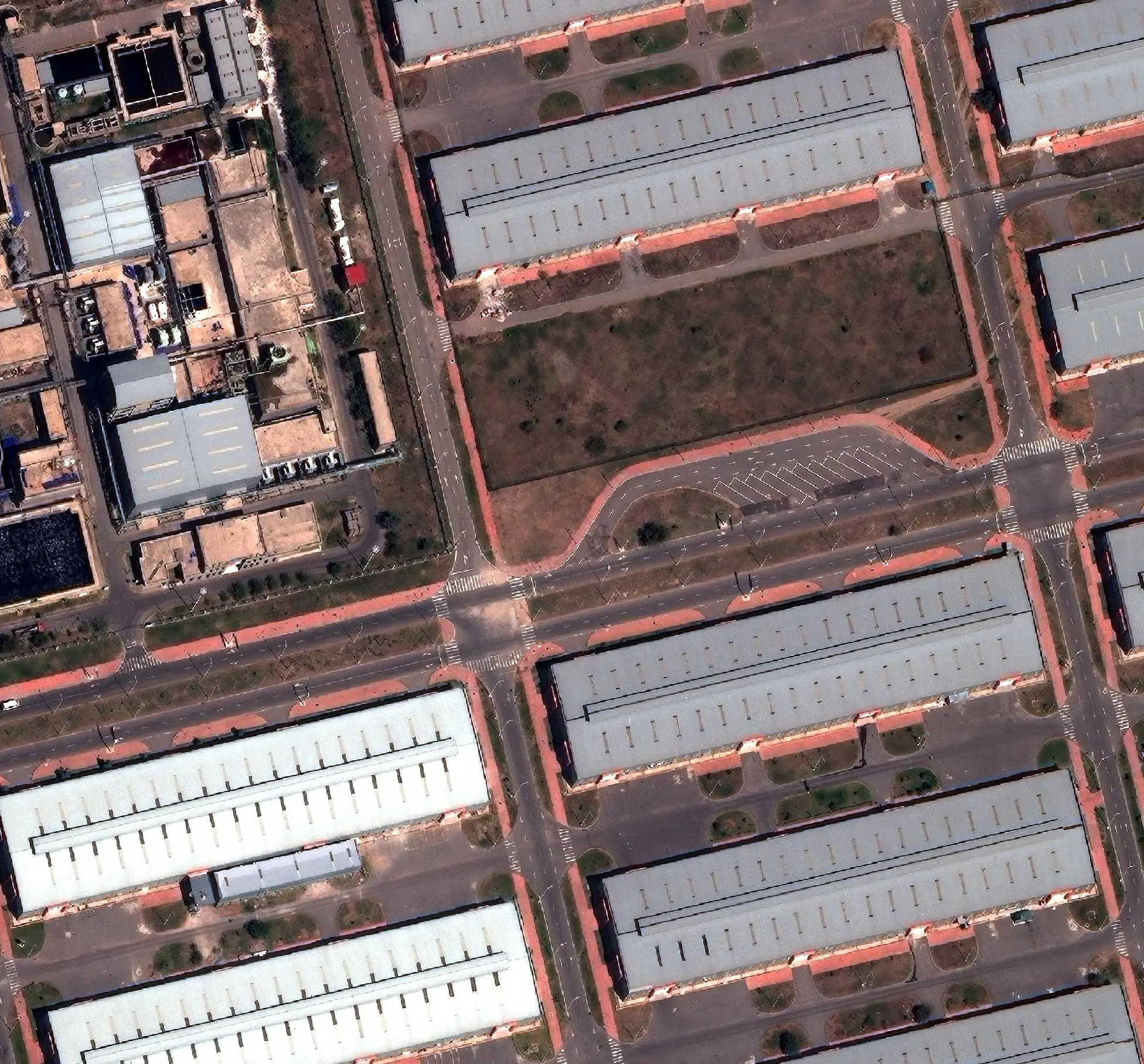
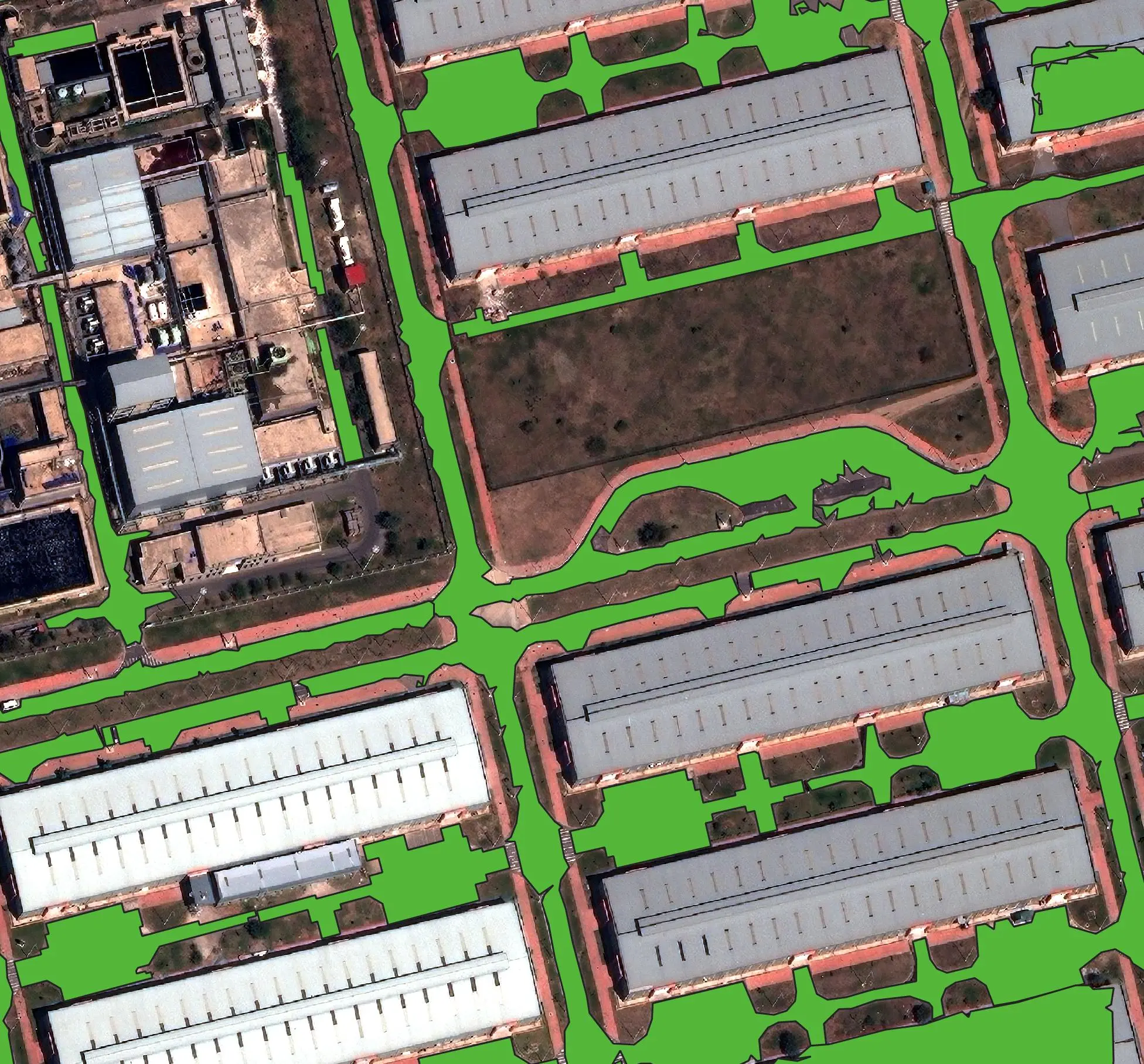
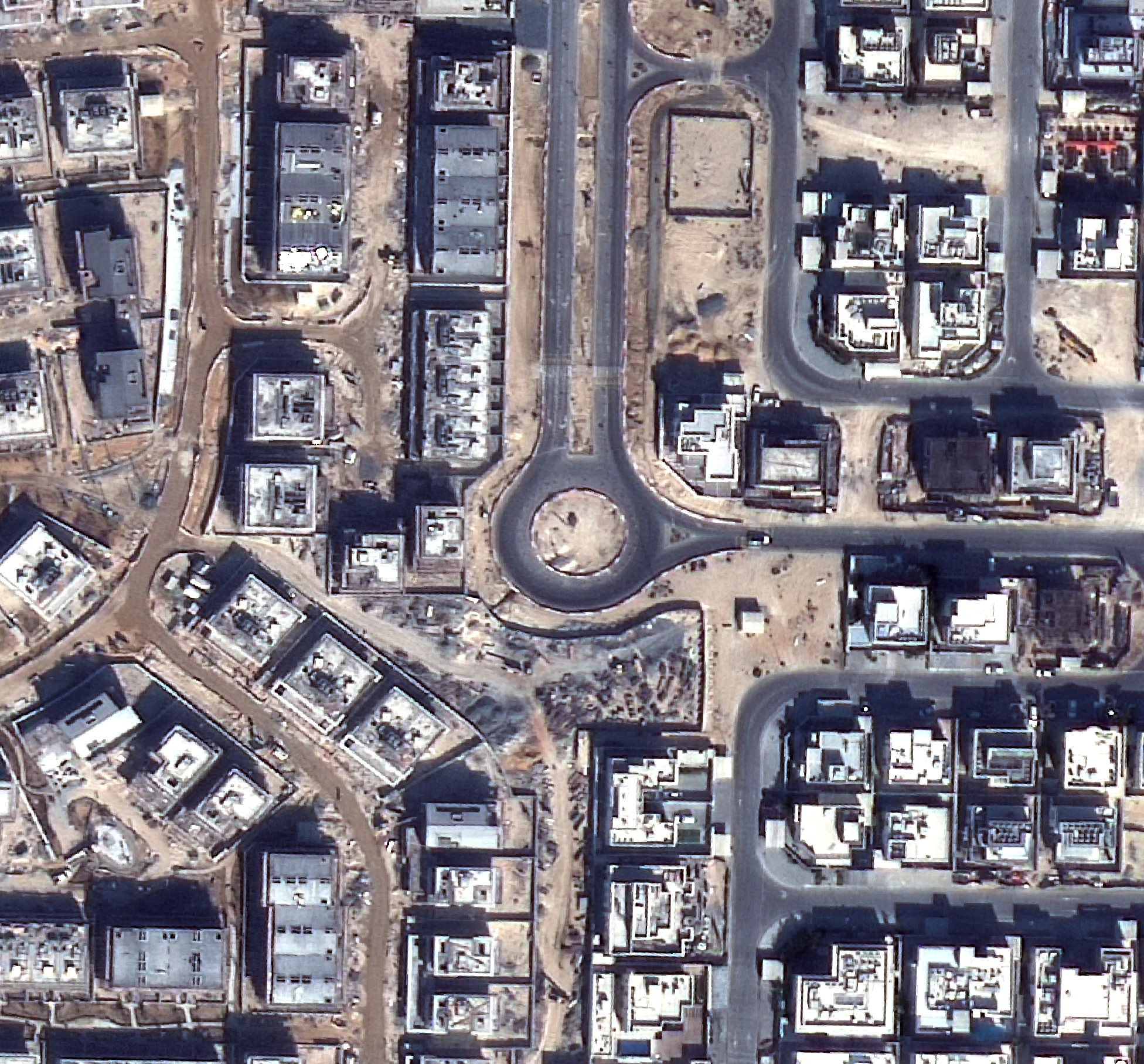
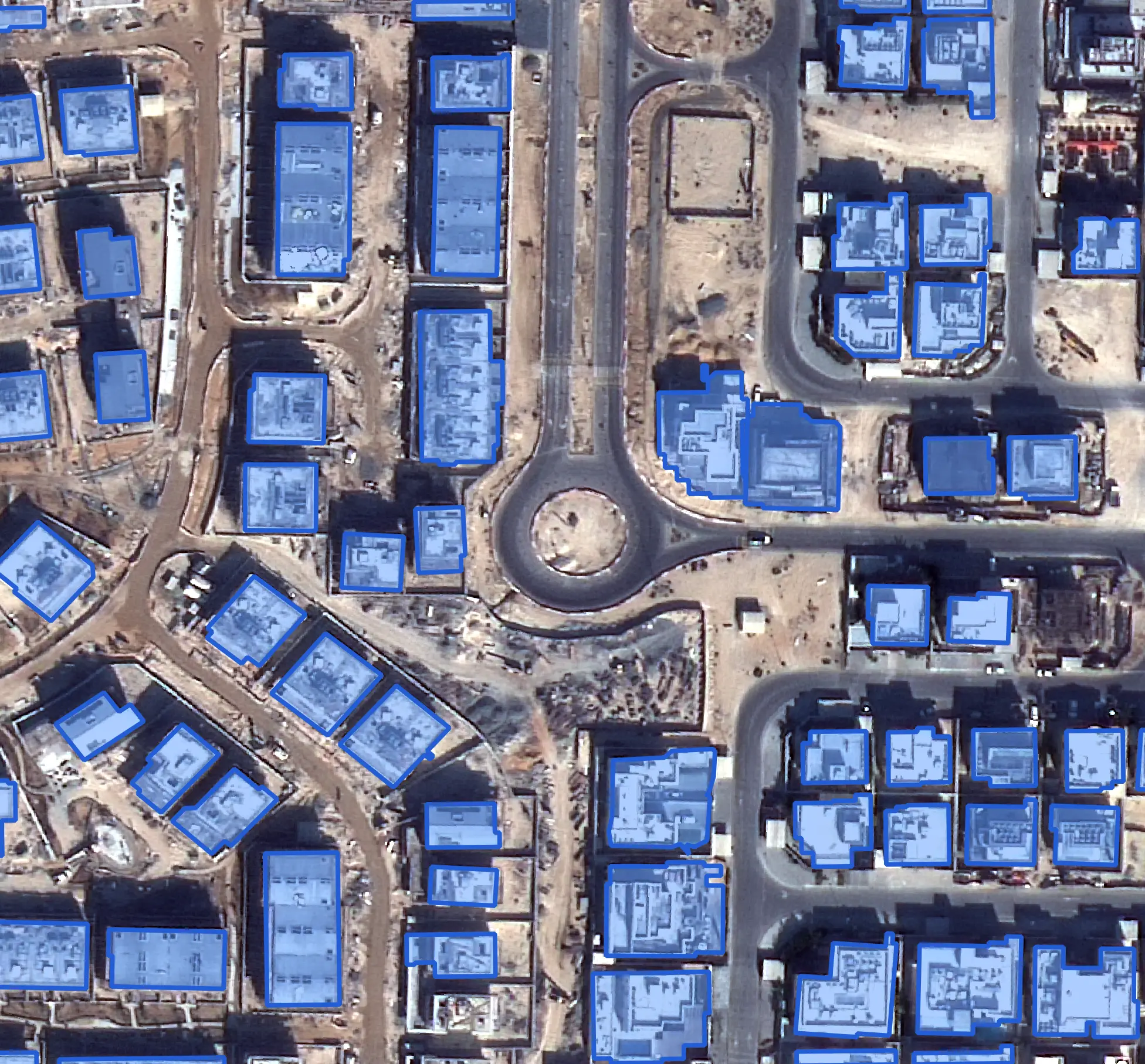
Traditionally, mapping features required analysts to manually trace boundaries. AI-based image segmentation automates this process by identifying spatial patterns and generating precise feature boundaries across high-resolution satellite scenes.
The resulting structured spatial information directly supports applications such as:
- Building Footprint Mapping: Rapid structural delineation and building counts.
- Road Network Mapping: Vector tracing for navigation updates and urban planning.
- Urban Expansion Monitoring: Tracking sprawl and suburban land development over time.
- Tree-Canopy Assessment: Municipal tree cover and urban forestry monitoring.
AI-Based Image Segmentation Architectures
Different machine learning approaches are deployed depending on the spatial complexity and detail required:
Supervised Classification
Trains on human-labeled sample datasets to learn specific spectral profiles and visual characteristics of predefined surface classes.
Unsupervised Classification
Clusters pixels automatically based on shared spectral reflectance values without requiring prior sample labeling or manual ground-truth data.
CNNs (Convolutional Neural Networks)
Deep-learning models built specifically to evaluate contextual spatial arrangements, texture patterns, and multi-spectral signatures across satellite images.
U-Net Architecture
An end-to-end encoder-decoder semantic segmentation network built for high-precision, pixel-level boundary detection across satellite frames.
Mask R-CNN Architecture
An object-level instance segmentation network that isolates individual spatial targets while simultaneously generating pixel-accurate boundary masks.
Land Use & Land Cover Classification
Automated feature extraction extends to broader LULC mapping by grouping similar features into structured environmental categories:
| Category | Extracted Feature Examples | Strategic Value & Application |
|---|---|---|
| Urban / Built-up | Buildings, roads, urban structures, pavement | Monitors urban growth, housing density, and municipal infrastructure. |
| Agriculture | Agricultural fields, cultivated land, fallow zones | Supports crop health tracking, spatial yield estimates, and land management. |
| Vegetation | Forests, tree canopies, dense vegetation, shrubland | Enables deforestation tracking, canopy assessment, and conservation monitoring. |
| Water | Rivers, lakes, reservoirs, coastal margins | Assists in watershed planning, flood extent modeling, and water resource management. |
Application Areas & Extended AI Simulations
AI moves satellite imagery from static visual observation to proactive scenario planning and decision support.
Urban
Development
Monitors urban expansion, maintains building inventories, and updates GIS databases automatically.
Infrastructure
Mapping
Accelerates large-area extraction of transportation networks and built structures.
Environmental
Monitoring
Automates vegetation classification, forest boundary tracking, and resource management.
Agriculture
Distinguishes agricultural plots from surrounding land cover for spatial yield modeling.
Predictive Visual Scenarios
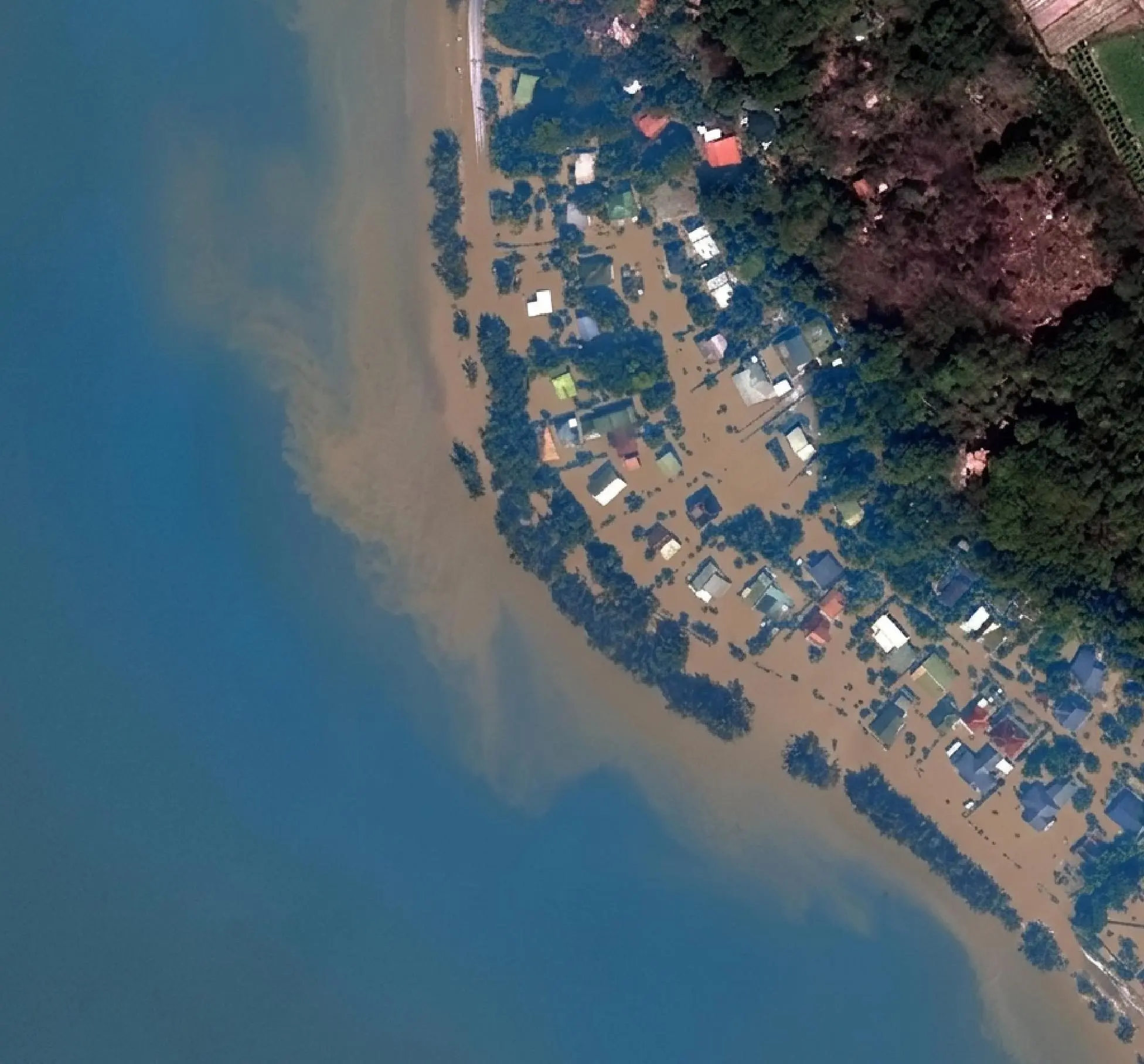
Flood Extent & Risk Simulation
Simulates flood levels across real landscapes. By visualizing water extents, emergency response teams identify vulnerable neighborhoods and support evacuation planning without physical field risks.
Rooftop Solar Panel Assessment
Projects solar-panel layouts across residential or industrial complexes, calculating rooftop surface area, pitch, and shading to estimate clean energy potential remotely.

The End-to-End Geospatial AI Workflow
Satellite Data Acquisition
High-resolution multi-spectral satellite imagery provides detailed ground observation data.
AI / ML Processing
Imagery is normalized and processed using appropriate machine-learning architectures.
Segmentation & Classification
AI models evaluate pixels, spatial patterns, and spectral signatures across bands.
Automated Feature Extraction
Buildings, roads, tree canopies, water bodies, and agricultural areas are delineated.
Geospatial Data Generation
Extracted predictions are converted into structured spatial vector datasets and LULC layers.
Analysis & Decision Support
Output datasets integrate into GIS environments to drive urban, environmental, and infrastructure planning.
Key Operational Benefits
Increased Efficiency
Reduces repetitive manual digitization across expansive geographic scenes.
Scalable Analysis
Applies workflows across multi-gigabyte satellite scenes and regional datasets.
Detailed Mapping
Identifies complex features at both pixel and object level with precision.
Consistent Rules
Delivers standardized feature categorization across varied terrain scenes.
From Satellite Imagery to Spatial Intelligence
The core value of AI lies in its ability to bridge the gap between raw imagery and direct operational answers:
- What buildings are present? Enables housing density and footprint analysis.
- Where are the roads? Automatically constructs transportation routes.
- How much vegetation exists? Measures tree canopy cover and green space density.
- Which areas are agricultural? Isolates cultivated land from natural cover.
- Where are water bodies? Tracks reservoirs, river courses, and water boundaries.
- How is the landscape changing? Evaluates temporal growth and environmental shifts.
Outcome & Conclusion
The integration of high-resolution satellite imagery with Artificial Intelligence and Machine Learning enables a fundamental shift from manual image interpretation to automated geospatial feature extraction. Through advanced architectures like CNNs, U-Net, and Mask R-CNN, organizations can process continuously changing landscapes at scale—transforming static visual products into a scalable foundation for structured spatial data, predictive modeling, and informed decision-making.