

AI in Mapping

How Artificial Intelligence is Transforming Satellite Remote Sensing
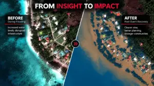
High-resolution earth observation imagery is evolving from static maps into dynamic, predictive decision engines. By pairing satellite data with advanced deep learning models, organizations can turn millions of raw pixels into real-time geospatial intelligence. Transforming Pixels into Spatial Intelligence This case study focuses on AI-powered automated feature extraction and land-use/land-cover (LULC) classification, demonstrating how satellite